- Printed on Polypropylene (plastic)
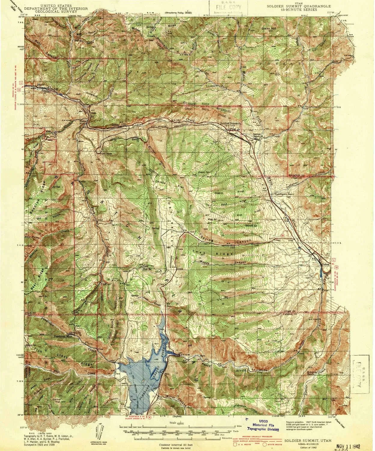
- USGS topographic map of Soldier Summit, UT, at 1:62500 scale. Heavier material. Waterproof. Tear-resistant. Foldable. Perfect for the outdoors.
- Cities, towns, villages: Sky View (historical),Gilluly,Soldier Summit,Tucker (historical),Colton
- Islands: Consult topo map preview for visible islands.
- Parks and forests: Scofield State Park,Starvation Wildlife Management Area
USGS topographic map of Soldier Summit, Utah, dated 1942.
Includes geographic coordinates (latitude and longitude), lines of elevation, bodies of water, roads, and more. This topo quad is suitable for recreational, outdoor uses, office applications, or wall map framing.
Printed on-demand by YellowMaps on the print material of your choice.
Shipping rolled from Minneapolis, MN, United States.
Product Number: USGS-5680021
Map Size: 19.8 inches high x 16.5 inches wide
Map Scale: 1:62500
Map Type: POD USGS Topographic Map
Map Series: HTMC
Map Version: Historical
Cell ID: 62739
Scan ID: 251955
Woodland Tint: Yes
Survey Year: 1939
Datum: NAD27
Map Projection: Polyconic
Map published by United States Geological Survey
Keywords: Overedge
Map Language: English
Scanner Resolution: 600 dpi
Map Cell Name: Soldier Summit
Grid size: 15 X 15 Minute
Date on map: 1942
Geographical region: Utah, United States
Northern map edge Latitude: 40°
Southern map edge Latitude: 39.75°
Western map edge Longitude: -111.25°
Eastern map edge Longitude: -111°
Surrounding map sheets (copy & paste the Product No. in the search bar):
North: USGS-5461177,USGS-5461171,USGS-5461169,USGS-5461173,USGS-5461175
East: USGS-5458473,USGS-5458475,USGS-5458471
South: USGS-5460645,USGS-5462867,USGS-5462871,USGS-5462873,USGS-5462869
West: USGS-5456025,USGS-5456027


