- Printed on Polypropylene (plastic)
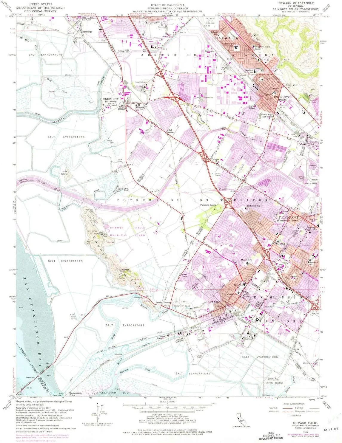
- USGS topographic map of Newark, CA, at 1:24000 scale. Heavier material. Waterproof. Tear-resistant. Foldable. Perfect for the outdoors.
- Cities, towns, villages: Jarvis Landing,Mowry Landing,Union City,Newark,Mattos,Baumberg,Carpenter,Hall Station,Pabrico
- Islands: Consult topo map preview for visible islands.
- Parks and forests: Musick Park,Hall Ranch Park,Ash Street Park,Casa Verde Park,Lowry Park,Civic Center Park,Newark Community Park,Ardenwood Regional Preserve,Willaim Cann Memorial Park,Mayhews Landing Park,Swiss Park,Brookvale Park,Town Estates Park,Patterson Park,Alvarado Park,Westridge Park,George M Sullivan Recreation Complex,Harvey Community Park,Contempo Park,Penke Park,Charles F Kennedy Park,Logan Stadium,Bridgepoint Park,Eucalyptus Grove Park,Birch Grove Park,Arroyo Park
USGS topographic map of Newark, California, dated 1959, updated 1975.
Includes geographic coordinates (latitude and longitude), lines of elevation, bodies of water, roads, and more. This topo quad is suitable for recreational, outdoor uses, office applications, or wall map framing.
Printed on-demand by YellowMaps on the print material of your choice.
Shipping rolled from Minneapolis, MN, United States.
Product Number: USGS-5519539
Map Size: 26.8 inches high x 22 inches wide
Map Scale: 1:24000
Map Type: POD USGS Topographic Map
Map Series: HTMC
Map Version: Historical
Cell ID: 31895
Scan ID: 293498
Imprint Year: 1975
Woodland Tint: Yes
Photo Revision Year: 1973
Aerial Photo Year: 1973
Field Check Year: 1959
Survey Year: 1947
Datum: NAD27
Map Projection: Polyconic
Map published by United States Geological Survey
Map Language: English
Scanner Resolution: 600 dpi
Map Cell Name: Newark
Grid size: 7.5 X 7.5 Minute
Date on map: 1959
Geographical region: California, United States
Northern map edge Latitude: 37.625°
Southern map edge Latitude: 37.5°
Western map edge Longitude: -122.125°
Eastern map edge Longitude: -122°
Surrounding map sheets (copy & paste the Product No. in the search bar):
North: USGS-5515283,USGS-5515295,USGS-5515293,USGS-5515287,USGS-5515289
East: USGS-5519621,USGS-5502713,USGS-5505465,USGS-5503703,USGS-5502711
South: USGS-5519057,USGS-5519047,USGS-5519063,USGS-5519061,USGS-5519051
West: USGS-5521575,USGS-5521581,USGS-5521589,USGS-5521585,USGS-5521583


