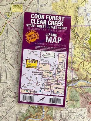
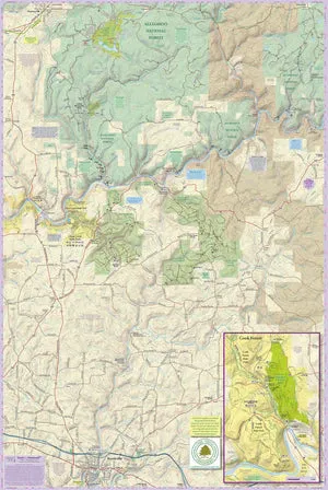
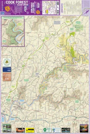
This map covers all of Clear Creek State Forest, Cook Forest State Park, Clear Creek State Park and the southernmost tier of the Allegheny National Forest, a beautiful stretch of the Clarion River from Halton/Irwin Run downriver to Clarion, southeast to the town of Brookville, and all the extraordinary public land and outdoor recreational opportunities in between.
It includes a detailed inset map of Cook Forest and the famed Cathedral Forest, and a detailed map of the Kennerdale Tract, which is separate parcel of Clear Creek State Forest on the Allegheny River northwest of Clarion.
Public land: all of Cook Forest and Clear Creek State Forest, multiple State Game Lands and a southernmost section of Allegheny National Forest including the Loleta Recreation Area and Buzzard Swamp Wildlife Area.
Destinations: There are beautiful vistas, and gorgeous hiking trails, and beautiful stretches of water, including a big stretch of the Clarion River in this part of Northeastern PA, with too many outdoor recreation destinations to list here. Little Purple Lizards throughout the map help your customers find special spots along the river and throughout the trails system and roads.
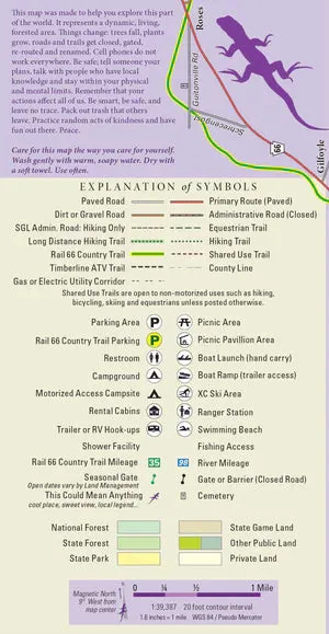
Roads: all Lizard Maps show which roads are paved, dirt/gravel and gated Administration roads. Lizard Maps are perfect for bicyclists, motorcyclists and and overlanders looking to put together remote backcountry routes across public lands.
Major hiking trails: The North Country Trail (NCT) and Baker Trail are shown where they traverse this map. The NCT is mapped from Clarion, PA, in the southwest corner to State Game Land 24 in the northeast corner. It shows the route of the NCT through Clear Creek State Forest and Cook Forest State Park, as well as the many private land traverses and road crossings so your customers can easily plan day hikes, or through hikes, or tackle the entire NCT which is the longest in the National Trails System at 4,700 miles across eight states from North Dakota to Vermont. The Baker Trail is mapped from the southern end where it enters the map at Corsica, PA, north to Cook Forest SP where it joins the NCT.
Equestrian trails: The designated equestrian trails in Cook Forest State Park are shown, as well as the shared use trails throughout Clear Creek State Forest.
ATV Trails: A section of the Timberline ATV Trail on Allegheny National Forest from the Buehler Trailhead on Arroyo Road north to NF Road 135.
Even more trails! Lizard Maps highlight and designate public trails and paths including hiking, biking, equestrian and rail trails managed by federal, state and local authorities, including DCNR, Allegheny National Forest and the Pennsylvania Game Commission.
Points of interest: Campgrounds, picnic areas, river access, boat launches, primitive car camping sites, scenic overlooks and lizard spots.
Wild and Natural areas: Forest Cathedral Natural Area, Swamp Natural Area, Loleta Recreation Area and Buzzard Swamp Wildlife Area
Towns: Clarion, Cooksburg, Brookville, Leeper, Lucinda, and Marienville.
A beautifully designed, easy to read, topographic outdoor recreation map featuring contour lines, elevation data, shaded relief, and all the key details you need to plan your adventures: backroads and trails, trail use designations, road surfaces (paved/gravel), parking access, campsites, public lands, historic sites and more.
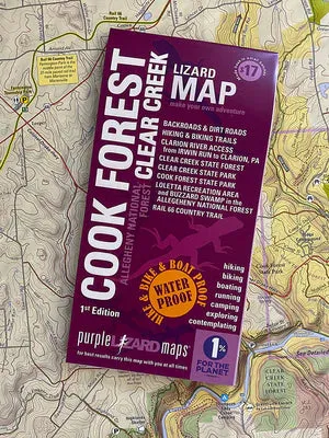
Lizard Maps are durable, waterproof, and give you the big picture – the map opens to 24” x 36” and folds easily to 4” x 8” to fit in your back pocket. The scale is 1:46,900, 1 inch equals 3/4 mile.

")


 (Erik the Black’s Hiking Maps) Map – October 1, 2024")


