- Printed on Tyvek® (synthetic)
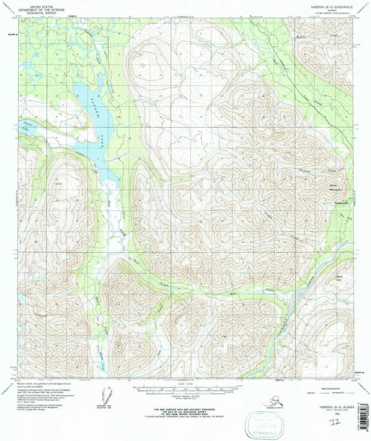
- USGS topographic map of Nabesna B 5, AK, at 1:63360 scale. Lighter material. Waterproof. Tear-resistant. Foldable. Very durable. Perfect for backpacking and the outdoors.
- Cities, towns, villages: Nabesna
- Mountains: Gold Hill,White Mountain
- Valleys: Swede Gulch,Porphyry Gulch,Cliff Gulch,Garnet Gulch
USGS topographic map of Nabesna B 5, Alaska, dated 1960, updated 1967.
Includes geographic coordinates (latitude and longitude), lines of elevation, bodies of water, roads, and more. This topo quad is suitable for recreational, outdoor uses, office applications, or wall map framing.
Printed on-demand by YellowMaps on the print material of your choice.
Shipping rolled from Minneapolis, MN, United States.
Product Number: USGS-5670582
Map Size: 21.6 inches high x 18 inches wide
Map Scale: 1:63360
Map Type: POD USGS Topographic Map
Map Series: HTMC
Map Version: Historical
Cell ID: 58231
Scan ID: 357922
Imprint Year: 1967
Woodland Tint: Yes
Aerial Photo Year: 1957
Datum: NAD27
Map Projection: Universal Transverse Mercator
Map published by United States Geological Survey
Map Language: English
Scanner Resolution: 600 dpi
Map Cell Name: Nabesna B-5
Grid size: 15 X 15 Minute
Date on map: 1960
Geographical region: Alaska, United States
Northern map edge Latitude: 62.5°
Southern map edge Latitude: 62.25°
Western map edge Longitude: -143.5°
Eastern map edge Longitude: -143°
Surrounding map sheets (copy & paste the Product No. in the search bar):
North: USGS-5670620,USGS-5670618,USGS-5670616,USGS-5670614
East: USGS-5670574,USGS-5670578,USGS-5670576
South: USGS-5670556,USGS-5670552,USGS-5670554
West: USGS-5670586,USGS-5670584


")


