- Printed on Tyvek® (synthetic)
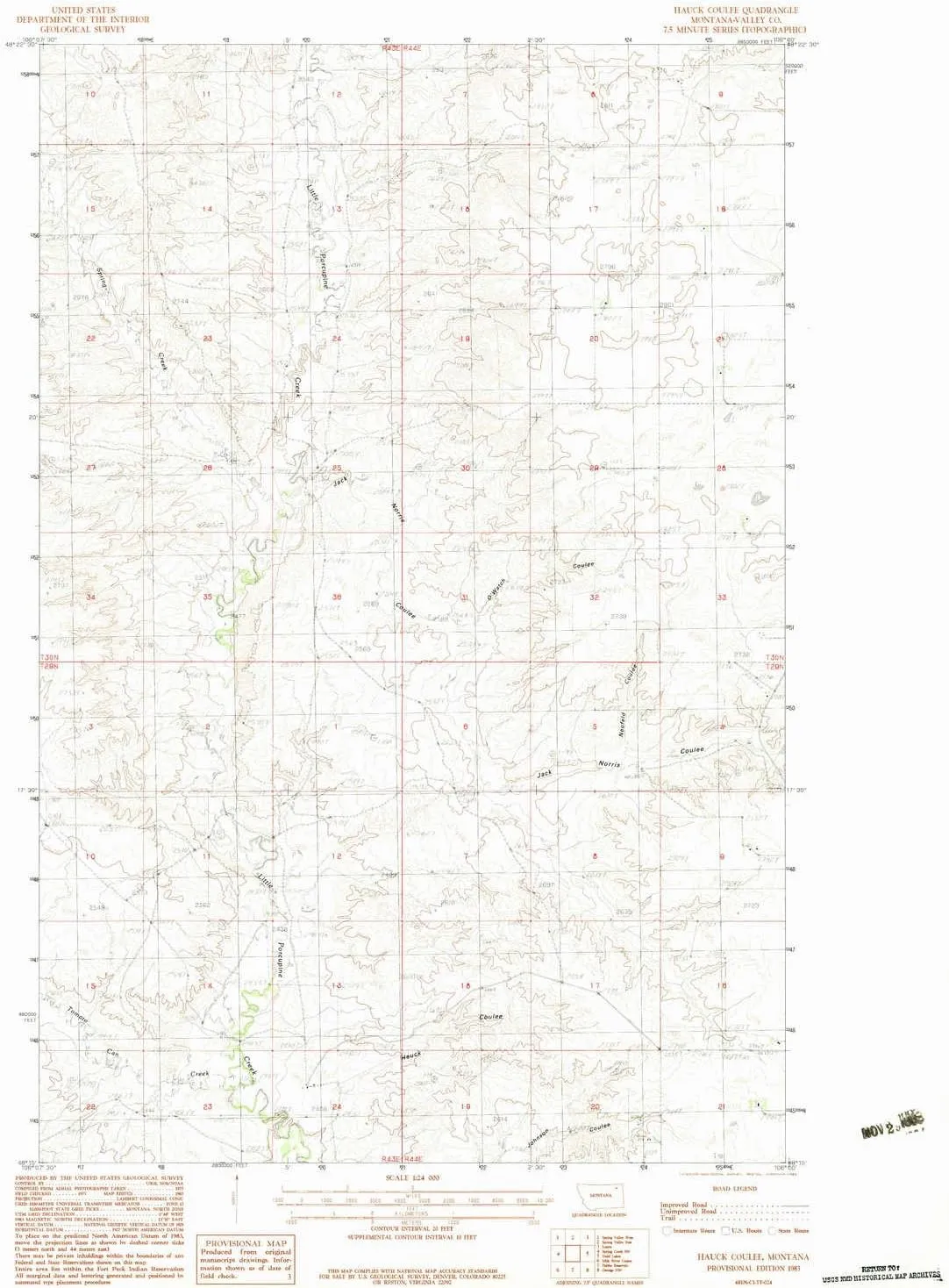
- USGS topographic map of Hauck Coulee, MT, at 1:24000 scale. Lighter material. Waterproof. Tear-resistant. Foldable. Very durable. Perfect for backpacking and the outdoors.
- Cities, towns, villages: Please see map preview to find populated places, townships, as well as roads and street names if available.
- Mountains: High elevation topographical features like high summits and peaks.
- Valleys: Neufeld Coulee,O'Watch Coulee,Hauck Coulee,Jack Norris Coulee
USGS topographic map of Hauck Coulee, Montana, dated 1983, updated 1983.
Includes geographic coordinates (latitude and longitude), lines of elevation, bodies of water, roads, and more. This topo quad is suitable for recreational, outdoor uses, office applications, or wall map framing.
Printed on-demand by YellowMaps on the print material of your choice.
Shipping rolled from Minneapolis, MN, United States.
Product Number: USGS-5394596
Map Size: 27 inches high x 22.1 inches wide
Map Scale: 1:24000
Map Type: POD USGS Topographic Map
Map Series: HTMC
Map Version: Historical
Cell ID: 19666
Scan ID: 264283
Imprint Year: 1983
Woodland Tint: Yes
Aerial Photo Year: 1975
Edit Year: 1983
Field Check Year: 1977
Datum: NAD27
Map Projection: Lambert Conformal Conic
Provisional map: Yes
Map published by United States Geological Survey
Map Language: English
Scanner Resolution: 600 dpi
Map Cell Name: Hauck Coulee
Grid size: 7.5 X 7.5 Minute
Date on map: 1983
Geographical region: Montana, United States
Northern map edge Latitude: 48.375°
Southern map edge Latitude: 48.25°
Western map edge Longitude: -106.125°
Eastern map edge Longitude: -106°
Surrounding map sheets (copy & paste the Product No. in the search bar):
North: USGS-5399058
East: USGS-5401386,USGS-5399680,USGS-5401382,USGS-5399678,USGS-5401384
South: USGS-5393226
West: USGS-5399052


")


")

