Cooking Essentials&Outdoor Tools|Foldable Shovels,Windproof Stoves&Headlamps
Cooking Essentials&Outdoor Tools|Foldable Shovels,Windproof Stoves&Headlamps Cooking Essentials&Outdoor Tools|Foldable Shovels,Windproof Stoves&Headlamps
Home Navigation Gear Waterproof Hiking Map
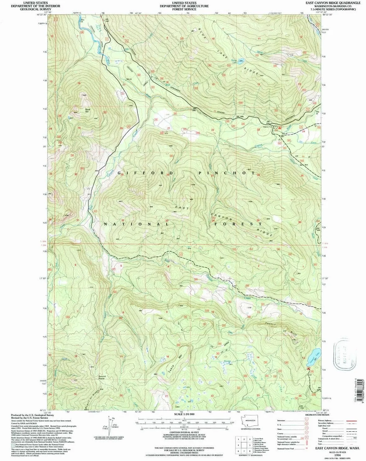
East Canyon Ridge WA topo map, 1:24000 Scale, 7.5 X 7.5 Minute, Historical, 1994, Updated 1996, 26.9 x 22.1 in

East Canyon Ridge WA topo map, 1:24000 Scale, 7.5 X 7.5 Minute, Historical, 1994, Updated 1996, 26.9 x 22.1 in

$ 52.00

$ 74.00

Save: $

Color:
  • Polypropylene
  • Regular Paper
  • Tyvek
Unavailable
Please select combo product attributes
The combo subtotal is $,SAVE$

Product Details

  • Printed on Polypropylene (plastic)
  • USGS topographic map of East Canyon Ridge, WA, at 1:24000 scale. Heavier material. Waterproof. Tear-resistant. Foldable. Perfect for the outdoors.
  • Cities, towns, villages: Please see map preview to find populated places, townships, as well as roads and street names if available.
  • Islands: Consult topo map preview for visible islands.
  • Parks and forests: National Parks, National Forests, etc. Please preview map image for specifics.


USGS topographic map of East Canyon Ridge, Washington, dated 1994, updated 1996.

Includes geographic coordinates (latitude and longitude), lines of elevation, bodies of water, roads, and more. This topo quad is suitable for recreational, outdoor uses, office applications, or wall map framing.

Printed on-demand by YellowMaps on the print material of your choice.

Shipping rolled from Minneapolis, MN, United States.

Product Number: USGS-5403908
Map Size: 26.9 inches high x 22.1 inches wide
Map Scale: 1:24000
Map Type: POD USGS Topographic Map
Map Series: HTMC
Map Version: Historical
Cell ID: 13348
Scan ID: 240921
Imprint Year: 1996
Woodland Tint: Yes
Aerial Photo Year: 1993
Datum: NAD27
Map Projection: Lambert Conformal Conic
Map published by United States Geological Survey
Map published by United States Forest Service
Map Language: English
Scanner Resolution: 600 dpi
Map Cell Name: East Canyon Ridge
Grid size: 7.5 X 7.5 Minute
Date on map: 1994
Geographical region: Washington, United States
Northern map edge Latitude: 46.375°
Southern map edge Latitude: 46.25°
Western map edge Longitude: -121.75°
Eastern map edge Longitude: -121.625°

Surrounding map sheets (copy & paste the Product No. in the search bar):
North: USGS-5402834,USGS-5402830,USGS-5402832
East: USGS-5404570,USGS-5404572,USGS-5404574
South: USGS-5408346,USGS-5408344
West: USGS-5406214,USGS-5406216,USGS-5406212

You May Also Like

4-in-1 Camping Cot Tent, Foldable Elevated Tent Set for 1 Person to Use, Elevated Camping Bed Tent for Outdoor Hiking, Camping

$ 156.00

Save: $

Zune Lotoo Survival Shovel Multitool 33 in 1 Upgrade Kit, Camping Tactical Shovel Foldable, Unbreakable Martensitic Steel Adjustable 7 Angles & Aluminum Carrying Box, Compact Gear for Outdoor Hiking

$ 100.00

$ 250.00

Save: $

Hot Pot Alcohol Stove,Spirit Cooker with Pot, Camping Stoves Set,No Power Required,Portable Stainless Steel Liquid Stove,Camping Cooker for Indoor Outdoor Camping Hiking (7.8In)(20cm)

$ 25.00

$ 36.00

Save: $

Emergency Kit Camping Multi- Folding Survival Shovel Set Camping Gear Emergency Box

$ 49.00

$ 70.00

Save: $

National Geographic United States Wall Map - Executive - Laminated (43.5 x 30.5 in) (National Geographic Reference Map) Map – October 2, 2021

$ 24.00

$ 30.00

Save: $

Little Donkey Andy Men's Waterproof Softshell Jacket with Detachable Sleeves and Hood, Fleece Mountain Ski Snow Rain Coat

$ 24.00

$ 30.00

Save: $

LetFeng Single Burner Outdoor Gas Stove - 200,000BTU Propane with Cast Iron Burner & Steel Braided Hose - Detachable Stand Legs

$ 54.00

$ 90.00

Save: $

Foxelli Men’s Hiking Boots – Waterproof Breathable & Lightweight Suede Leather Hiking Boots for Men

$ 55.00

$ 100.00

Save: $

National Geographic World Ocean Floor - 42.5 x 29.5 inches - Laminated

$ 38.00

$ 55.00

Save: $

Park Valley UT topo map, 1:62500 Scale, 15 X 15 Minute, Historical, 1959, Updated 1960, 20.8 x 17 in

$ 48.00

$ 69.00

Save: $

Cart
Cooking Essentials&Outdoor Tools|Foldable Shovels,Windproof Stoves&Headlamps
Your cart is currently empty.