- Printed on Polypropylene (plastic)
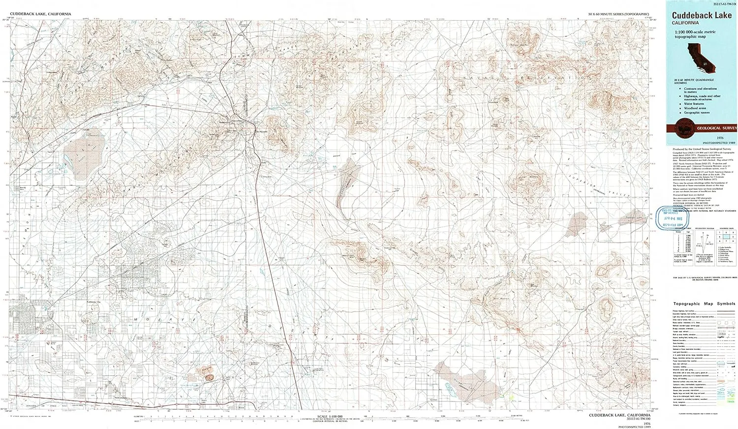
- USGS topographic map of Cuddeback Lake, CA, at 1:100000 scale. Heavier material. Waterproof. Tear-resistant. Foldable. Perfect for the outdoors.
- Cities, towns, villages: Gypsite,Saint Elmo (historical),Teagle (historical),California City,Baker,Johannesburg,Garlock,Lockhart,North Muroc (historical),North Edwards,West Baker (historical),Goler Heights,Rancho Seco,Red Mountain,Atolia,Aerial Acres,Ricardo,Copper City,Redrock (historical),Fremont,Rand,Old Garlock,Saltdale,Ceneda,Randsburg,Searles,Desert Lake,Cantil
- Islands: Consult topo map preview for visible islands.
- Parks and forests: B Park,J Kerman Cooper Field,Balsitis Park,Red Rock Canyon State Park,Galileo Park,Desert Tortoise Preserve,I Park,H Park,Central Park,Garlock Historical Marker,Borax Bill Park
USGS topographic map of Cuddeback Lake, California, dated 1976, updated 1993.
Includes geographic coordinates (latitude and longitude), lines of elevation, bodies of water, roads, and more. This topo quad is suitable for recreational, outdoor uses, office applications, or wall map framing.
Printed on-demand by YellowMaps on the print material of your choice.
Shipping rolled from Minneapolis, MN, United States.
Product Number: USGS-5505247
Map Size: 24.1 inches high x 41.9 inches wide
Map Scale: 1:100000
Map Type: POD USGS Topographic Map
Map Series: HTMC
Map Version: Historical
Cell ID: 67370
Scan ID: 299069
Imprint Year: 1993
Photo Inspection Year: 1989
Aerial Photo Year: 1973
Edit Year: 1976
Datum: NAD27
Map Projection: Universal Transverse Mercator
Map published by United States Geological Survey
Map Language: English
Scanner Resolution: 600 dpi
Map Cell Name: Cuddeback Lake
Grid size: 30 X 60 Minute
Date on map: 1976
Geographical region: California, United States
Northern map edge Latitude: 35.5°
Southern map edge Latitude: 35°
Western map edge Longitude: -118°
Eastern map edge Longitude: -117°
Surrounding map sheets (copy & paste the Product No. in the search bar):
North: USGS-5502283,USGS-5514191,USGS-5502279,USGS-5505403,USGS-5505401
East: USGS-5505463,USGS-5502601,USGS-5502599,USGS-5502603,USGS-5618396
South: USGS-5513939,USGS-5506649,USGS-5504037,USGS-5506643,USGS-5506639
West: USGS-5506489,USGS-5506505,USGS-5506503,USGS-5506001,USGS-5522693


