- Printed on Polypropylene (plastic)
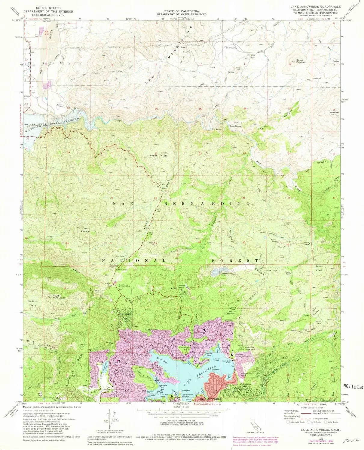
- USGS topographic map of Lake Arrowhead, CA, at 1:24000 scale. Heavier material. Waterproof. Tear-resistant. Foldable. Perfect for the outdoors.
- Cities, towns, villages: North Shore,Arrowhead Equestrian Estates,Cedar Glen
- Islands: Lone Pine Island
- Parks and forests: Deer Lodge Park
USGS topographic map of Lake Arrowhead, California, dated 1971, updated 1981.
Includes geographic coordinates (latitude and longitude), lines of elevation, bodies of water, roads, and more. This topo quad is suitable for recreational, outdoor uses, office applications, or wall map framing.
Printed on-demand by YellowMaps on the print material of your choice.
Shipping rolled from Minneapolis, MN, United States.
Product Number: USGS-5516785
Map Size: 26.8 inches high x 22 inches wide
Map Scale: 1:24000
Map Type: POD USGS Topographic Map
Map Series: HTMC
Map Version: Historical
Cell ID: 24331
Scan ID: 292040
Imprint Year: 1981
Woodland Tint: Yes
Photo Revision Year: 1980
Aerial Photo Year: 1978
Edit Year: 1980
Field Check Year: 1971
Datum: NAD27
Map Projection: Lambert Conformal Conic
Map published by United States Geological Survey
Map Language: English
Scanner Resolution: 600 dpi
Map Cell Name: Lake Arrowhead
Grid size: 7.5 X 7.5 Minute
Date on map: 1971
Geographical region: California, United States
Northern map edge Latitude: 34.375°
Southern map edge Latitude: 34.25°
Western map edge Longitude: -117.25°
Eastern map edge Longitude: -117.125°
Surrounding map sheets (copy & paste the Product No. in the search bar):
North: USGS-5507621,USGS-5507627,USGS-5507625,USGS-5507615,USGS-5507617
East: USGS-5509569,USGS-5509565,USGS-5509563
South: USGS-5503939,USGS-5503945,USGS-5515193,USGS-5515183,USGS-5503949
West: USGS-5502151,USGS-5502153,USGS-5523401,USGS-5502163,USGS-5502159


")


