Cooking Essentials&Outdoor Tools|Foldable Shovels,Windproof Stoves&Headlamps
Cooking Essentials&Outdoor Tools|Foldable Shovels,Windproof Stoves&Headlamps Cooking Essentials&Outdoor Tools|Foldable Shovels,Windproof Stoves&Headlamps
Home Navigation Gear Laminated Hiking Map
Western Australia Gold Map 1958

Western Australia Gold Map 1958

$ 79.95

$ 0.00

Save: $

Finish:
  • Paper
  • Laminated
  • Canvas
  • Canvas with Hang Rails
Unavailable
Please select combo product attributes
The combo subtotal is $,SAVE$

Product Details

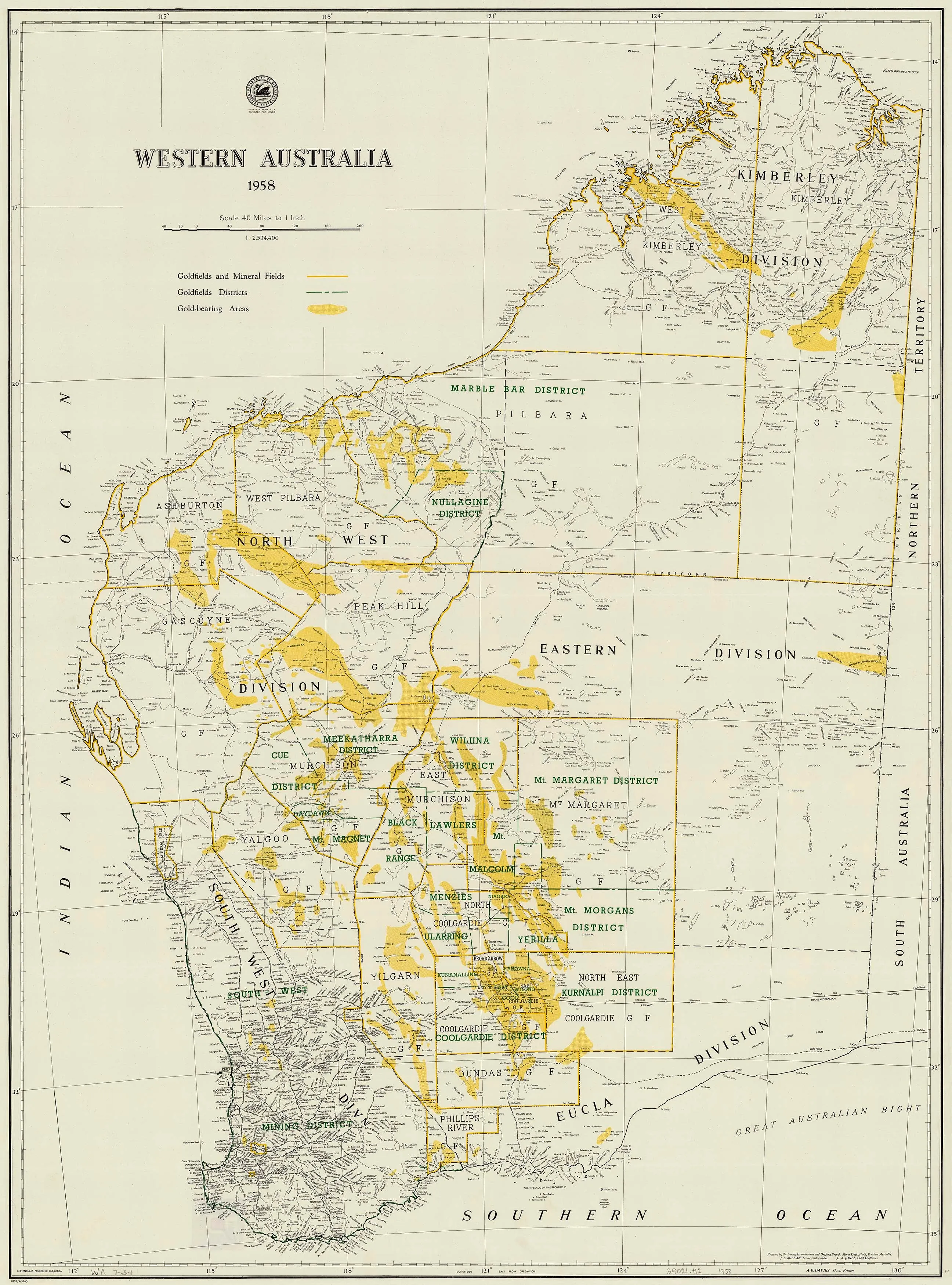
The Western Australia Gold Map published in 1958 was prepared by the Survey Examination and Drafting Branch of the Mines Department. The map highlights the goldfields and mineral fields as well as the gold-bearing areas. 

The map can come either printed on heavyweight 160 gsm paper or laminated. The paper version is perfect for framing under glass, and the laminated version is exceptionally hard-wearing as we use a true encapsulation of two pieces of 80-micron gloss laminate. 

Alternatively, we can supply this map on 395 gsm HP Professional Matte Canvas using pigment-based inks - making the map highly durable and fade-resistant. The exceptional clarity of printing makes this map a stunning addition to any room, and its high quality means that it will provide years of enjoyment.

The easiest way to hang your canvas map is by having wooden hang rollers attached top and bottom with a hanging cord on the top roller, so all you have to do is put a hook on the wall. The hang rails come lacquered in a natural timber colour.

Note: Please allow ten working days to deliver the hang-railed version, as the rails need to be attached by our framer.

Size 990 x 750mm


You May Also Like

Chrismar Mississagi Provincial Park & Area Map

$ 14.95

Save: $

Petzl Rechargeable Battery for Pixa 3R

$ 90.95

Save: $

Moccasin CA topo map, 1:24000 Scale, 7.5 X 7.5 Minute, Historical, 1948, Updated 1987, 26.8 x 21.5 in

$ 54.00

Save: $

Waterproof Map Case, Hiking Map Pouch Holder Transparent Window Map Storage Bag with Zipper and Lanyard Deisgn for Outdoor Hiking Camping

$ 24.00

$ 29.00

Save: $

Happyyami Stainless Steel Portable Camping Stove Rack Detachable Outdoor Fire Stand for Bonfire Cooking Lightweight Compact Design for Hiking Picnics and Campfires

$ 25.00

$ 36.00

Save: $

Green Mountain Club Killington Area Hiking Trail Map With Ascutney & Okemo Waterproof

$ 4.95

Save: $

LHX Camping Cooker Household Gas Windproof Cassette Stove Outdoor Stove (Color : Brass)

$ 81.00

$ 202.00

Save: $

33,000ft Packable Rain Jacket Men's Lightweight Waterproof Rain Shell Jacket Raincoat with Hood for Golf Cycling Windbreaker

$ 26.00

$ 37.00

Save: $

Little Donkey Andy Women's Lightweight Hooded Softshell Jacket for Running Travel Hiking, Windproof, Water Repellent

$ 35.00

$ 50.00

Save: $

PLUME TS V2 SHOVEL
PLUME TS V2 SHOVEL

$ 84.95

Save: $

Cart
Cooking Essentials&Outdoor Tools|Foldable Shovels,Windproof Stoves&Headlamps
Your cart is currently empty.