- Printed on Polypropylene (plastic)
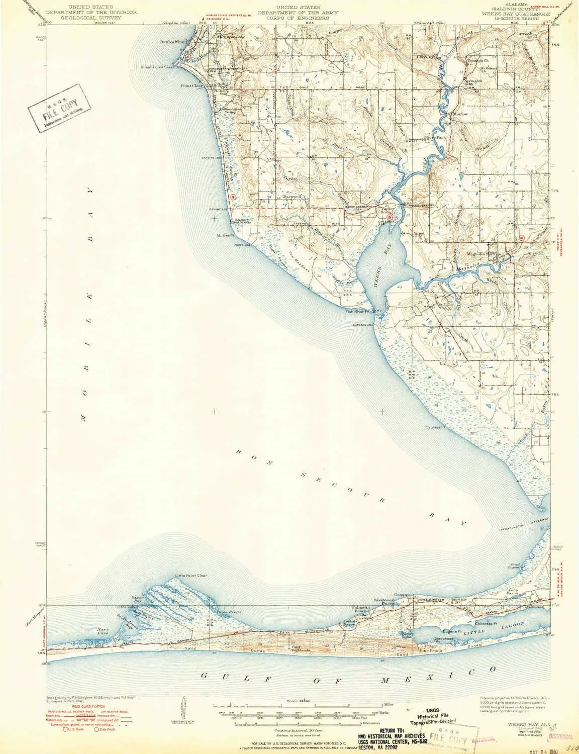
- USGS topographic map of Weeks Bay, AL, at 1:62500 scale. Heavier material. Waterproof. Tear-resistant. Foldable. Perfect for the outdoors.
- Cities, towns, villages: Magnolia Springs,Bayside,Gasque,Battles Wharf,Barnwell,Clay City,River Park,Point Clear,Turkey Branch,Marlow,Yupon
- Islands: Consult topo map preview for visible islands.
- Parks and forests: Mullet Point Park
USGS topographic map of Weeks Bay, Alabama, dated 1943, updated 1950.
Includes geographic coordinates (latitude and longitude), lines of elevation, bodies of water, roads, and more. This topo quad is suitable for recreational, outdoor uses, office applications, or wall map framing.
Printed on-demand by YellowMaps on the print material of your choice.
Shipping rolled from Minneapolis, MN, United States.
Product Number: USGS-5679148
Map Size: 22.7 inches high x 17.4 inches wide
Map Scale: 1:62500
Map Type: POD USGS Topographic Map
Map Series: HTMC
Map Version: Historical
Cell ID: 64356
Scan ID: 305731
Imprint Year: 1950
Survey Year: 1941
Datum: NAD27
Map Projection: Polyconic
Map published by United States Geological Survey
Map published by United States Army Corps of Engineers
Keywords: Overedge
Map Language: English
Scanner Resolution: 600 dpi
Map Cell Name: Weeks Bay
Grid size: 15 X 15 Minute
Date on map: 1943
Geographical region: Alabama, United States
Northern map edge Latitude: 30.5°
Southern map edge Latitude: 30.25°
Western map edge Longitude: -88°
Eastern map edge Longitude: -87.75°
Surrounding map sheets (copy & paste the Product No. in the search bar):
North: USGS-5538623,USGS-5542121,USGS-5542119,USGS-5538621,USGS-5542309
East: USGS-5682645,USGS-5682655,USGS-5682651,USGS-5682659,USGS-5682649
South: USGS-5541465
West: USGS-5542233,USGS-5540153,USGS-5542229,USGS-5542231,USGS-5540151
")
")


