- Printed on Tyvek® (synthetic)
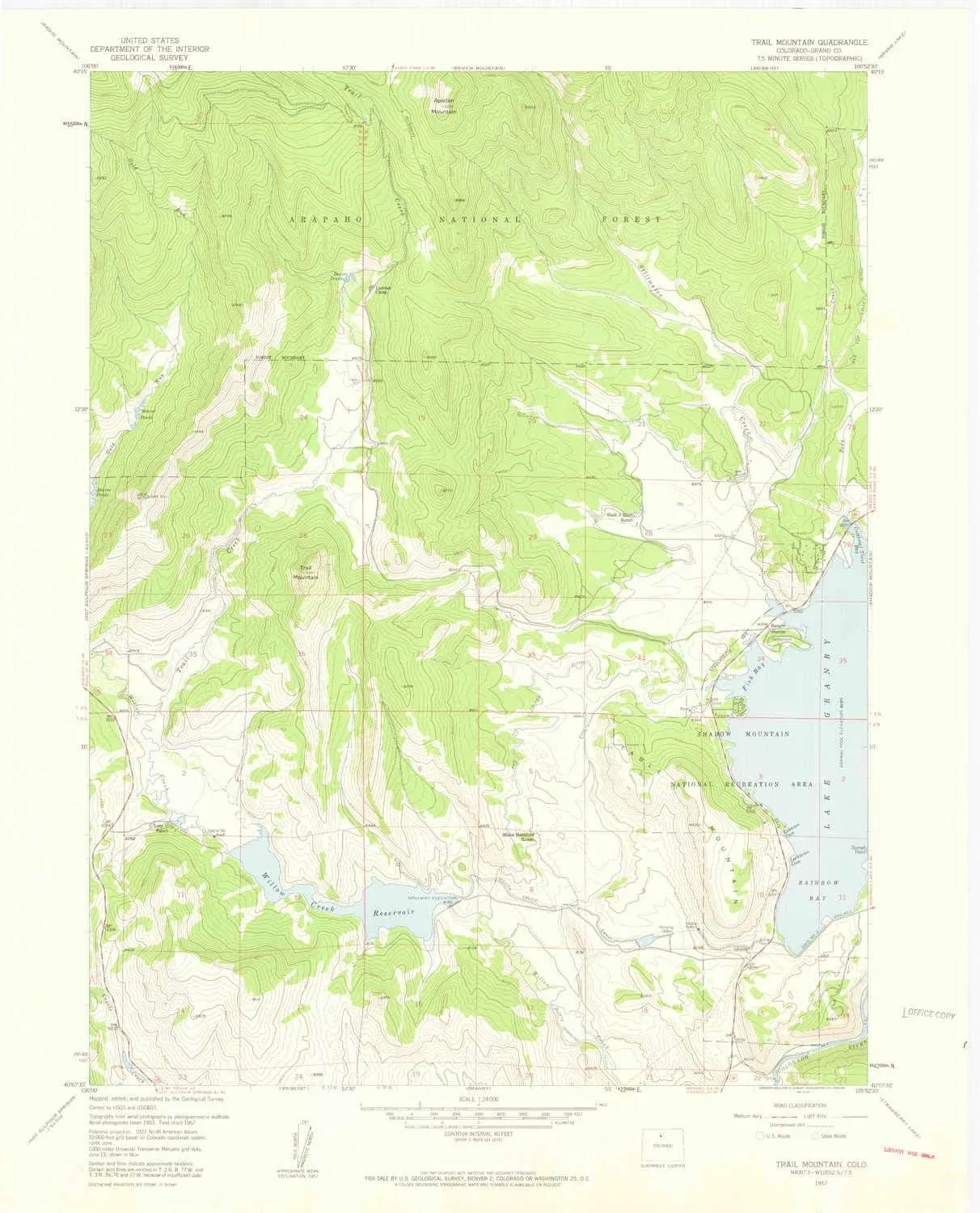
- USGS topographic map of Trail Mountain, CO, at 1:24000 scale. Lighter material. Waterproof. Tear-resistant. Foldable. Very durable. Perfect for backpacking and the outdoors.
- Cities, towns, villages: Please see map preview to find populated places, townships, as well as roads and street names if available.
- Mountains: Table Mountain,Apiatan Mountain,Trail Mountain
- Valleys: Low elevation topographic features such as flatlands, river valleys, and canyons.
USGS topographic map of Trail Mountain, Colorado, dated 1957, updated 1959.
Includes geographic coordinates (latitude and longitude), lines of elevation, bodies of water, roads, and more. This topo quad is suitable for recreational, outdoor uses, office applications, or wall map framing.
Printed on-demand by YellowMaps on the print material of your choice.
Shipping rolled from Minneapolis, MN, United States.
Product Number: USGS-5356929
Map Size: 27.2 inches high x 22 inches wide
Map Scale: 1:24000
Map Type: POD USGS Topographic Map
Map Series: HTMC
Map Version: Historical
Cell ID: 45552
Scan ID: 402012
Imprint Year: 1959
Woodland Tint: Yes
Visual Version Number: 1
Aerial Photo Year: 1953
Field Check Year: 1957
Datum: NAD27
Map Projection: Polyconic
Map published by United States Geological Survey
Map Language: English
Scanner Resolution: 508 dpi
Map Cell Name: Trail Mountain
Grid size: 7.5 X 7.5 Minute
Date on map: 1957
Geographical region: Colorado, United States
Northern map edge Latitude: 40.25°
Southern map edge Latitude: 40.125°
Western map edge Longitude: -106°
Eastern map edge Longitude: -105.875°
Surrounding map sheets (copy & paste the Product No. in the search bar):
North: USGS-5347143,USGS-5347153,USGS-5347149,USGS-5347141,USGS-5347145
East: USGS-5355847,USGS-5683261,USGS-5355851,USGS-5355845
South: USGS-5350349,USGS-5350345,USGS-5350347,USGS-5350351
West: USGS-5347519,USGS-5347515,USGS-5347517
")


