- Printed on Tyvek® (synthetic)
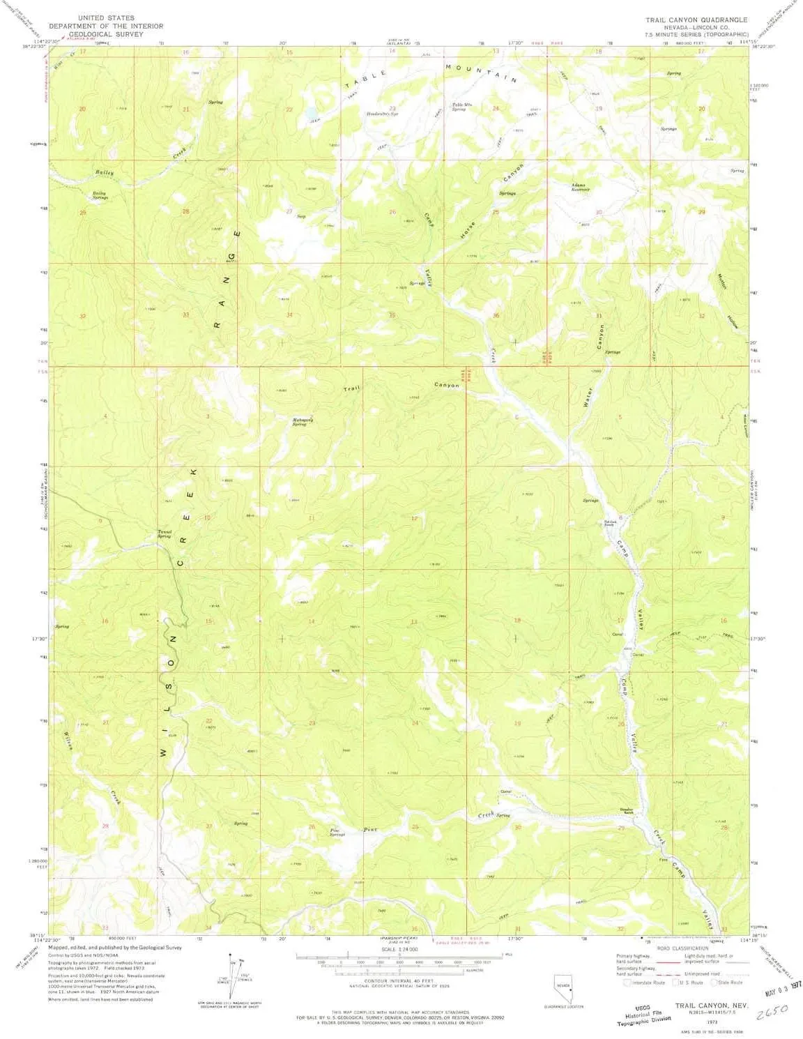
- USGS topographic map of Trail Canyon, NV, at 1:24000 scale. Lighter material. Waterproof. Tear-resistant. Foldable. Very durable. Perfect for backpacking and the outdoors.
- Cities, towns, villages: Cedarhurst (historical)
- Mountains: Table Mountain
- Valleys: Water Canyon,Trail Canyon,Horse Canyon
USGS topographic map of Trail Canyon, Nevada, dated 1973, updated 1977.
Includes geographic coordinates (latitude and longitude), lines of elevation, bodies of water, roads, and more. This topo quad is suitable for recreational, outdoor uses, office applications, or wall map framing.
Printed on-demand by YellowMaps on the print material of your choice.
Shipping rolled from Minneapolis, MN, United States.
Product Number: USGS-5571524
Map Size: 26.8 inches high x 22 inches wide
Map Scale: 1:24000
Map Type: POD USGS Topographic Map
Map Series: HTMC
Map Version: Historical
Cell ID: 71870
Scan ID: 320363
Imprint Year: 1977
Woodland Tint: Yes
Aerial Photo Year: 1972
Field Check Year: 1973
Datum: NAD27
Map Projection: Transverse Mercator
Map published by United States Geological Survey
Map Language: English
Scanner Resolution: 600 dpi
Map Cell Name: Trail Canyon
Grid size: 7.5 X 7.5 Minute
Date on map: 1973
Geographical region: Nevada, United States
Northern map edge Latitude: 38.375°
Southern map edge Latitude: 38.25°
Western map edge Longitude: -114.375°
Eastern map edge Longitude: -114.25°
Surrounding map sheets (copy & paste the Product No. in the search bar):
North: USGS-5566760
East: USGS-5569574
South: USGS-5570248,USGS-5570250
West: USGS-5570778


