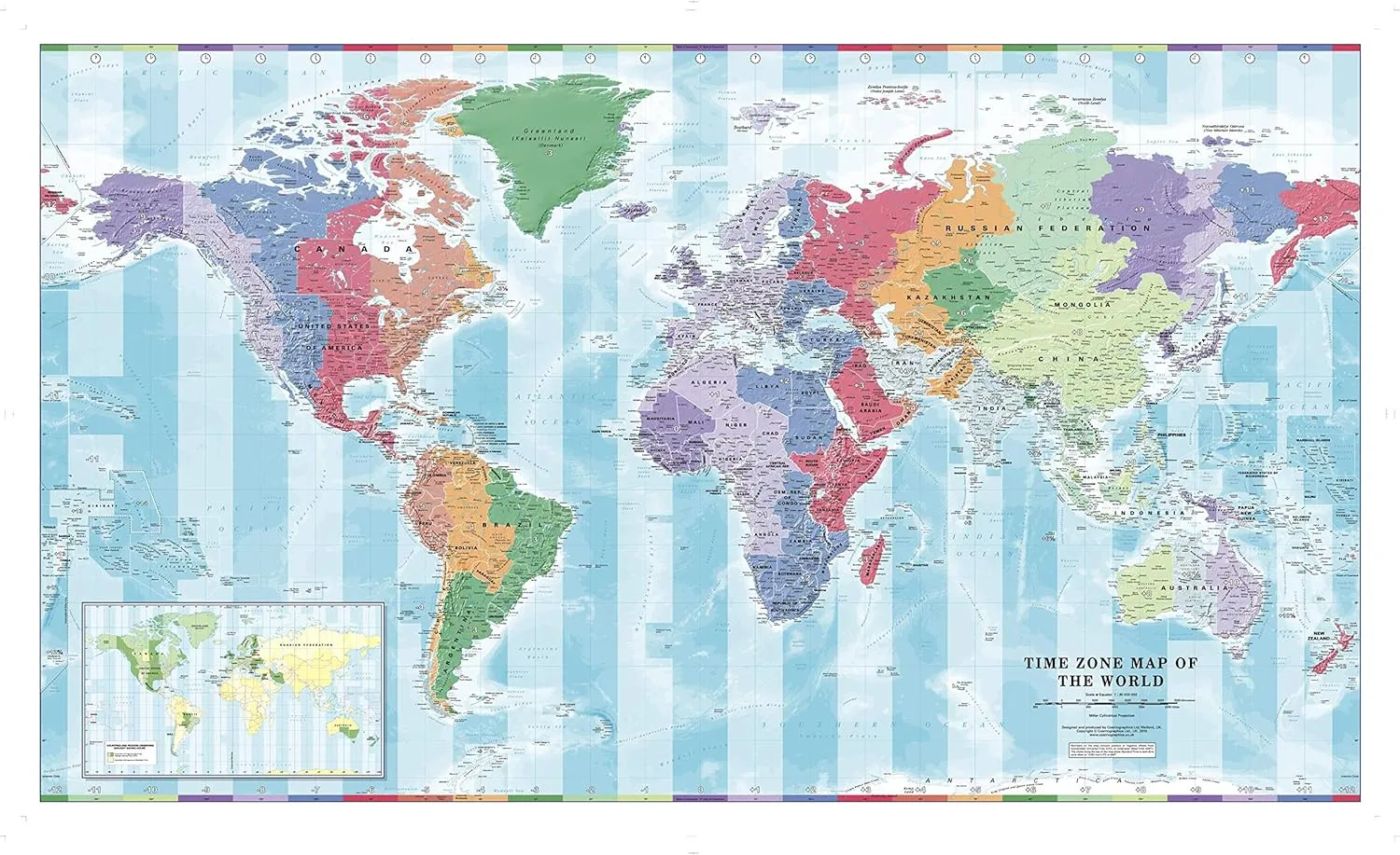
- Colorful yet informative map; Combined with a detailed political map of the world, contrasting colors are used to accurately depict the different time zones, both on land and in the oceans; Includes an additional map showing countries/states that adopt daylight saving hours
- Colourful yet informative map
- Combined with a detailed political map of the world, contrasting colours are used to accurately depict the different time zones, both on land and in the oceans; Includes an additional map showing countries/states that adopt daylight saving hours
- International products have separate terms, are sold from abroad and may differ from local products, including fit, age ratings, and language of product, labeling or instructions
53.75 x 31.5 inches. Laminated. Flat map, tubed for shipping.
Colorful yet informative map. Combined with a detailed political map of the world, contrasting colors are used to accurately depict the different time zones, both on land and in the oceans. Includes an additional map showing countries/states that adopt daylight saving hours.
Scale 1:30,000,000


 Topographic Wall Map by Spatial Vision")


