- Printed on Polypropylene (plastic)
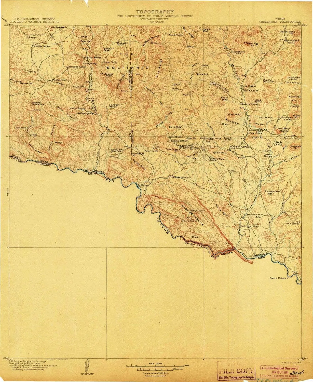
- USGS topographic map of Terlingua, TX, at 1:125000 scale. Heavier material. Waterproof. Tear-resistant. Foldable. Perfect for the outdoors.
- Cities, towns, villages: Terlingua Abaja,Lajitas,Lunas,Santa Elena Crossing,Terlingua,Tres Papalotes,Papalote Escondido,Papalote Seco,Papalote Llano,Study Butte,Castolon
- Islands: Consult topo map preview for visible islands.
- Parks and forests: National Parks, National Forests, etc. Please preview map image for specifics.
USGS topographic map of Terlingua, Texas, dated 1904.
Includes geographic coordinates (latitude and longitude), lines of elevation, bodies of water, roads, and more. This topo quad is suitable for recreational, outdoor uses, office applications, or wall map framing.
Printed on-demand by YellowMaps on the print material of your choice.
Shipping rolled from Minneapolis, MN, United States.
Product Number: USGS-5659646
Map Size: 20 inches high x 16.4 inches wide
Map Scale: 1:125000
Map Type: POD USGS Topographic Map
Map Series: HTMC
Map Version: Historical
Cell ID: 66765
Scan ID: 137522
Visual Version Number: 1
Survey Year: 1903
Datum: Unstated
Map Projection: Unstated
Map published by United States Geological Survey
Map Language: English
Scanner Resolution: 600 dpi
Map Cell Name: Terlingua
Grid size: 30 X 30 Minute
Date on map: 1904
Geographical region: Texas, United States
Northern map edge Latitude: 29.5°
Southern map edge Latitude: 29°
Western map edge Longitude: -104°
Eastern map edge Longitude: -103.5°
Surrounding map sheets (copy & paste the Product No. in the search bar):
North: USGS-5479425,USGS-5480113,USGS-5488703,USGS-5479427,USGS-5479421
East: USGS-5686627,USGS-5494443,USGS-5686631,USGS-5686629
South:
West: USGS-5481121,USGS-5481123,USGS-5480661,USGS-5481119,USGS-5480663


