- Printed on Polypropylene (plastic)
- USGS topographic map of Tanana, AK, at 1:250000 scale. Heavier material. Waterproof. Tear-resistant. Foldable. Perfect for the outdoors.
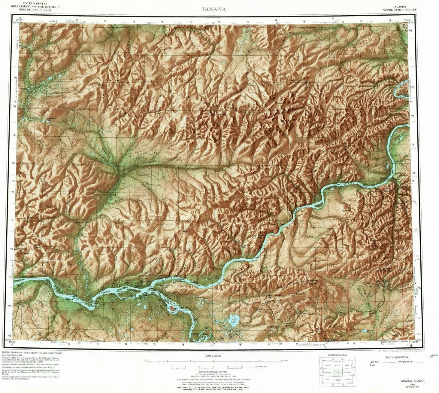
- Cities, towns, villages: Woodchopper (historical),Tanana,Eureka,Grant Creek,Manley Hot Springs,Tofty,Tozikakat (historical),Rampart
- Islands: Sixmile Island,Sixmile Island,Sixmile Island,Bull Island,Leonard Island,Basco Island,Garnet Island,Long Island
- Parks and forests: Senati (historical)
USGS topographic map of Tanana, Alaska, dated 1960, updated 1978.
Includes geographic coordinates (latitude and longitude), lines of elevation, bodies of water, roads, and more. This topo quad is suitable for recreational, outdoor uses, office applications, or wall map framing.
Printed on-demand by YellowMaps on the print material of your choice.
Shipping rolled from Minneapolis, MN, United States.
Product Number: USGS-5662200
Map Size: 22.1 inches high x 24.9 inches wide
Map Scale: 1:250000
Map Type: POD USGS Topographic Map
Map Series: HTMC
Map Version: Historical
Cell ID: 69046
Scan ID: 361539
Imprint Year: 1978
Aerial Photo Year: 1975
Edit Year: 1976
Survey Year: 1956
Datum: NAD27
Map Projection: Universal Transverse Mercator
Shaded Relief map: Yes
Map published by United States Geological Survey
Map Language: English
Scanner Resolution: 600 dpi
Map Cell Name: Tanana
Grid size: 1 X 3 Degree
Date on map: 1960
Geographical region: Alaska, United States
Northern map edge Latitude: 66°
Southern map edge Latitude: 65°
Western map edge Longitude: -153°
Eastern map edge Longitude: -150°
Surrounding map sheets (copy & paste the Product No. in the search bar):
North: USGS-5660534,USGS-5660530,USGS-5660544,USGS-5663724,USGS-5660540
East: USGS-5668974,USGS-5661398,USGS-5661394,USGS-5661380,USGS-5661390
South: USGS-5667742,USGS-5661196,USGS-5667740,USGS-5661208,USGS-5661206
West: USGS-5661478,USGS-5661474,USGS-5669736,USGS-5661470,USGS-5661482
")


")
