- Printed on Tyvek® (synthetic)
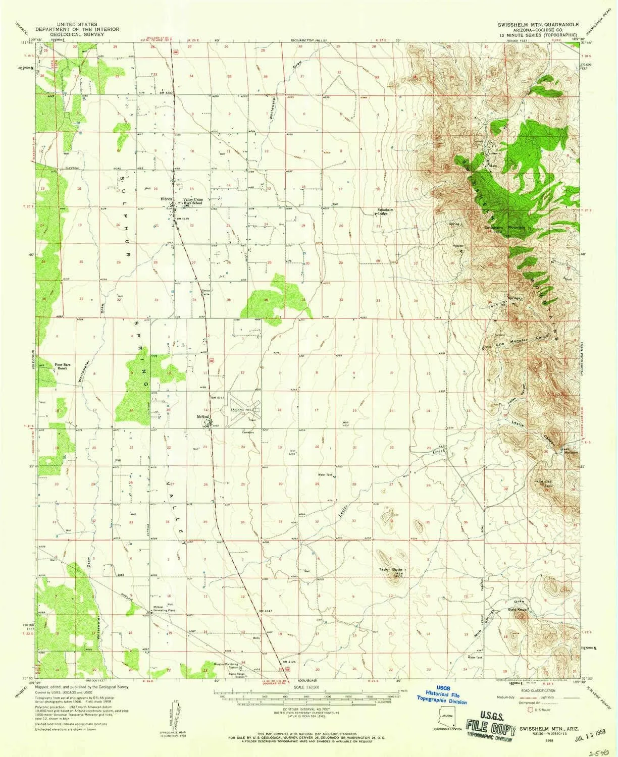
- USGS topographic map of Swisshelm Mtn, AZ, at 1:62500 scale. Lighter material. Waterproof. Tear-resistant. Foldable. Very durable. Perfect for backpacking and the outdoors.
- Cities, towns, villages: McNeal,Elfrida
- Mountains: Swisshelm Mountain,Bald Knob,Taylor Butte
- Valleys: Indian Canyon,Gila Monster Canyon,Leslie Canyon
USGS topographic map of Swisshelm Mtn, Arizona, dated 1958, updated 1959.
Includes geographic coordinates (latitude and longitude), lines of elevation, bodies of water, roads, and more. This topo quad is suitable for recreational, outdoor uses, office applications, or wall map framing.
Printed on-demand by YellowMaps on the print material of your choice.
Shipping rolled from Minneapolis, MN, United States.
Product Number: USGS-5548814
Map Size: 20.8 inches high x 17 inches wide
Map Scale: 1:62500
Map Type: POD USGS Topographic Map
Map Series: HTMC
Map Version: Historical
Cell ID: 63200
Scan ID: 315090
Imprint Year: 1959
Woodland Tint: Yes
Aerial Photo Year: 1956
Field Check Year: 1958
Datum: NAD27
Map Projection: Polyconic
Map published by United States Geological Survey
Map Language: English
Scanner Resolution: 600 dpi
Map Cell Name: Swisshelm Mountain
Grid size: 15 X 15 Minute
Date on map: 1958
Geographical region: Arizona, United States
Northern map edge Latitude: 31.75°
Southern map edge Latitude: 31.5°
Western map edge Longitude: -109.75°
Eastern map edge Longitude: -109.5°
Surrounding map sheets (copy & paste the Product No. in the search bar):
North: USGS-5548766,USGS-5548768,USGS-5556144,USGS-5556146
East: USGS-5549326,USGS-5554820,USGS-5554816,USGS-5549328,USGS-5549332
South: USGS-5547832,USGS-5551560,USGS-5547836,USGS-5547830,USGS-5551564
West: USGS-5552196,USGS-5552198,USGS-5552192,USGS-5547970,USGS-5552194


