- Printed on Polypropylene (plastic)
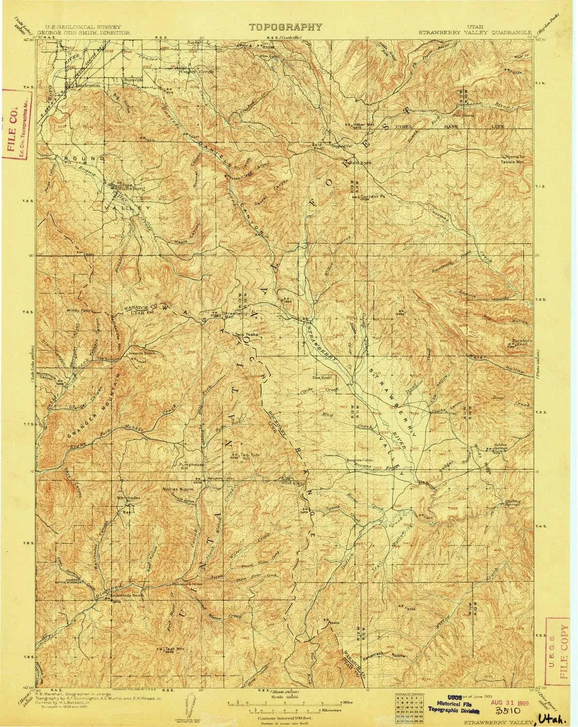
- USGS topographic map of Strawberry Valley, UT, at 1:125000 scale. Heavier material. Waterproof. Tear-resistant. Foldable. Perfect for the outdoors.
- Cities, towns, villages: Patrick Place,Wallsburg,Bryants Fork Summer Home Area,West Portal,Daniel,Timber Lakes,Independence,Three Forks,Charleston,Center Creek
- Islands: Consult topo map preview for visible islands.
- Parks and forests: Uinta National Forest,Strawberry River Day Use Area,Wallsburg Wildlife Management Area,Strawberry Bay Recreation Complex,Soldier Creek Dam Day Use Area,Diamond Battle Historical Monument,Diamond Fork Youth Forest,Soldier Creek Recreation Complex
USGS topographic map of Strawberry Valley, Utah, dated 1909.
Includes geographic coordinates (latitude and longitude), lines of elevation, bodies of water, roads, and more. This topo quad is suitable for recreational, outdoor uses, office applications, or wall map framing.
Printed on-demand by YellowMaps on the print material of your choice.
Shipping rolled from Minneapolis, MN, United States.
Product Number: USGS-5463320
Map Size: 19.6 inches high x 15.6 inches wide
Map Scale: 1:125000
Map Type: POD USGS Topographic Map
Map Series: HTMC
Map Version: Historical
Cell ID: 66712
Scan ID: 244074
Survey Year: 1907
Datum: Unstated
Map Projection: Unstated
Map published by United States Geological Survey
Map Language: English
Scanner Resolution: 600 dpi
Map Cell Name: Strawberry Valley
Grid size: 30 X 30 Minute
Date on map: 1909
Geographical region: Utah, United States
Northern map edge Latitude: 40.5°
Southern map edge Latitude: 40°
Western map edge Longitude: -111.5°
Eastern map edge Longitude: -111°
Surrounding map sheets (copy & paste the Product No. in the search bar):
North: USGS-5457869,USGS-5457855,USGS-5457853,USGS-5463246,USGS-5457859
East: USGS-6009405,USGS-5461135,USGS-6009397,USGS-6009407,USGS-6009401
South: USGS-5461467,USGS-5461463,USGS-5461465
West: USGS-5460941,USGS-5460937,USGS-5460935,USGS-5460933,USGS-5460931


 for 3.7V Rechargeable Batteries Kids Vehicles Toys")

")


