- Printed on Polypropylene (plastic)
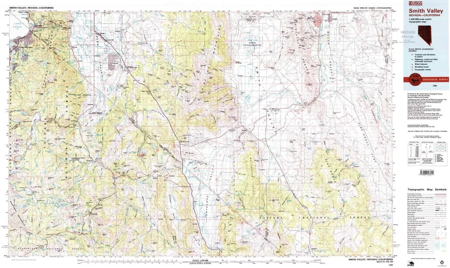
- USGS topographic map of Smith Valley, NV, at 1:100000 scale. Heavier material. Waterproof. Tear-resistant. Foldable. Perfect for the outdoors.
- Cities, towns, villages: Minden,Paynesville,Gardnerville,Buckeye,Stateline,Round Hill,Mountain House (historical),Centerville (historical),Mesa Vista,Fredericksburg,Walker River (historical),Woodfords,Cambridge (historical),Valley View (historical),Holbrook Junction,Nordyke,Kingsbury Village,Summit Village,Stateline,Sulfur,Mottsville,Hudson (historical),Kingsbury Meadows,Double Springs (historical),South Lake Tahoe,Tippecanoe (historical),Wellington Springs,Mammoth Ledge (historical)
- Islands: Consult topo map preview for visible islands.
- Parks and forests: Toiyabe National Forest,Lampe Park,Bijou Community Park,Thomas F Regan Memorial City Beach,Lahontan National Fish Hatchery,Topaz Lake Park,Grover Hot Springs State Park,Snowshoe Thompson Historical Mon,Snowshoe Thompson Historical Monument,Artesia Lake State Wildlife Management Area,Indian Creek Recreation Lands,Turtle Rock County Park,South Lake Tahoe-El Dorado Recreation Area
USGS topographic map of Smith Valley, Nevada, dated 1985, updated 1985.
Includes geographic coordinates (latitude and longitude), lines of elevation, bodies of water, roads, and more. This topo quad is suitable for recreational, outdoor uses, office applications, or wall map framing.
Printed on-demand by YellowMaps on the print material of your choice.
Shipping rolled from Minneapolis, MN, United States.
Product Number: USGS-5573590
Map Size: 24.1 inches high x 41.2 inches wide
Map Scale: 1:100000
Map Type: POD USGS Topographic Map
Map Series: HTMC
Map Version: Historical
Cell ID: 68380
Scan ID: 321557
Imprint Year: 1985
Woodland Tint: Yes
Visual Version Number: 1
Aerial Photo Year: 1980
Edit Year: 1985
Datum: NAD27
Map Projection: Universal Transverse Mercator
Map published by United States Geological Survey
Map Language: English
Scanner Resolution: 600 dpi
Map Cell Name: Smith Valley
Grid size: 30 X 60 Minute
Date on map: 1985
Geographical region: Nevada, United States
Northern map edge Latitude: 39°
Southern map edge Latitude: 38.5°
Western map edge Longitude: -120°
Eastern map edge Longitude: -119°
Surrounding map sheets (copy & paste the Product No. in the search bar):
North: USGS-5573850,USGS-5568438,USGS-5568432,USGS-5573842,USGS-5573640
East: USGS-5572858,USGS-5569646,USGS-5572860,USGS-5573606,USGS-5573604
South: USGS-5505745,USGS-5501401,USGS-5501403,USGS-5505755,USGS-5630971
West: USGS-5647655,USGS-5647653,USGS-5647637,USGS-5647649,USGS-5504547
")


