- Printed on Tyvek® (synthetic)
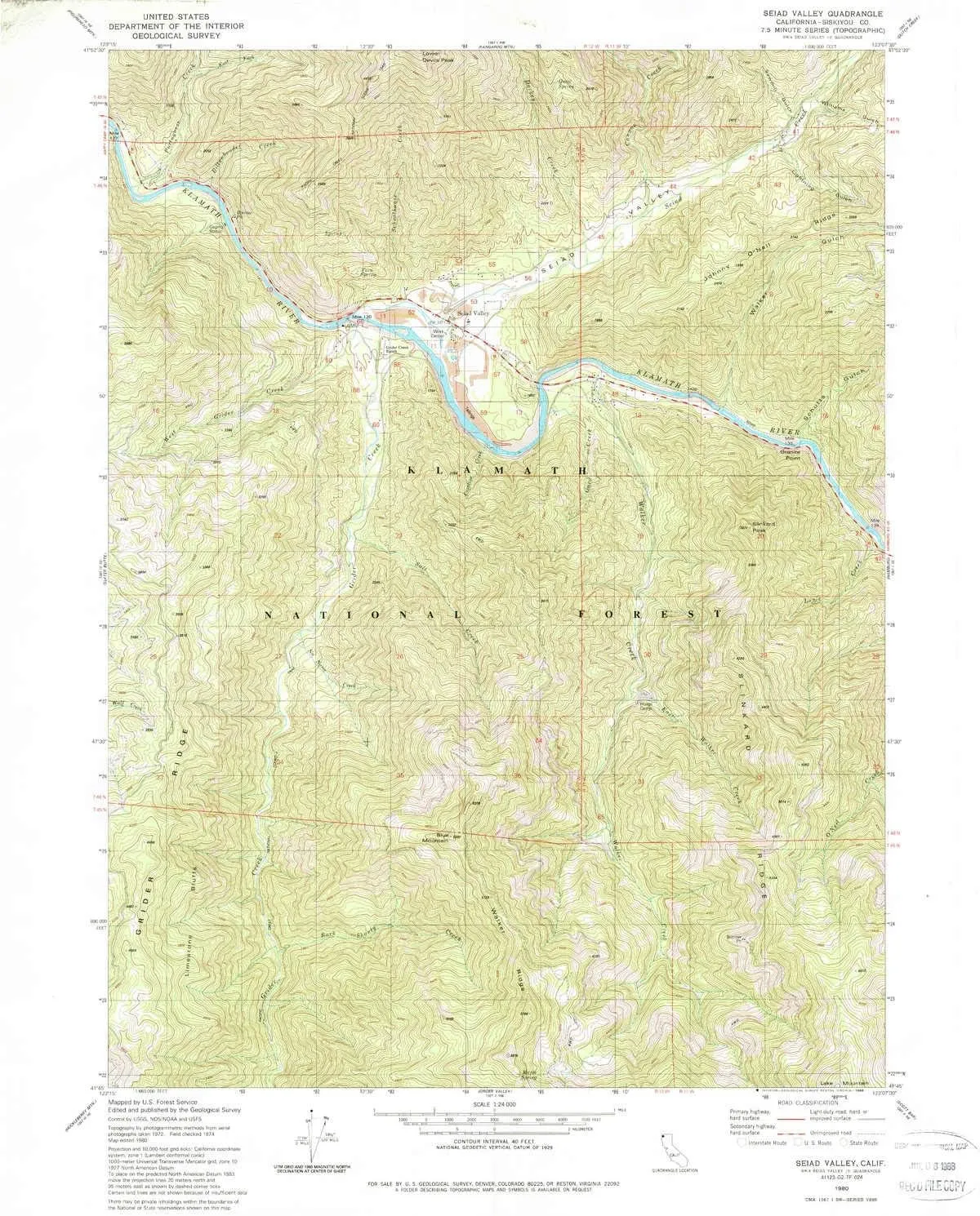
- USGS topographic map of Seiad Valley, CA, at 1:24000 scale. Lighter material. Waterproof. Tear-resistant. Foldable. Very durable. Perfect for backpacking and the outdoors.
- Cities, towns, villages: Seiad Valley
- Mountains: Slinkard Peak,Blue Mountain
- Valleys: Schutts Gulch,Sawmill Gulch,Seiad Valley,Williams Gulch,Walker Gulch,Lightning Gulch
USGS topographic map of Seiad Valley, California, dated 1980, updated 1988.
Includes geographic coordinates (latitude and longitude), lines of elevation, bodies of water, roads, and more. This topo quad is suitable for recreational, outdoor uses, office applications, or wall map framing.
Printed on-demand by YellowMaps on the print material of your choice.
Shipping rolled from Minneapolis, MN, United States.
Product Number: USGS-5523117
Map Size: 26.8 inches high x 21.4 inches wide
Map Scale: 1:24000
Map Type: POD USGS Topographic Map
Map Series: HTMC
Map Version: Historical
Cell ID: 40471
Scan ID: 295123
Imprint Year: 1988
Woodland Tint: Yes
Aerial Photo Year: 1972
Edit Year: 1980
Field Check Year: 1974
Datum: NAD27
Map Projection: Lambert Conformal Conic
Map published by United States Geological Survey
Map Language: English
Scanner Resolution: 600 dpi
Map Cell Name: Seiad Valley
Grid size: 7.5 X 7.5 Minute
Date on map: 1980
Geographical region: California, United States
Northern map edge Latitude: 41.875°
Southern map edge Latitude: 41.75°
Western map edge Longitude: -123.25°
Eastern map edge Longitude: -123.125°
Surrounding map sheets (copy & paste the Product No. in the search bar):
North: USGS-5516321,USGS-5516319,USGS-5516317
East: USGS-5515077,USGS-5515075
South: USGS-5504437,USGS-5514853,USGS-5514855,USGS-5504439,USGS-5514851
West: USGS-5523499,USGS-5502043,USGS-5523497,USGS-5502041


