- Printed on Polypropylene (plastic)
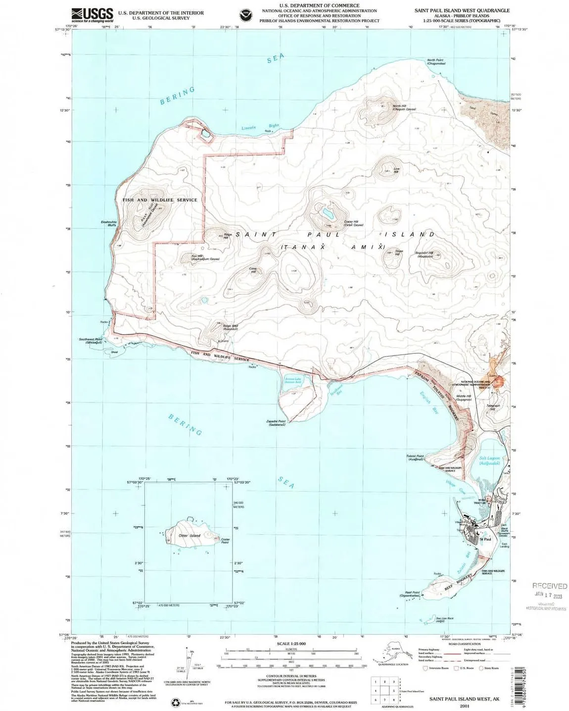
- USGS topographic map of Saint Paul Island West, AK, at 1:25000 scale. Heavier material. Waterproof. Tear-resistant. Foldable. Perfect for the outdoors.
- Cities, towns, villages: Marunich (historical),Saint Paul
- Islands: Kamenisti,Ardiguen,Sea Lion Rock,Antones Island
- Parks and forests: National Parks, National Forests, etc. Please preview map image for specifics.
USGS topographic map of Saint Paul Island West, Alaska, dated 2001, updated 2002.
Includes geographic coordinates (latitude and longitude), lines of elevation, bodies of water, roads, and more. This topo quad is suitable for recreational, outdoor uses, office applications, or wall map framing.
Printed on-demand by YellowMaps on the print material of your choice.
Shipping rolled from Minneapolis, MN, United States.
Product Number: USGS-5660240
Map Size: 26.9 inches high x 22 inches wide
Map Scale: 1:25000
Map Type: POD USGS Topographic Map
Map Series: HTMC
Map Version: Historical
Cell ID: 395640
Scan ID: 353773
Imprint Year: 2002
Aerial Photo Year: 2001
Datum: NAD83
Map Projection: Universal Transverse Mercator
Map published by United States Geological Survey
Map published by United States Department of Commerce
Keywords: Inset
Map Language: English
Scanner Resolution: 600 dpi
Map Cell Name: Saint Paul Island West
Grid size: 7.5 X 7.5 Minute
Date on map: 2001
Geographical region: Alaska, United States
Northern map edge Latitude: 57.225°
Southern map edge Latitude: 57.1°
Western map edge Longitude: -170.4333333°
Eastern map edge Longitude: -170.2666667°
Surrounding map sheets (copy & paste the Product No. in the search bar):
North:
East:
South:
West:
")


")


