- ✔Main Functions:Basic positioning, measuring azimuth, deflection angle, it's easy to read data in all weather at any time.
- ✔excellent for camping, hiking, exploring, and other outdoor activities.
- ✔WATERPROOF AND SHOCKPROOF FOR ROUGH USE - The base and cover are constructed with metal for years of durable using. Suitable for motoring, boating, camping, mountaineering, exploring, hunting, and other outdoor activities.
- ✔It is recommended to put it in your pocket, backpack or directly on your neck so that your direction will always be correct.
- ✔Applicable occasions and people:This compass is waterproof and shockproof, suitable for driving, camping, hiking, so this compass is a good tool for backpackers, campers, hikers, hunters, geologists to do outdoor activities.
This professional grade military compass will always lead you in the right direction. Ideal for camping, military usage, emergencies, and anywhere the beaten track takes you
The base and cover are constructed with metal for years of durable using. Suitable for motoring, boating, camping, mountaineering, exploring, hunting, and other outdoor activities.
Main Functions:Basic positioning, measuring azimuth, deflection angle, it's easy to read data in all weather at any time.
excellent for camping, hiking, exploring, and other outdoor activities.
Easy to carry:The compass is medium in size and easy to carry.
It is recommended to put it in your pocket, backpack or directly on your neck so that your direction will always be correct.
Applicable occasions and people:This compass is waterproof and shockproof, suitable for driving, camping, hiking, so this compass is a good tool for backpackers, campers, hikers, hunters, geologists to do outdoor activities.
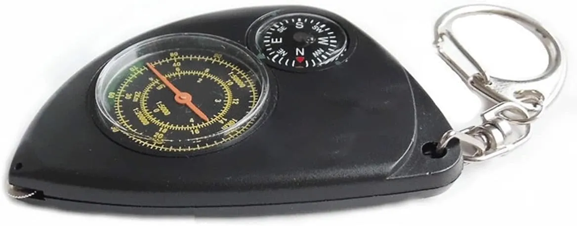
Product material: ABS shell, metal fittings, white oil
Product weight: 22 grams (product net weight), 28 grams (including packaging)
Product size: 77*53* 12mm
Packing size: 78*55* 1 7mm
Dial diameter: 32mm (odometer), 18mm (compass)
Product features: four proportional scale modes
1: 1 original ratio (outer circle), 1: 50000, 1: 20000, 1: 5000.
You can choose different scale scales according to the actual length, just use the pulley at the front of the body.
Move along the path from the starting point to the end point on the map, and then measure the actual distance between the two places according to different scale standards.
quantity: 1
Global Mountaineering,Navigating training.
Thank you for your patronage. I sell products with integrity. If you have any questions, please contact me in time. We will solve it for you within 24 hours.


