- Printed on Polypropylene (plastic)
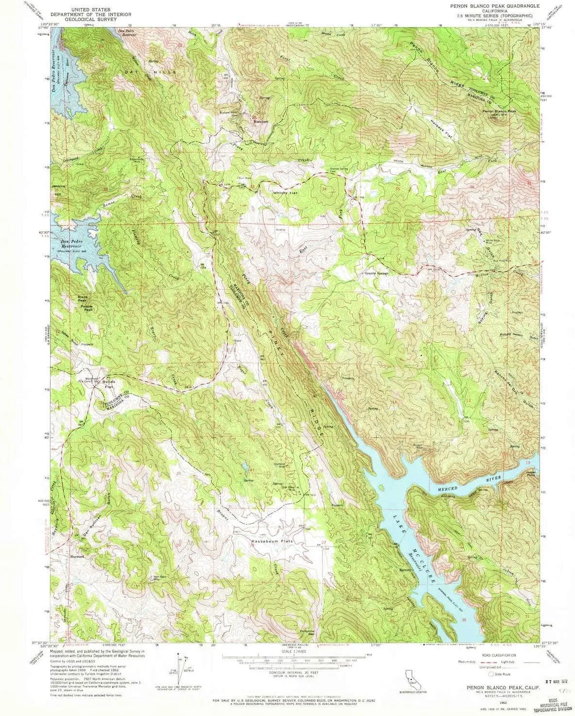
- USGS topographic map of Penon Blanco Peak, CA, at 1:24000 scale. Heavier material. Waterproof. Tear-resistant. Foldable. Perfect for the outdoors.
- Cities, towns, villages: Hayward,Granite Springs,Blanchard,Barrett
- Islands: Consult topo map preview for visible islands.
- Parks and forests: Barrett Cove Recreation Area
USGS topographic map of Penon Blanco Peak, California, dated 1962, updated 1972.
Includes geographic coordinates (latitude and longitude), lines of elevation, bodies of water, roads, and more. This topo quad is suitable for recreational, outdoor uses, office applications, or wall map framing.
Printed on-demand by YellowMaps on the print material of your choice.
Shipping rolled from Minneapolis, MN, United States.
Product Number: USGS-5520575
Map Size: 26.9 inches high x 22 inches wide
Map Scale: 1:24000
Map Type: POD USGS Topographic Map
Map Series: HTMC
Map Version: Historical
Cell ID: 34738
Scan ID: 294044
Imprint Year: 1972
Woodland Tint: Yes
Aerial Photo Year: 1959
Field Check Year: 1962
Datum: NAD27
Map Projection: Polyconic
Map published by United States Geological Survey
Map Language: English
Scanner Resolution: 600 dpi
Map Cell Name: Penon Blanco Peak
Grid size: 7.5 X 7.5 Minute
Date on map: 1962
Geographical region: California, United States
Northern map edge Latitude: 37.75°
Southern map edge Latitude: 37.625°
Western map edge Longitude: -120.375°
Eastern map edge Longitude: -120.25°
Surrounding map sheets (copy & paste the Product No. in the search bar):
North: USGS-5518669,USGS-5518667,USGS-5518665,USGS-5518661,USGS-5518659
East: USGS-5511675,USGS-5511667,USGS-5511669,USGS-5511665,USGS-5511681
South: USGS-5518355,USGS-5682909,USGS-5518351,USGS-5518353,USGS-5499679
West: USGS-5516665,USGS-5499535,USGS-5516661,USGS-5499537,USGS-5516663


")


, Ultimate Survival Tool, Tactical Military Spade, Compact Entrenching Tool for Camping, Off Roading, Metal Detecting, Backpacking and Emergency")


