- Printed on Tyvek® (synthetic)
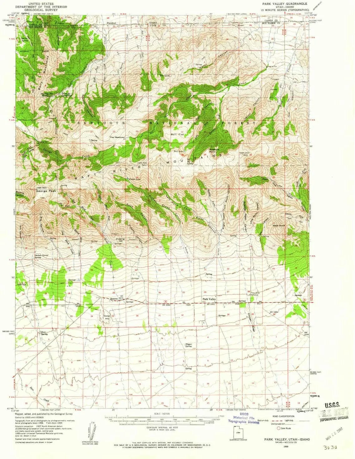
- USGS topographic map of Park Valley, UT, at 1:62500 scale. Lighter material. Waterproof. Tear-resistant. Foldable. Very durable. Perfect for backpacking and the outdoors.
- Cities, towns, villages: Standrod,Rosette,Park Valley
- Mountains: Raft River Mountains,Bally Mountains,Cedar Hill,George Peak,Bald Knoll
- Valleys: Fisher Creek Canyon,Bills Canyon,Italian Canyon,Bull Canyon,Mike Bernetta Hollow,Rock Canyon,Water Canyon,Spring Hollow,Duncan Canyon,Jim Canyon,Big Hollow,Right Hand Fork Dunn Canyon
USGS topographic map of Park Valley, Utah, dated 1959, updated 1960.
Includes geographic coordinates (latitude and longitude), lines of elevation, bodies of water, roads, and more. This topo quad is suitable for recreational, outdoor uses, office applications, or wall map framing.
Printed on-demand by YellowMaps on the print material of your choice.
Shipping rolled from Minneapolis, MN, United States.
Product Number: USGS-5462819
Map Size: 20.8 inches high x 17 inches wide
Map Scale: 1:62500
Map Type: POD USGS Topographic Map
Map Series: HTMC
Map Version: Historical
Cell ID: 60763
Scan ID: 251225
Imprint Year: 1960
Woodland Tint: Yes
Aerial Photo Year: 1956
Field Check Year: 1959
Datum: NAD27
Map Projection: Polyconic
Map published by United States Geological Survey
Map Language: English
Scanner Resolution: 600 dpi
Map Cell Name: Park Valley
Grid size: 15 X 15 Minute
Date on map: 1959
Geographical region: Utah, United States
Northern map edge Latitude: 42°
Southern map edge Latitude: 41.75°
Western map edge Longitude: -113.5°
Eastern map edge Longitude: -113.25°
Surrounding map sheets (copy & paste the Product No. in the search bar):
North: USGS-5431238,USGS-5431236
East: USGS-5455639,USGS-5462569
South: USGS-5460451,USGS-5460449,USGS-5460453
West: USGS-5456707,USGS-5463055,USGS-5456709,USGS-5463053


