- Printed on Polypropylene (plastic)
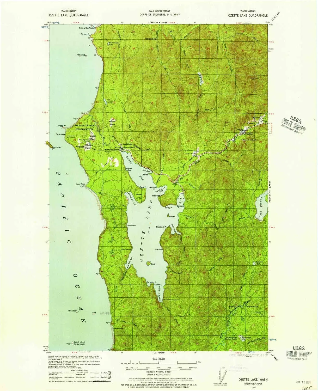
- USGS topographic map of Ozette Lake, WA, at 1:62500 scale. Heavier material. Waterproof. Tear-resistant. Foldable. Perfect for the outdoors.
- Cities, towns, villages: Ozette
- Islands: Ozette Island,Tskawahyah Island,Carroll Island,Garden Island,Baby Island,Tivoli Island
- Parks and forests: Norwegian Memorial,Flattery Rocks National Wildlife Refuge
USGS topographic map of Ozette Lake, Washington, dated 1935, updated 1957.
Includes geographic coordinates (latitude and longitude), lines of elevation, bodies of water, roads, and more. This topo quad is suitable for recreational, outdoor uses, office applications, or wall map framing.
Printed on-demand by YellowMaps on the print material of your choice.
Shipping rolled from Minneapolis, MN, United States.
Product Number: USGS-5687089
Map Size: 21 inches high x 17 inches wide
Map Scale: 1:62500
Map Type: POD USGS Topographic Map
Map Series: HTMC
Map Version: Historical
Cell ID: 60684
Scan ID: 243044
Imprint Year: 1957
Woodland Tint: Yes
Datum: NAD27
Map Projection: Polyconic
Map published by United States Army Corps of Engineers
Map published by United States Department of War
Keywords: Overedge with No Adjacent Map
Map Language: English
Scanner Resolution: 600 dpi
Map Cell Name: Ozette Lake
Grid size: 15 X 15 Minute
Date on map: 1935
Geographical region: Washington, United States
Northern map edge Latitude: 48.25°
Southern map edge Latitude: 48°
Western map edge Longitude: -124.75°
Eastern map edge Longitude: -124.5°
Surrounding map sheets (copy & paste the Product No. in the search bar):
North: USGS-5409620,USGS-5409616,USGS-5409618,USGS-5405552
East: USGS-5410082,USGS-5410080,USGS-5404614,USGS-5410078,USGS-5410084
South: USGS-5405146,USGS-5410056,USGS-5410058,USGS-5410060,USGS-5405148
West:


