- Printed on Polypropylene (plastic)
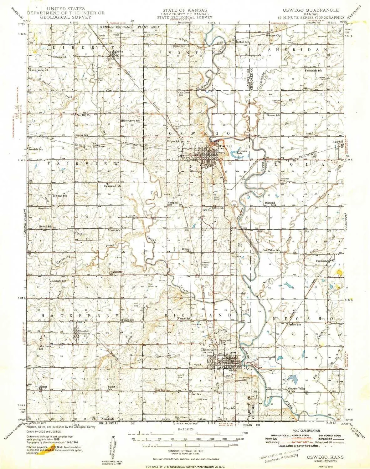
- USGS topographic map of Oswego, KS, at 1:62500 scale. Heavier material. Waterproof. Tear-resistant. Foldable. Perfect for the outdoors.
- Cities, towns, villages: Bartlett,Labette,Oswego,Chetopa,Faulkner,Stover,Hoag,Garvin
- Islands: Consult topo map preview for visible islands.
- Parks and forests: Elmore Park,Riverside Park,Mathews Park,Harmon Wildlife Area
USGS topographic map of Oswego, Kansas, dated 1948.
Includes geographic coordinates (latitude and longitude), lines of elevation, bodies of water, roads, and more. This topo quad is suitable for recreational, outdoor uses, office applications, or wall map framing.
Printed on-demand by YellowMaps on the print material of your choice.
Shipping rolled from Minneapolis, MN, United States.
Product Number: USGS-6006776
Map Size: 20.71 inches high x 16.31 inches wide
Map Scale: 1:62500
Map Type: POD USGS Topographic Map
Map Series: HTMC
Map Version: Historical
Cell ID: 72764
Scan ID: 512194
Aerial Photo Year: 1938
Survey Year: 1944
Datum: NAD27
Map Projection: Polyconic
Map published by United States Geological Survey
Map Language: English
Scanner Resolution: 508 dpi
Map Cell Name: Oswego
Grid size: 15 X 15 Minute
Date on map: 1948
Geographical region: Kansas, United States
Northern map edge Latitude: 37.25°
Southern map edge Latitude: 37°
Western map edge Longitude: -95.25°
Eastern map edge Longitude: -95°
Surrounding map sheets (copy & paste the Product No. in the search bar):
North: USGS-5972474,USGS-5973058,USGS-6006746
East: USGS-6006710,USGS-5575454,USGS-6006712,USGS-5970420,USGS-5277722
South: USGS-5472123,USGS-5472125
West: USGS-5970712,USGS-5972652,USGS-6006756


")

")


