- Printed on Polypropylene (plastic)
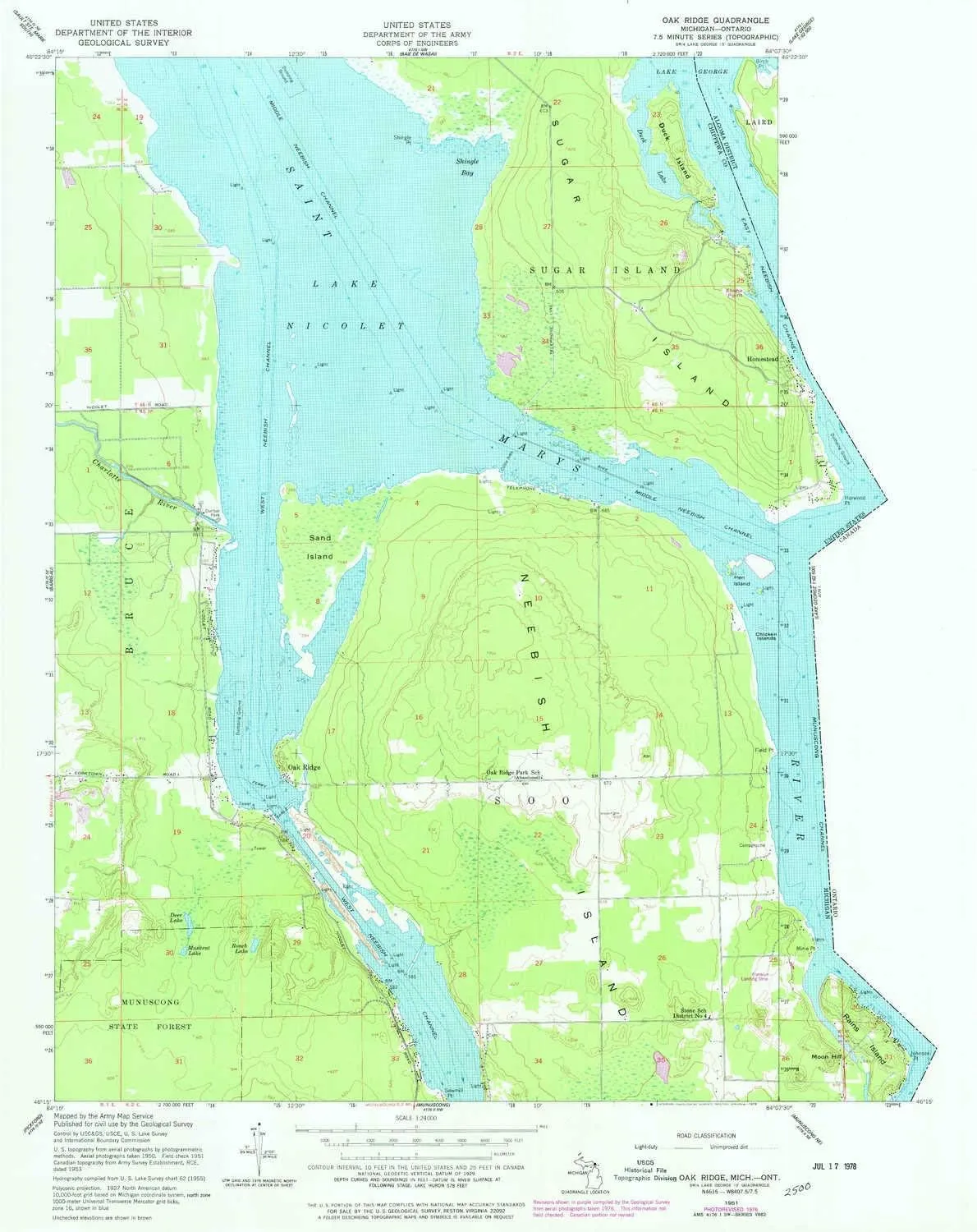
- USGS topographic map of Oak Ridge, MI, at 1:24000 scale. Heavier material. Waterproof. Tear-resistant. Foldable. Perfect for the outdoors.
- Cities, towns, villages: Oak Ridge
- Islands: Chicken Islands,Hen Island,Sand Island,Duck Island,Neebish Island
- Parks and forests: Dunbar Park
USGS topographic map of Oak Ridge, Michigan, dated 1951, updated 1978.
Includes geographic coordinates (latitude and longitude), lines of elevation, bodies of water, roads, and more. This topo quad is suitable for recreational, outdoor uses, office applications, or wall map framing.
Printed on-demand by YellowMaps on the print material of your choice.
Shipping rolled from Minneapolis, MN, United States.
Product Number: USGS-5685551
Map Size: 26.9 inches high x 21.3 inches wide
Map Scale: 1:24000
Map Type: POD USGS Topographic Map
Map Series: HTMC
Map Version: Historical
Cell ID: 32757
Scan ID: 276844
Imprint Year: 1978
Woodland Tint: Yes
Photo Revision Year: 1976
Aerial Photo Year: 1976
Field Check Year: 1951
Datum: NAD27
Map Projection: Polyconic
Map published by United States Army Corps of Engineers
Keywords: Overedge with No Adjacent Map
Map Language: English
Scanner Resolution: 600 dpi
Map Cell Name: Oak Ridge
Grid size: 7.5 X 7.5 Minute
Date on map: 1951
Geographical region: Michigan, United States
Northern map edge Latitude: 46.375°
Southern map edge Latitude: 46.25°
Western map edge Longitude: -84.25°
Eastern map edge Longitude: -84.125°
Surrounding map sheets (copy & paste the Product No. in the search bar):
North: USGS-5685507,USGS-5685509
East:
South: USGS-5440168,USGS-5440166
West: USGS-5438010,USGS-5685589,USGS-5685587,USGS-5438012,USGS-5438014


")
")
