- Printed on Tyvek® (synthetic)
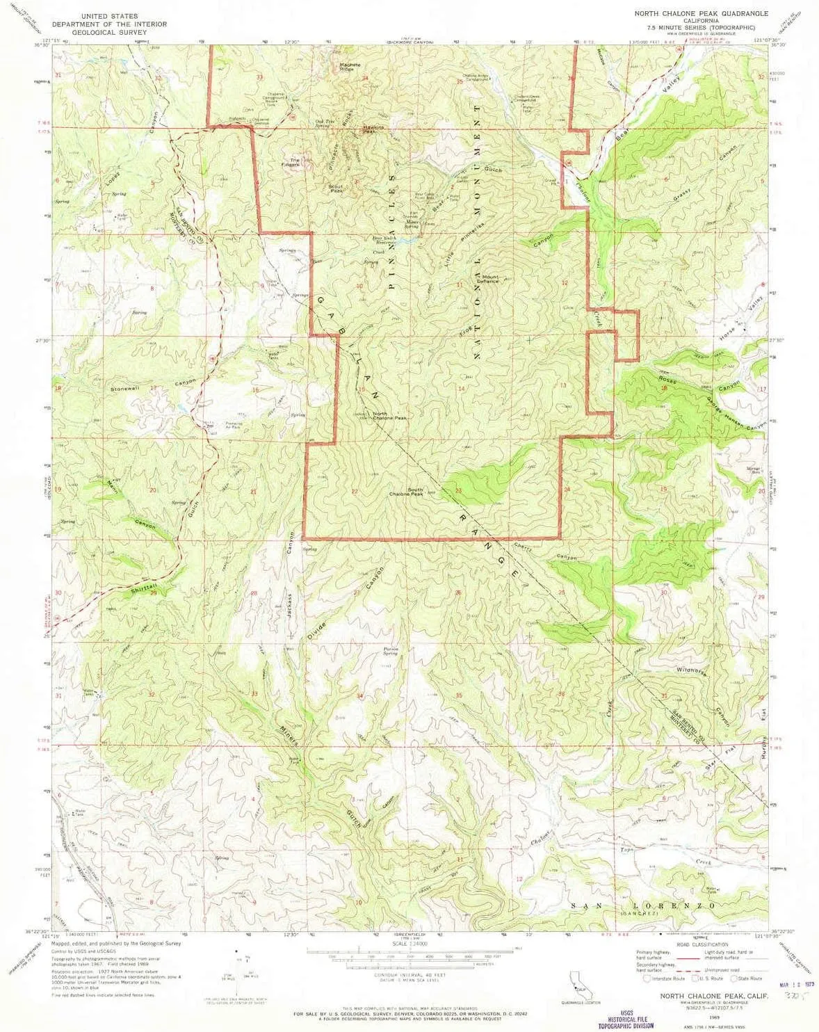
- USGS topographic map of North Chalone Peak, CA, at 1:24000 scale. Lighter material. Waterproof. Tear-resistant. Foldable. Very durable. Perfect for backpacking and the outdoors.
- Cities, towns, villages: Please see map preview to find populated places, townships, as well as roads and street names if available.
- Mountains: Monolith,The Fingers,South Chalone Peak,North Chalone Peak,Mount Defiance,High Peaks,Scout Peak,Hawkins Peak
- Valleys: Crow Canyon,Bear Valley,George Hansen Canyon,Miners Gulch,McCabe Canyon,Bear Gulch,Frog Canyon,Mann Canyon,Grassy Canyon,Cherry Canyon,Horse Valley,Jackass Canyon,Wildhorse Canyon,Rosas Canyon
USGS topographic map of North Chalone Peak, California, dated 1969, updated 1973.
Includes geographic coordinates (latitude and longitude), lines of elevation, bodies of water, roads, and more. This topo quad is suitable for recreational, outdoor uses, office applications, or wall map framing.
Printed on-demand by YellowMaps on the print material of your choice.
Shipping rolled from Minneapolis, MN, United States.
Product Number: USGS-5519681
Map Size: 26.8 inches high x 22 inches wide
Map Scale: 1:24000
Map Type: POD USGS Topographic Map
Map Series: HTMC
Map Version: Historical
Cell ID: 32336
Scan ID: 293579
Imprint Year: 1973
Woodland Tint: Yes
Aerial Photo Year: 1967
Field Check Year: 1969
Datum: NAD27
Map Projection: Polyconic
Map published by United States Geological Survey
Map Language: English
Scanner Resolution: 600 dpi
Map Cell Name: North Chalone Peak
Grid size: 7.5 X 7.5 Minute
Date on map: 1969
Geographical region: California, United States
Northern map edge Latitude: 36.5°
Southern map edge Latitude: 36.375°
Western map edge Longitude: -121.25°
Eastern map edge Longitude: -121.125°
Surrounding map sheets (copy & paste the Product No. in the search bar):
North: USGS-5504147,USGS-5508405,USGS-5504145,USGS-5508422,USGS-5504141
East: USGS-5524751,USGS-5524753
South: USGS-5514813,USGS-5514817,USGS-5514815,USGS-5514811
West: USGS-5523649,USGS-5523645,USGS-5523643,USGS-5523647


")
")
 (discontinued)")
