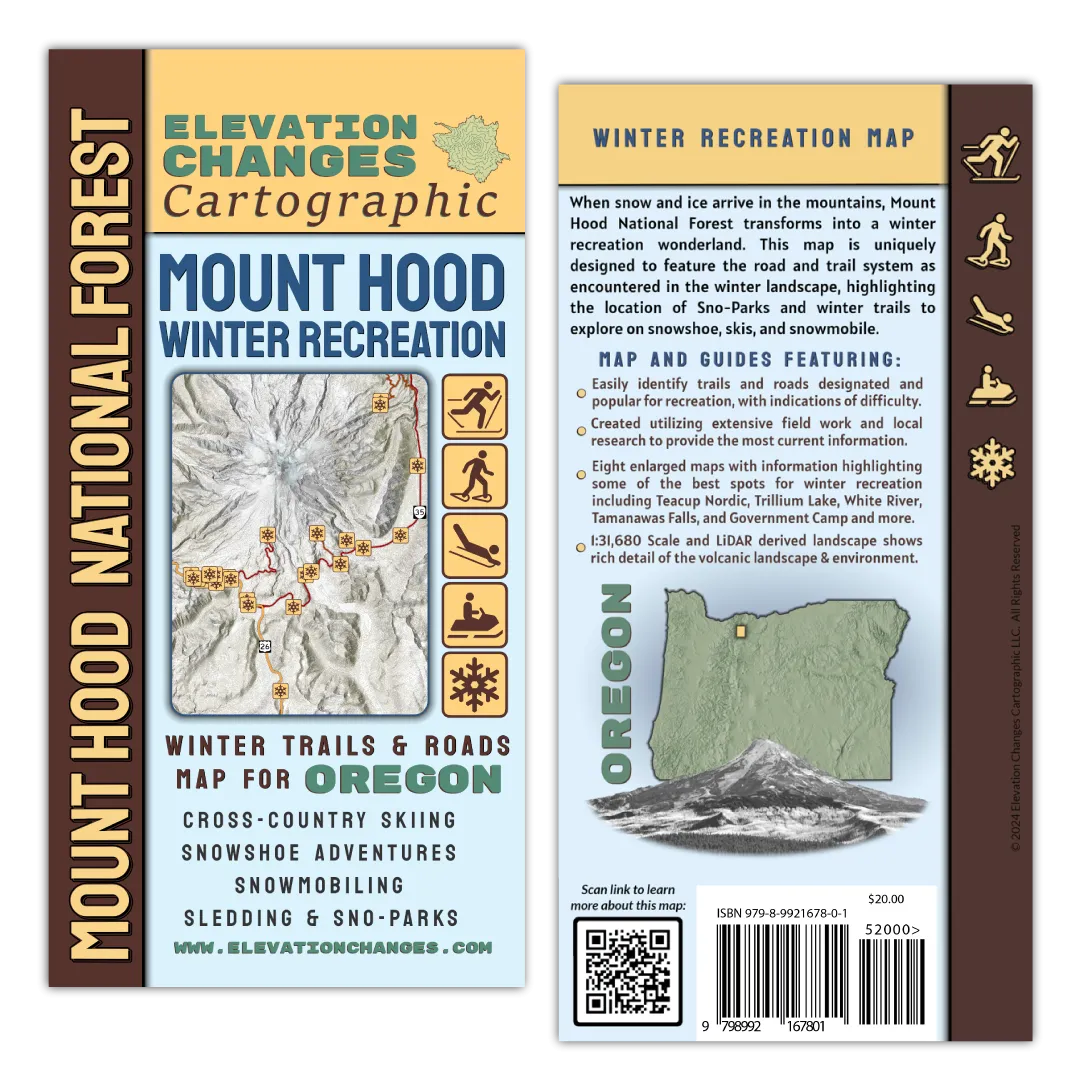
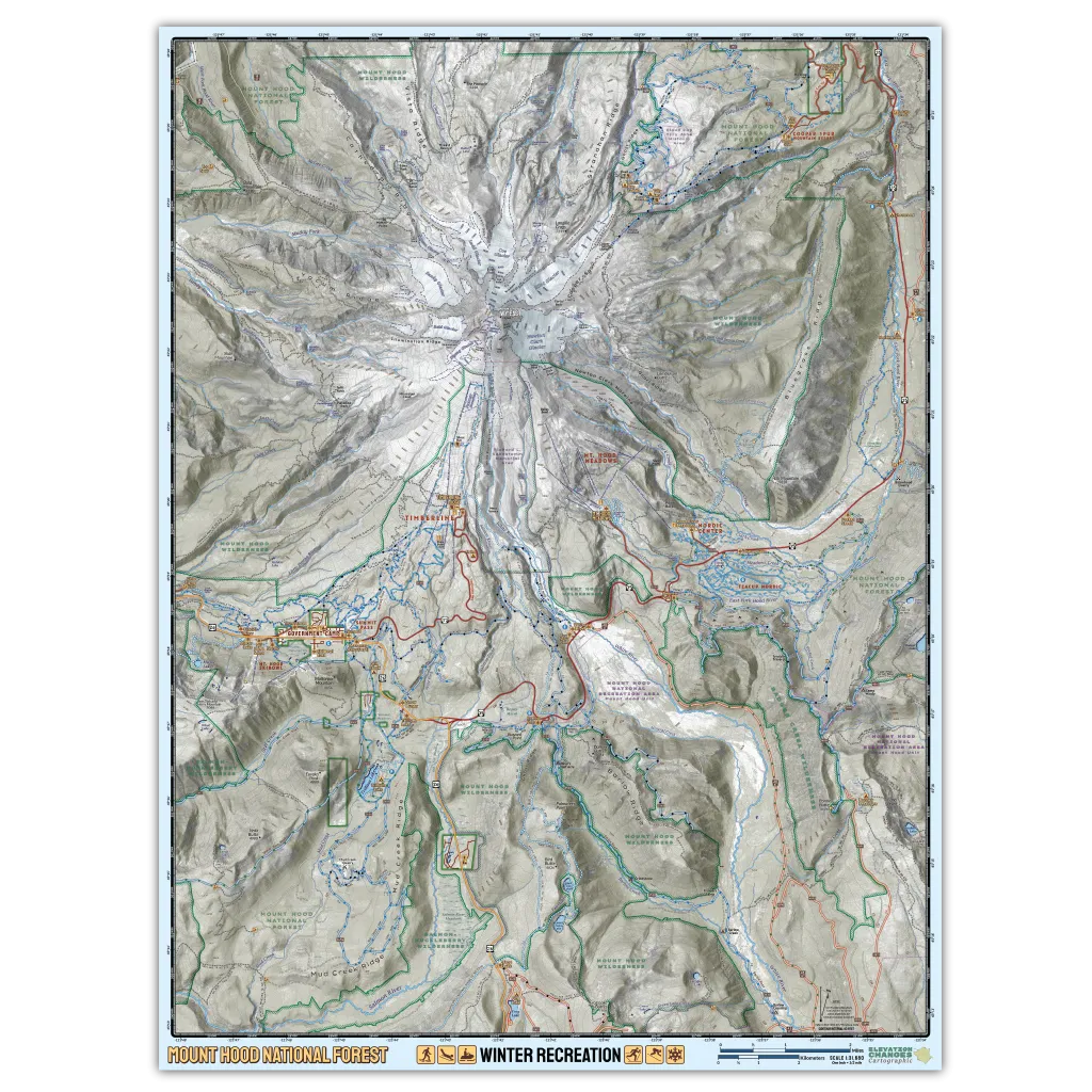
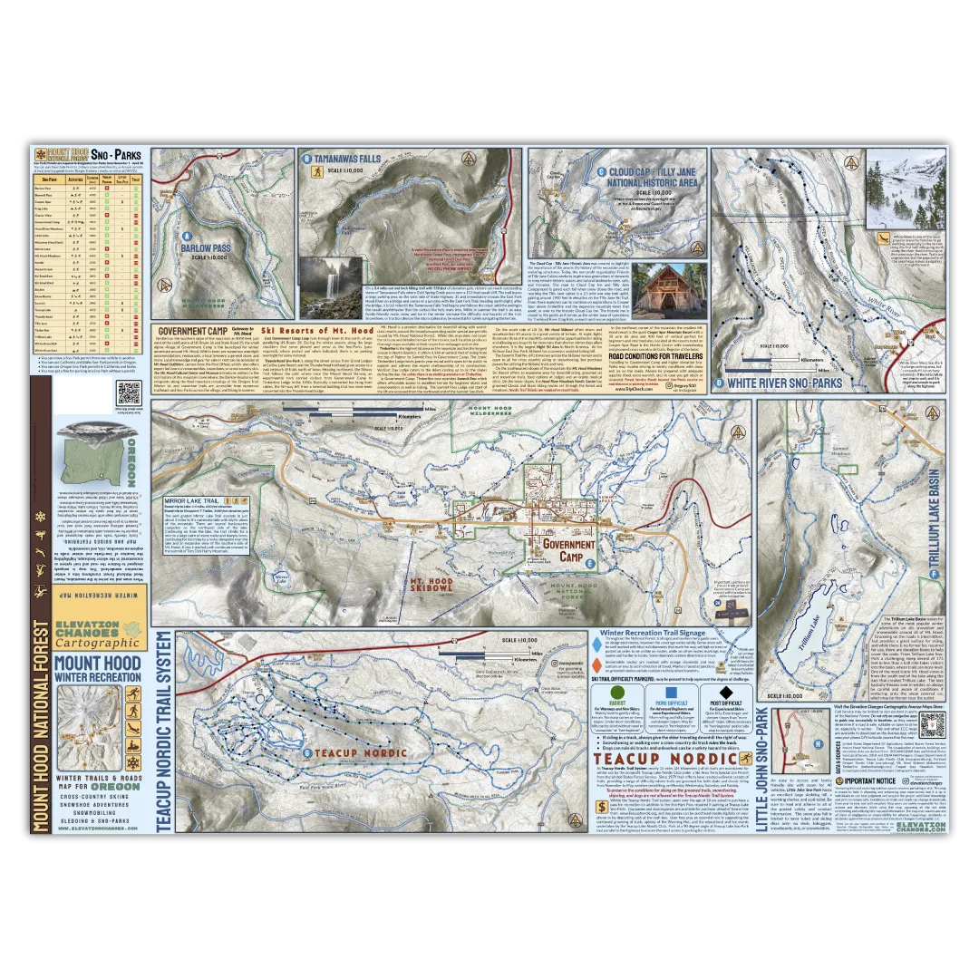
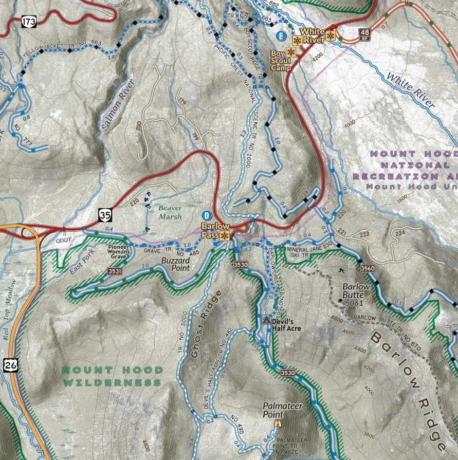
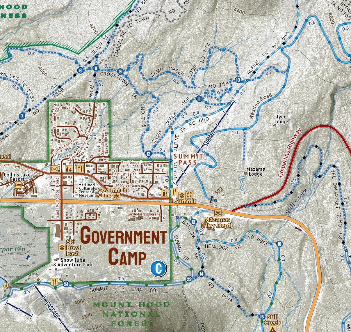
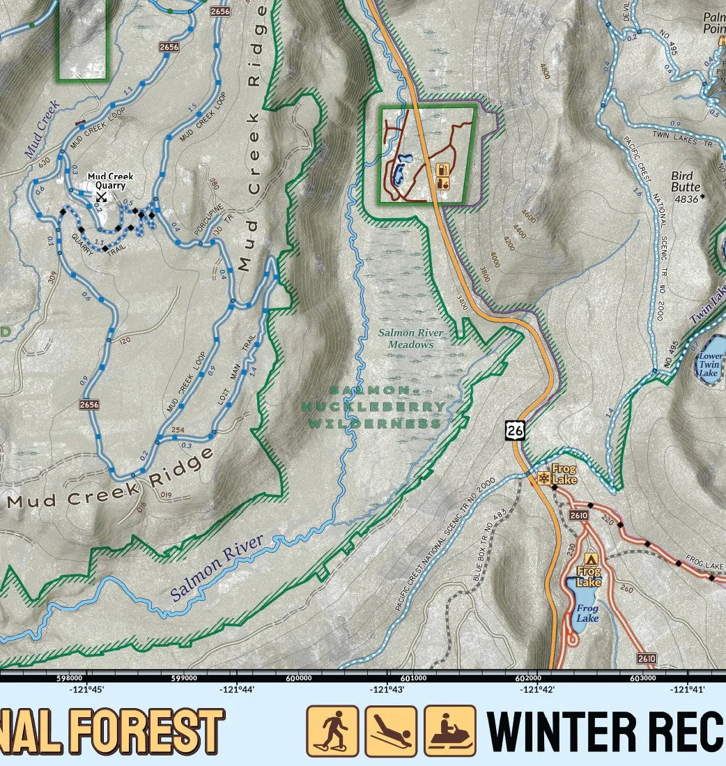
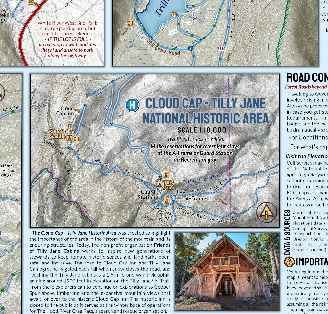
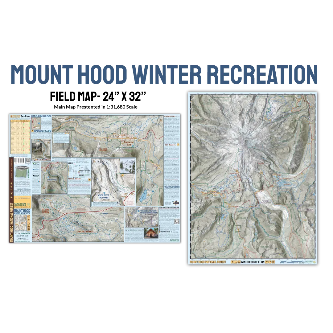
This double-sided 24″ x 32″ field map is printed on durable waterproof and tear proof synthetic paper to go with you on your winter adventures! Uniquely designed to highlight the landscape, road system and trail network as encountered in winter- when Forest Roads are shut down by snow cover or gated and trails and roads become ski or snowshoe routes, this map is the ultimate guide in getting you to the Sno-Park and out on winter adventures! Unique symbology denotes trails and routes that are groomed for cross-country skiing through the forest or on roads, snowmobile routes, winter trails for ski and snowshoe, and more. Detailed maps on the backside and information show the popular winter recreation areas of Government Camp, Trillium Lake Basin, Pocket Creek and Teacup Nordic, Tilly Jane and Cooper Spur, and more in the most accurate, detailed views ever produced. Information about where to go sledding, and a Sno-Park table featuring amenities and activities at the Mount Hood National Forest destinations.
Printed in USA


")


