- Printed on Tyvek® (synthetic)
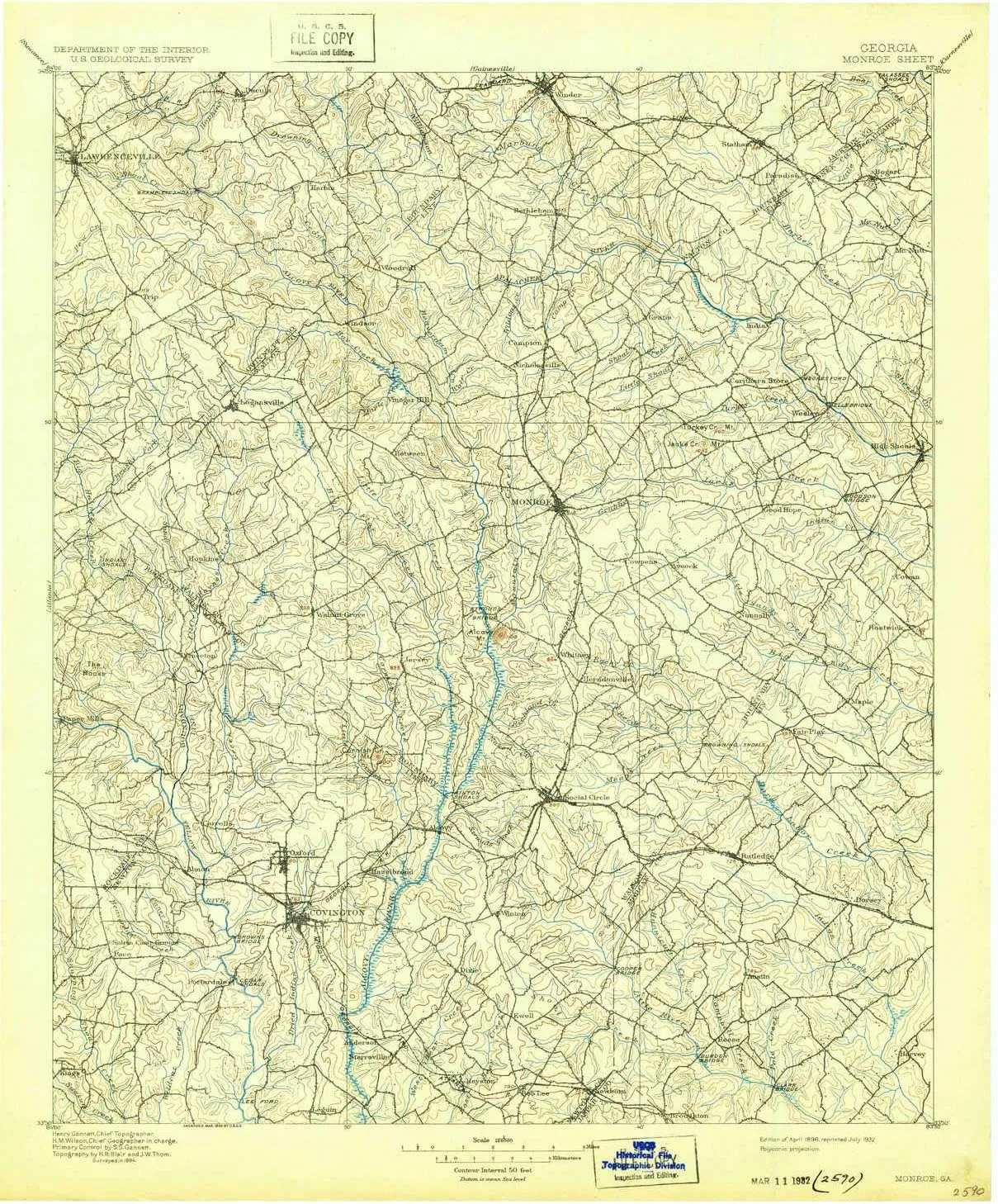
- USGS topographic map of Monroe, GA, at 1:125000 scale. Lighter material. Waterproof. Tear-resistant. Foldable. Very durable. Perfect for backpacking and the outdoors.
- Cities, towns, villages: Settlers Grove,Ebenezer,Rosebud,Alcovy Forest,Salem Branch,Salem Village,Twin Haynes Creek,Millers Glen,Pannell,Lawrenceville,Graystone North,Frogtown,Quail Valley,Cedar Creek,Lake Carlton,River North,Forest River,Between,Brookwood East,Springhill,Bold Springs,Herndonville,Lakeside,Skyline,Bradley,Almon,Bostwick,Walker Park,High Shoals,Deer Track,Split Silk,Stone Lea,Whitney,Pine Top Hill,Melody,Saddle Club Estates,Slades Mill,High Point,Pace,Fernwood,Cedar Ridge
- Mountains: Jacks Creek Mountain,Cornish Mountain,Turkey Creek Mountain,Alcovy Mountain,Griffin Mountain
- Valleys: Low elevation topographic features such as flatlands, river valleys, and canyons.
USGS topographic map of Monroe, Georgia, dated 1896, updated 1932.
Includes geographic coordinates (latitude and longitude), lines of elevation, bodies of water, roads, and more. This topo quad is suitable for recreational, outdoor uses, office applications, or wall map framing.
Printed on-demand by YellowMaps on the print material of your choice.
Shipping rolled from Minneapolis, MN, United States.
Product Number: USGS-5365262
Map Size: 20.6 inches high x 16.8 inches wide
Map Scale: 1:125000
Map Type: POD USGS Topographic Map
Map Series: HTMC
Map Version: Historical
Cell ID: 66082
Scan ID: 247765
Imprint Year: 1932
Survey Year: 1894
Datum: Unstated
Map Projection: Polyconic
Map published by United States Geological Survey
Map Language: English
Scanner Resolution: 600 dpi
Map Cell Name: Monroe
Grid size: 30 X 30 Minute
Date on map: 1896
Geographical region: Georgia, United States
Northern map edge Latitude: 34°
Southern map edge Latitude: 33.5°
Western map edge Longitude: -84°
Eastern map edge Longitude: -83.5°
Surrounding map sheets (copy & paste the Product No. in the search bar):
North: USGS-5362232,USGS-5365238,USGS-5362236,USGS-5365232,USGS-5362230
East: USGS-5362820,USGS-5362822
South: USGS-5364616,USGS-5364618,USGS-5365112
West: USGS-5365144,USGS-5365152,USGS-5365154,USGS-5365146,USGS-5365150


")


