- Printed on Tyvek® (synthetic)
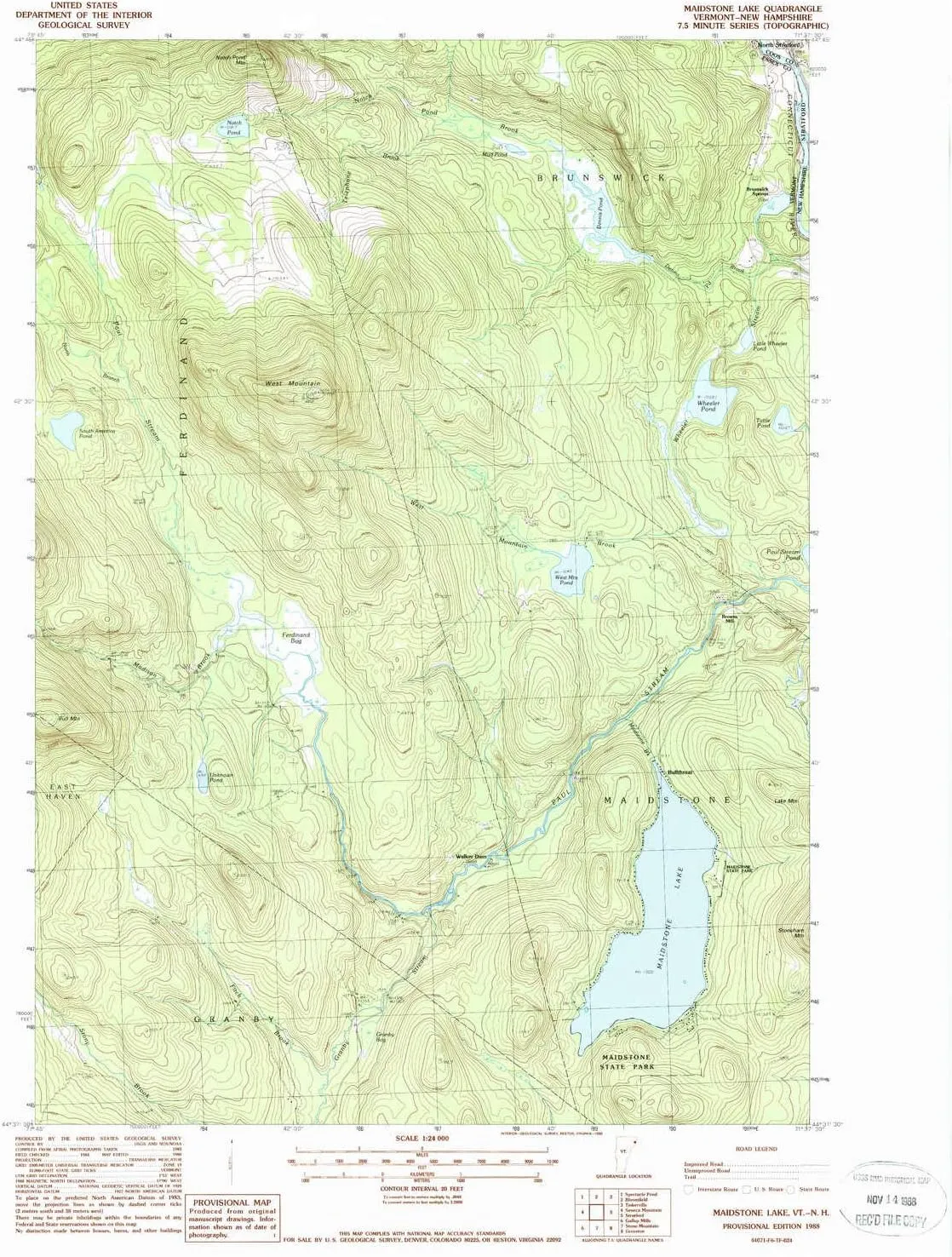
- USGS topographic map of Maidstone Lake, VT, at 1:24000 scale. Lighter material. Waterproof. Tear-resistant. Foldable. Very durable. Perfect for backpacking and the outdoors.
- Cities, towns, villages: Brunswick Springs,Bullthroat,Browns Mill
- Mountains: Bull Mountain,West Mountain,Notch Pond Mountain
- Valleys: Low elevation topographic features such as flatlands, river valleys, and canyons.
USGS topographic map of Maidstone Lake, Vermont, dated 1988, updated 1988.
Includes geographic coordinates (latitude and longitude), lines of elevation, bodies of water, roads, and more. This topo quad is suitable for recreational, outdoor uses, office applications, or wall map framing.
Printed on-demand by YellowMaps on the print material of your choice.
Shipping rolled from Minneapolis, MN, United States.
Product Number: USGS-5599524
Map Size: 26.8 inches high x 22 inches wide
Map Scale: 1:24000
Map Type: POD USGS Topographic Map
Map Series: HTMC
Map Version: Historical
Cell ID: 27287
Scan ID: 337495
Imprint Year: 1988
Woodland Tint: Yes
Aerial Photo Year: 1983
Edit Year: 1988
Field Check Year: 1984
Datum: NAD27
Map Projection: Transverse Mercator
Provisional map: Yes
Map published by United States Geological Survey
Map Language: English
Scanner Resolution: 600 dpi
Map Cell Name: Maidstone Lake
Grid size: 7.5 X 7.5 Minute
Date on map: 1988
Geographical region: Vermont, United States
Northern map edge Latitude: 44.75°
Southern map edge Latitude: 44.625°
Western map edge Longitude: -71.75°
Eastern map edge Longitude: -71.625°
Surrounding map sheets (copy & paste the Product No. in the search bar):
North: USGS-5638445,USGS-5680045,USGS-5638457,USGS-7473767,USGS-7473765
East: USGS-5582900
South: USGS-5599832
West: USGS-5599776


 560 Lumens AAA/10440 Headlamp Pocket EDC Flashlight with Magnetic Tail & Reversible Clip")


 w/Battery and Eco Sensa USB-C Charging Cable")

