- Printed on Polypropylene (plastic)
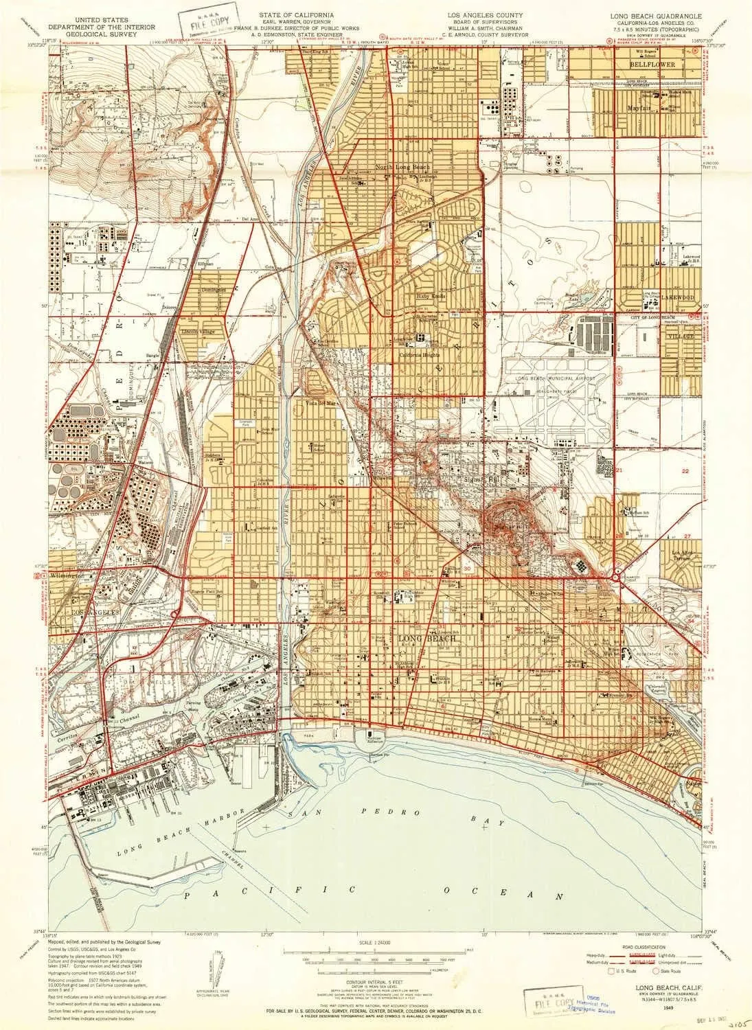
- USGS topographic map of Long Beach, CA, at 1:24000 scale. Heavier material. Waterproof. Tear-resistant. Foldable. Perfect for the outdoors.
- Cities, towns, villages: Belmont Heights,Signal Hill,Douglas Junction,Los Altos,Del Amo,Cambodia Town,Bluff Park,Thenard,Dolores,Bluff Heights,Wrigley,Cota,Long Beach,Elftman,Rose Park,North Long Beach,Watson,Dominguez Junction,Bangle,Dominguez,Lincoln Village,Gaspur (historical),California Heights,Lakewood,Willowville,Belmont Shore,Vista del Mar,Bixby Knolls
- Islands: Island Grissom,Island White,Island Chaffee,Terminal Island,Island Freeman
- Parks and forests: Michelson Street Park,Mayfair Park,Simon Bolivar Park,Long Beach City Beach,Coolidge Park,Dominguez Park,Veterans Memorial Park,Recreation Park,Joe Rodgers Field,Hillbrook Park,Rainbow Lagoon Park,Bayshore Aquatic Playground Park,Cherry Cove Park,Martin Luther King Junior Park,Los Cerritos Park,Shoreline Aquatic Park,Admiral Kidd Park,Reservoir Park,Bruin Stadium,Marine Vista Park,Bixby Park,Blair Field,Scherer Park,Palm Beach Park,Atlantic Plaza Park
USGS topographic map of Long Beach, California, dated 1949, updated 1952.
Includes geographic coordinates (latitude and longitude), lines of elevation, bodies of water, roads, and more. This topo quad is suitable for recreational, outdoor uses, office applications, or wall map framing.
Printed on-demand by YellowMaps on the print material of your choice.
Shipping rolled from Minneapolis, MN, United States.
Product Number: USGS-5657707
Map Size: 30 inches high x 21.9 inches wide
Map Scale: 1:24000
Map Type: POD USGS Topographic Map
Map Series: HTMC
Map Version: Historical
Cell ID: 395996
Scan ID: 292494
Imprint Year: 1952
Aerial Photo Year: 1947
Field Check Year: 1949
Survey Year: 1923
Datum: NAD27
Map Projection: Polyconic
Map published by United States Geological Survey
Map Language: English
Scanner Resolution: 600 dpi
Map Cell Name: Long Beach
Grid size: 7.5 X 7.5 Minute
Date on map: 1949
Geographical region: California, United States
Northern map edge Latitude: 33.875°
Southern map edge Latitude: 33.7333333°
Western map edge Longitude: -118.25°
Eastern map edge Longitude: -118.125°
Surrounding map sheets (copy & paste the Product No. in the search bar):
North: USGS-5523757,USGS-5523759,USGS-5523751,USGS-5523761,USGS-5523753
East:
South:
West:


")

