- Printed on Polypropylene (plastic)
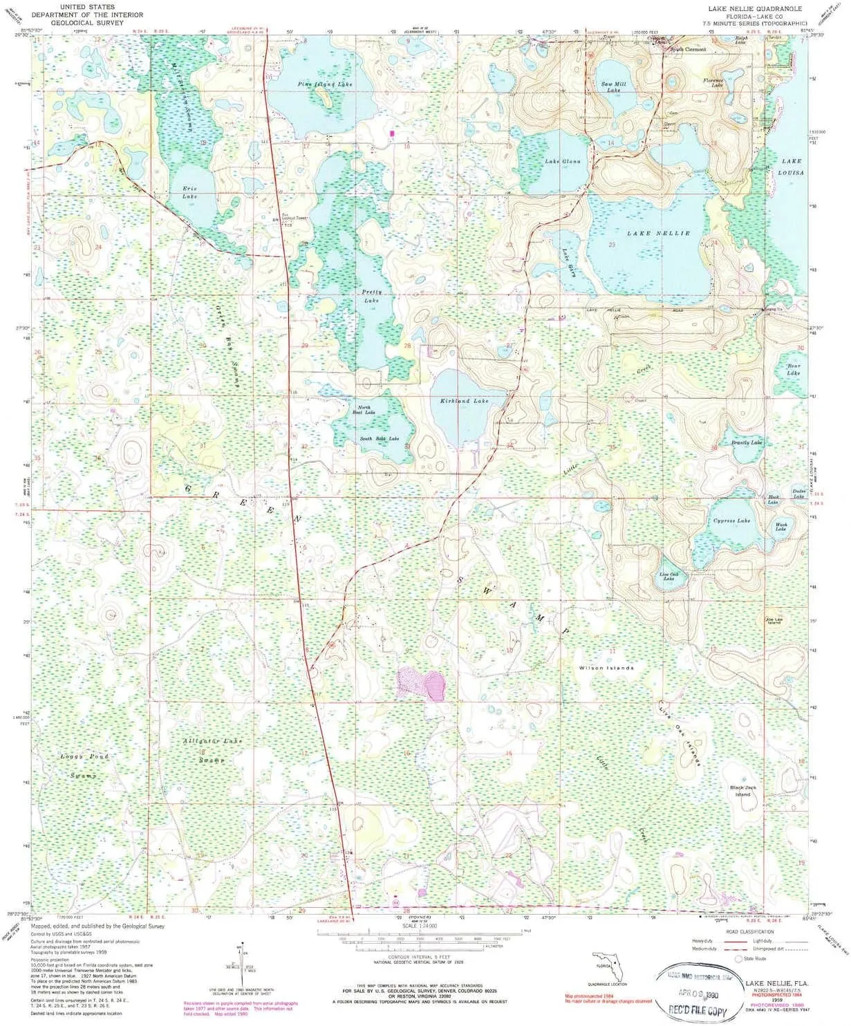
- USGS topographic map of Lake Nellie, FL, at 1:24000 scale. Heavier material. Waterproof. Tear-resistant. Foldable. Perfect for the outdoors.
- Cities, towns, villages: South Clermont
- Islands: Live Oak Islands,Wilson Islands,Black Jack Island,Joe Lee Island,Wolf Bend Island
- Parks and forests: Lake Louisa State Park
USGS topographic map of Lake Nellie, Florida, dated 1959, updated 1981.
Includes geographic coordinates (latitude and longitude), lines of elevation, bodies of water, roads, and more. This topo quad is suitable for recreational, outdoor uses, office applications, or wall map framing.
Printed on-demand by YellowMaps on the print material of your choice.
Shipping rolled from Minneapolis, MN, United States.
Product Number: USGS-5625668
Map Size: 26.8 inches high x 23 inches wide
Map Scale: 1:24000
Map Type: POD USGS Topographic Map
Map Series: HTMC
Map Version: Historical
Cell ID: 24583
Scan ID: 347085
Imprint Year: 1981
Woodland Tint: Yes
Visual Version Number: 1
Photo Inspection Year: 1984
Photo Revision Year: 1980
Aerial Photo Year: 1977
Edit Year: 1980
Survey Year: 1959
Datum: NAD27
Map Projection: Polyconic
Map published by United States Geological Survey
Map Language: English
Scanner Resolution: 600 dpi
Map Cell Name: Lake Nellie
Grid size: 7.5 X 7.5 Minute
Date on map: 1959
Geographical region: Florida, United States
Northern map edge Latitude: 28.5°
Southern map edge Latitude: 28.375°
Western map edge Longitude: -81.875°
Eastern map edge Longitude: -81.75°
Surrounding map sheets (copy & paste the Product No. in the search bar):
North: USGS-5623044,USGS-5623046
East: USGS-5625606,USGS-5625610,USGS-5625608
South: USGS-5627450,USGS-5627448,USGS-5627452,USGS-5627446
West: USGS-5622172,USGS-5622170,USGS-5622174,USGS-5622168


