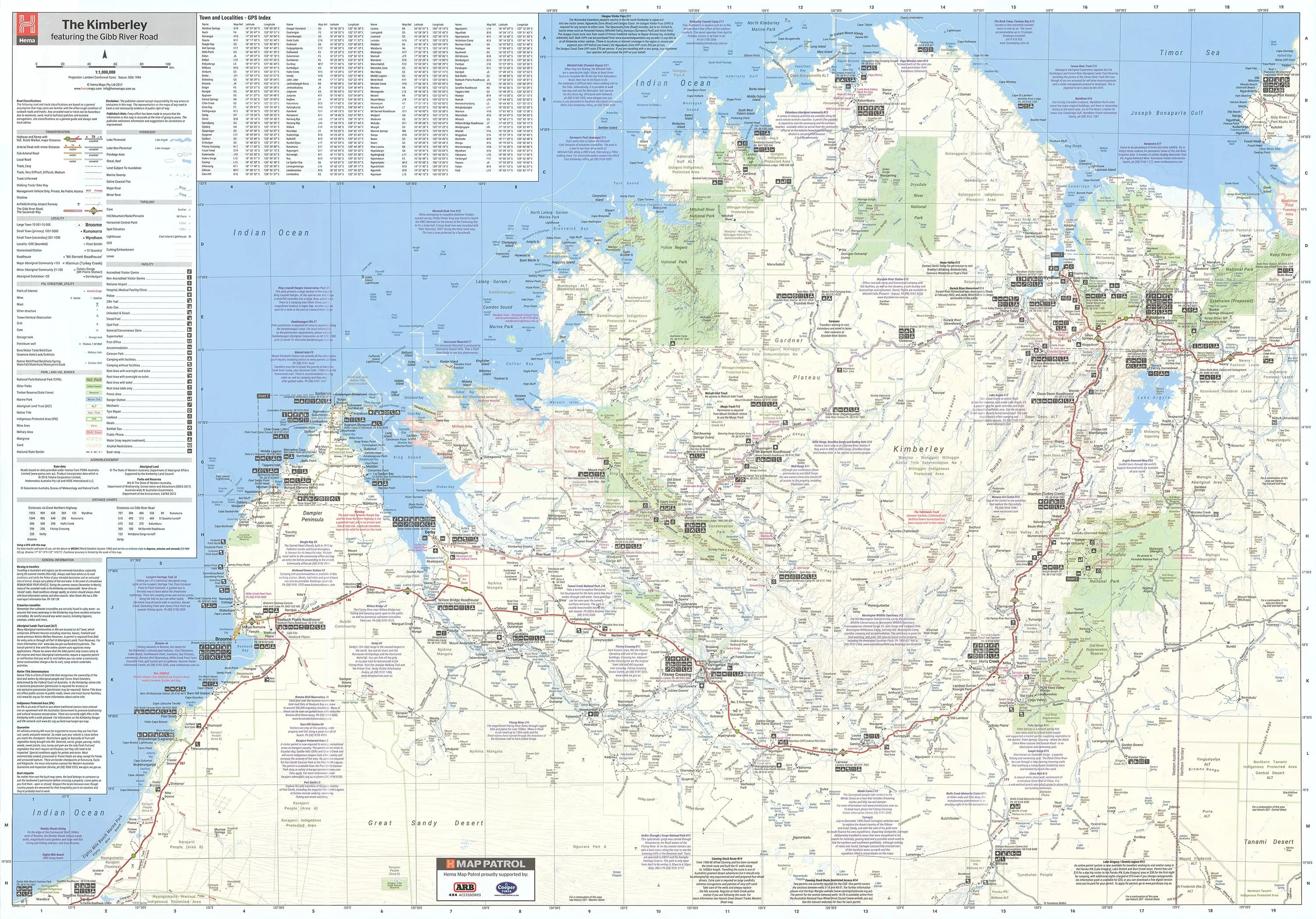
This regional map of the Kimberley places particular focus on the iconic Gibb River Road. Thoroughly field-checked using Hema's GPS Mapping System, The Kimberley map clearly differentiates between roads and tracks and shows all road distances, points of interest, and facilities.
This map comes laminated, making it very durable and versatile, so you can draw on it and wipe it off afterwards, you can also place our Mark-It-Dots to show places of interest.
This fantastic map features:
- Waterproof paper
- Detailed 4WD tracks
- National parks
- Camping areas
- GPS surveyed roads & tracks
- GPS positions and grid
Format: Laminated Wall Map
Size: 1430mm (height) x 1000mm (width)
Note: This is a print on demand map so please allow 10 working days for delivery.

![Wall Art Impact 24"x36" Poster Topographic Political Map of Korean Peninsula [Laminated]](https://www.toolight.shop/image/wall-art-impact-24quotx36quot-poster-topographic-political-map-of-korean-peninsula-laminated_mwYiYC_300x.webp "Wall Art Impact 24\"x36\" Poster Topographic Political Map of Korean Peninsula [Laminated]")
")


