- Printed on Tyvek® (synthetic)
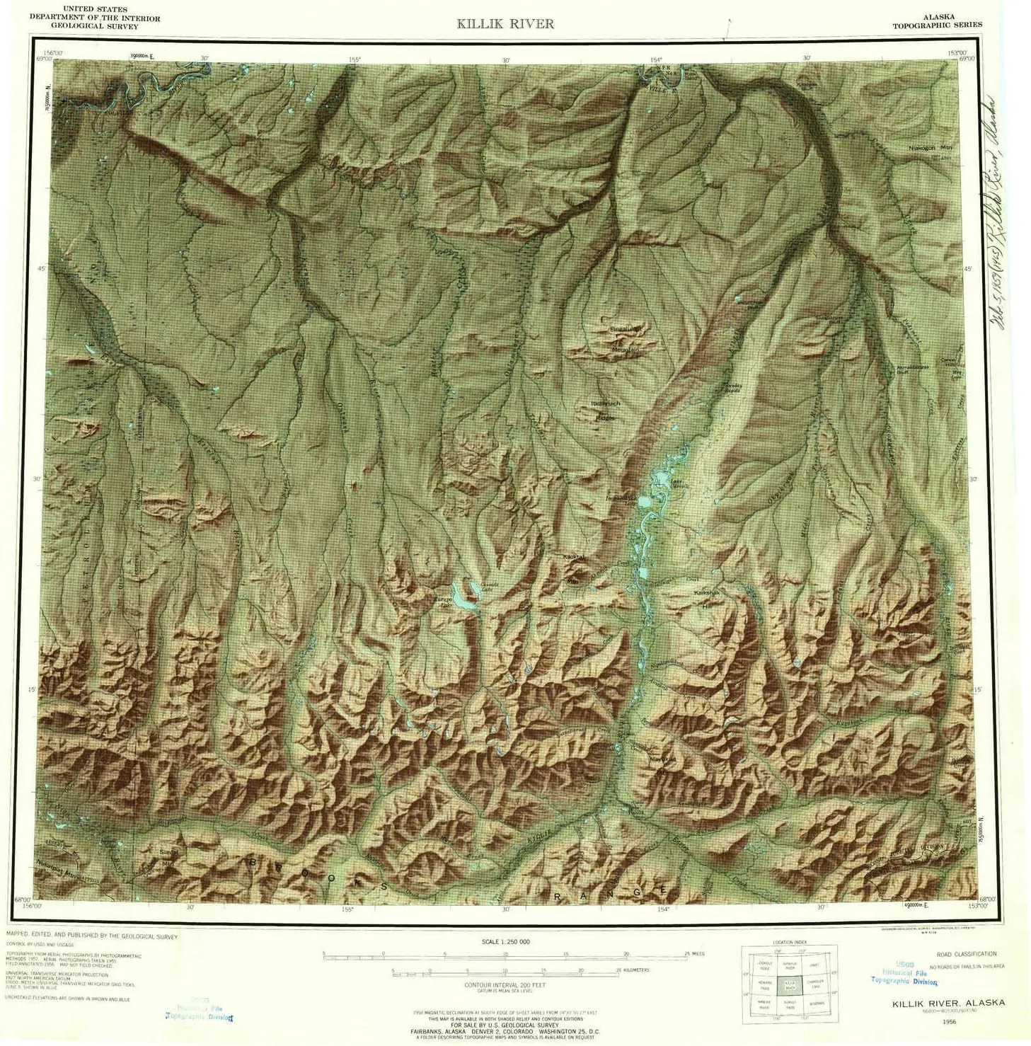
- USGS topographic map of Killik River, AK, at 1:250000 scale. Lighter material. Waterproof. Tear-resistant. Foldable. Very durable. Perfect for backpacking and the outdoors.
- Cities, towns, villages: Please see map preview to find populated places, townships, as well as roads and street names if available.
- Mountains: Kurupa Hills,Ivotuk Hills,Reubens Peak,Siavlat Mountain,Nukatpiat Mountain,Egiklak Mountain,Kikiktat Mountain,Grizzly Mountain,Mayukuit Mountain,Papik Mountain,Niakogon Mountain,Pingaluligit Mountain,Marker Mountain
- Valleys: Low elevation topographic features such as flatlands, river valleys, and canyons.
USGS topographic map of Killik River, Alaska, dated 1956, updated 1959.
Includes geographic coordinates (latitude and longitude), lines of elevation, bodies of water, roads, and more. This topo quad is suitable for recreational, outdoor uses, office applications, or wall map framing.
Printed on-demand by YellowMaps on the print material of your choice.
Shipping rolled from Minneapolis, MN, United States.
Product Number: USGS-5661266
Map Size: 22.2 inches high x 21.8 inches wide
Map Scale: 1:250000
Map Type: POD USGS Topographic Map
Map Series: HTMC
Map Version: Historical
Cell ID: 68857
Scan ID: 361042
Imprint Year: 1959
Visual Version Number: 1
Aerial Photo Year: 1957
Datum: NAD27
Map Projection: Universal Transverse Mercator
Shaded Relief map: Yes
Map published by United States Geological Survey
Map Language: English
Scanner Resolution: 600 dpi
Map Cell Name: Killik River
Grid size: 1 X 3 Degree
Date on map: 1956
Geographical region: Alaska, United States
Northern map edge Latitude: 69°
Southern map edge Latitude: 68°
Western map edge Longitude: -156°
Eastern map edge Longitude: -153°
Surrounding map sheets (copy & paste the Product No. in the search bar):
North: USGS-5661132,USGS-5661134,USGS-5661124,USGS-5661128,USGS-5667222
East: USGS-5660688,USGS-5660694,USGS-5660686,USGS-5664492,USGS-5660680
South: USGS-5662088,USGS-5662090,USGS-5662094,USGS-5662080,USGS-5662084
West: USGS-5661086,USGS-5661088,USGS-5661084,USGS-5666990,USGS-5661082


")


