- Printed on Polypropylene (plastic)
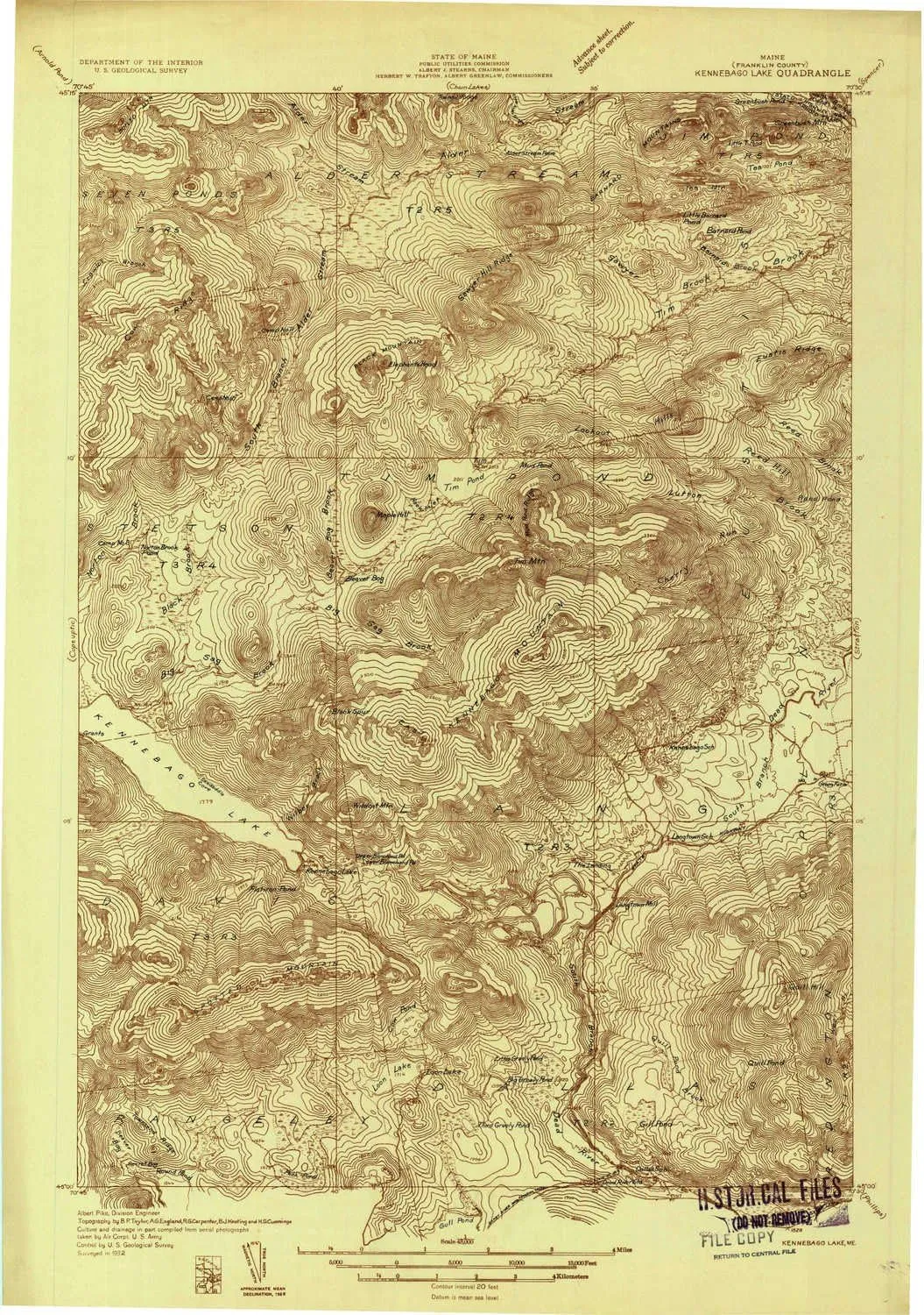
- USGS topographic map of Kennebago Lake, ME, at 1:48000 scale. Heavier material. Waterproof. Tear-resistant. Foldable. Perfect for the outdoors.
- Cities, towns, villages: Kennebago Settlement,Dead River (historical),Loon Lake,The Landing,Grants Camps,Langtown Mill
- Islands: Consult topo map preview for visible islands.
- Parks and forests: National Parks, National Forests, etc. Please preview map image for specifics.
USGS topographic map of Kennebago Lake, Maine, dated 1932.
Includes geographic coordinates (latitude and longitude), lines of elevation, bodies of water, roads, and more. This topo quad is suitable for recreational, outdoor uses, office applications, or wall map framing.
Printed on-demand by YellowMaps on the print material of your choice.
Shipping rolled from Minneapolis, MN, United States.
Product Number: USGS-5637989
Map Size: 27.4 inches high x 19.3 inches wide
Map Scale: 1:48000
Map Type: POD USGS Topographic Map
Map Series: HTMC
Map Version: Historical
Cell ID: 320811
Scan ID: 807530
Survey Year: 1932
Datum: NAD
Map Projection: Polyconic
Advance: Yes
Map published by United States Geological Survey
Keywords: Overedge; Nonstandard Press Run
Map Language: English
Scanner Resolution: 508 dpi
Map Cell Name: Kennebago Lake
Grid size: 15 X 15 Minute
Date on map: 1932
Geographical region: Maine, United States
Northern map edge Latitude: 45.25°
Southern map edge Latitude: 45°
Western map edge Longitude: -70.75°
Eastern map edge Longitude: -70.5°
Surrounding map sheets (copy & paste the Product No. in the search bar):
North: USGS-5533421,USGS-5536317,USGS-5684033,USGS-5684041,USGS-5684039
East: USGS-5685273,USGS-5685275,USGS-5685279,USGS-5537157,USGS-5685271
South: USGS-5685009,USGS-5535063,USGS-5535061,USGS-5685001,USGS-5685005
West: USGS-5690324,USGS-5684097,USGS-5684093,USGS-5684091,USGS-5534131


