- Printed on Polypropylene (plastic)
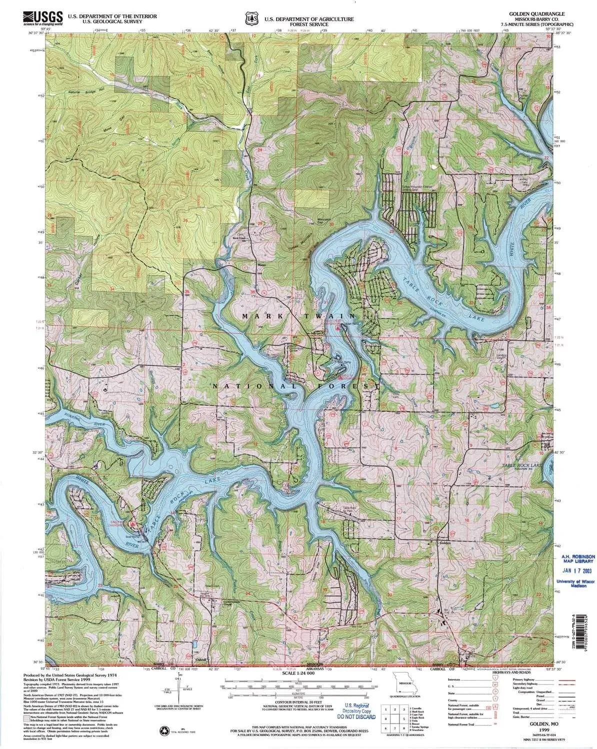
- USGS topographic map of Golden, MO, at 1:24000 scale. Heavier material. Waterproof. Tear-resistant. Foldable. Perfect for the outdoors.
- Cities, towns, villages: Golden,Oakhill,Emerald Beach,Chain-O-Lakes,Mano
- Islands: Consult topo map preview for visible islands.
- Parks and forests: Highway M Public Use Area,Viney Creek Public Use Area,Eagle Rock Public Use Area
USGS topographic map of Golden, Missouri, dated 1999, updated 2002.
Includes geographic coordinates (latitude and longitude), lines of elevation, bodies of water, roads, and more. This topo quad is suitable for recreational, outdoor uses, office applications, or wall map framing.
Printed on-demand by YellowMaps on the print material of your choice.
Shipping rolled from Minneapolis, MN, United States.
Product Number: USGS-8618440
Map Size: 27 inches high x 21.5 inches wide
Map Scale: 1:24000
Map Type: POD USGS Topographic Map
Map Series: HTMC
Map Version: Historical
Cell ID: 17617
Scan ID: 513805
Imprint Year: 2002
Woodland Tint: Yes
Aerial Photo Year: 1997
Datum: NAD27
Map Projection: Transverse Mercator
Map published by United States Forest Service
Keywords: Overedge
Map Language: English
Scanner Resolution: 508 dpi
Map Cell Name: Golden
Grid size: 7.5 X 7.5 Minute
Date on map: 1999
Geographical region: Missouri, United States
Northern map edge Latitude: 36.625°
Southern map edge Latitude: 36.5°
Western map edge Longitude: -93.75°
Eastern map edge Longitude: -93.625°
Surrounding map sheets (copy & paste the Product No. in the search bar):
North: USGS-5580464,USGS-5580466,USGS-5580462
East: USGS-5658710,USGS-5658712
South: USGS-5426122
West: USGS-5678628,USGS-8618328,USGS-5677236,USGS-8618378,USGS-5679605

 (Color : Skull Camouflage)")

 (Silver One Size)")


")


