- Printed on Polypropylene (plastic)
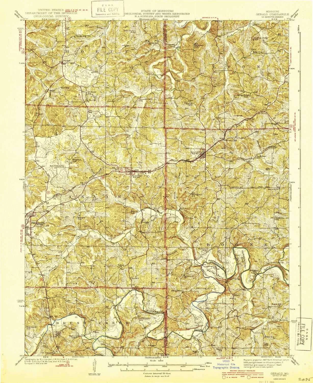
- USGS topographic map of Gerald, MO, at 1:62500 scale. Heavier material. Waterproof. Tear-resistant. Foldable. Perfect for the outdoors.
- Cities, towns, villages: Gerald,Rosebud,Walbert (historical),Port Hudson,Boone (historical),Beemont,Drake,Jaegers Shop,Rock Ford,Tea,Champion City,Millrock Ford,Bem,Wiffenberg,Strain
- Islands: Consult topo map preview for visible islands.
- Parks and forests: Lions Park
USGS topographic map of Gerald, Missouri, dated 1944.
Includes geographic coordinates (latitude and longitude), lines of elevation, bodies of water, roads, and more. This topo quad is suitable for recreational, outdoor uses, office applications, or wall map framing.
Printed on-demand by YellowMaps on the print material of your choice.
Shipping rolled from Minneapolis, MN, United States.
Product Number: USGS-8618424
Map Size: 19.9 inches high x 16.3 inches wide
Map Scale: 1:62500
Map Type: POD USGS Topographic Map
Map Series: HTMC
Map Version: Historical
Cell ID: 54549
Scan ID: 324913
Woodland Tint: Yes
Survey Year: 1941
Datum: NAD27
Map Projection: Polyconic
Map published by United States Geological Survey
Map Language: English
Scanner Resolution: 600 dpi
Map Cell Name: Gerald
Grid size: 15 X 15 Minute
Date on map: 1944
Geographical region: Missouri, United States
Northern map edge Latitude: 38.5°
Southern map edge Latitude: 38.25°
Western map edge Longitude: -91.5°
Eastern map edge Longitude: -91.25°
Surrounding map sheets (copy & paste the Product No. in the search bar):
North: USGS-8618474,USGS-5575638,USGS-5575640,USGS-5575644,USGS-5574762
East: USGS-5580546,USGS-5575324,USGS-5580548,USGS-5575326,USGS-5580544
South: USGS-5579634,USGS-5579628,USGS-5579630,USGS-8618596,USGS-5579632
West: USGS-5574350,USGS-5579746,USGS-5574352,USGS-5574354


")


