- Printed on Polypropylene (plastic)
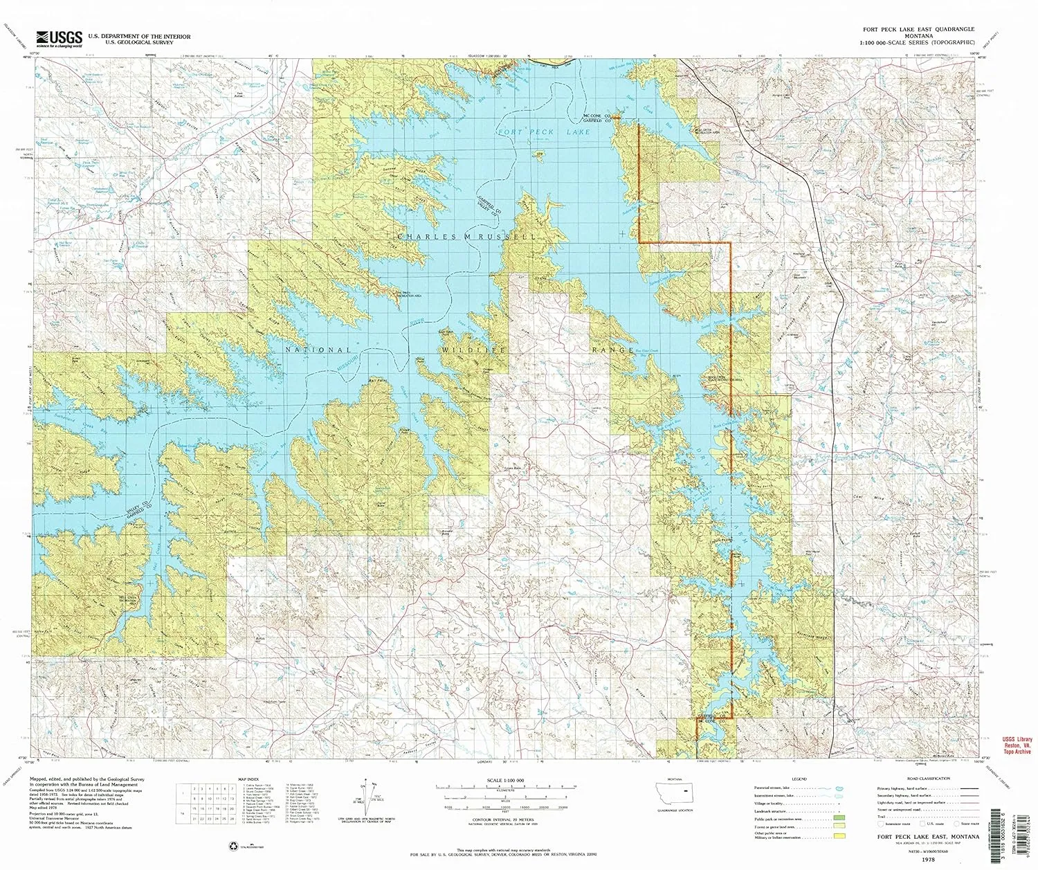
- USGS topographic map of Fort Peck Lake East, MT, at 1:100000 scale. Heavier material. Waterproof. Tear-resistant. Foldable. Perfect for the outdoors.
- Cities, towns, villages: Haxby,Coal Creek (historical),Phon (historical),Lismas (historical)
- Islands: York Island
- Parks and forests: Bear Creek Recreation Area,The Pines Recreation Area,Hell Creek Recreation Area,Fort Peck Recreation Area,McGuire Creek Recreation Area,Rock Creek State Park,Hell Creek State Park,Duck Creek Recreation Area,Nelson Creek Recreation Area
USGS topographic map of Fort Peck Lake East, Montana, dated 1978, updated 1978.
Includes geographic coordinates (latitude and longitude), lines of elevation, bodies of water, roads, and more. This topo quad is suitable for recreational, outdoor uses, office applications, or wall map framing.
Printed on-demand by YellowMaps on the print material of your choice.
Shipping rolled from Minneapolis, MN, United States.
Product Number: USGS-5401530
Map Size: 28.1 inches high x 33 inches wide
Map Scale: 1:100000
Map Type: POD USGS Topographic Map
Map Series: HTMC
Map Version: Historical
Cell ID: 67536
Scan ID: 268408
Imprint Year: 1978
Woodland Tint: Yes
Aerial Photo Year: 1976
Edit Year: 1978
Datum: NAD27
Map Projection: Universal Transverse Mercator
Map published by United States Geological Survey
Map Language: English
Scanner Resolution: 600 dpi
Map Cell Name: Fort Peck Lake East
Grid size: 30 X 60 Minute
Date on map: 1978
Geographical region: Montana, United States
Northern map edge Latitude: 48°
Southern map edge Latitude: 47.5°
Western map edge Longitude: -107°
Eastern map edge Longitude: -106°
Surrounding map sheets (copy & paste the Product No. in the search bar):
North: USGS-5401118,USGS-5401744,USGS-5401536,USGS-5396530
East: USGS-5400142
South: USGS-5401558,USGS-5395336
West: USGS-5399774,USGS-5399772

 (National Geographic Reference Map) Map – February 23, 2018")


