- Printed on Polypropylene (plastic)
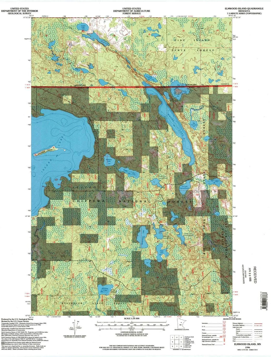
- USGS topographic map of Elmwood Island, MN, at 1:24000 scale. Heavier material. Waterproof. Tear-resistant. Foldable. Perfect for the outdoors.
- Cities, towns, villages: Please see map preview to find populated places, townships, as well as roads and street names if available.
- Islands: Elmwood Island
- Parks and forests: Farm Service Agency Interest of Minnesota
USGS topographic map of Elmwood Island, Minnesota, dated 1996, updated 1998.
Includes geographic coordinates (latitude and longitude), lines of elevation, bodies of water, roads, and more. This topo quad is suitable for recreational, outdoor uses, office applications, or wall map framing.
Printed on-demand by YellowMaps on the print material of your choice.
Shipping rolled from Minneapolis, MN, United States.
Product Number: USGS-5986530
Map Size: 27.23 inches high x 21.53 inches wide
Map Scale: 1:24000
Map Type: POD USGS Topographic Map
Map Series: HTMC
Map Version: Historical
Cell ID: 14209
Scan ID: 805636
Imprint Year: 1998
Woodland Tint: Yes
Aerial Photo Year: 1991
Field Check Year: 1996
Datum: NAD27
Map Projection: Lambert Conformal Conic
Map published by United States Forest Service
Map Language: English
Scanner Resolution: 508 dpi
Map Cell Name: Elmwood Island
Grid size: 7.5 X 7.5 Minute
Date on map: 1996
Geographical region: Minnesota, United States
Northern map edge Latitude: 47.875°
Southern map edge Latitude: 47.75°
Western map edge Longitude: -94.25°
Eastern map edge Longitude: -94.125°
Surrounding map sheets (copy & paste the Product No. in the search bar):
North: USGS-5342598
East: USGS-5986016,USGS-5340204
South: USGS-5988846,USGS-5988844,USGS-5988842,USGS-5987966,USGS-5987964
West: USGS-5985708,USGS-5342860,USGS-5988104


")


