- Printed on Polypropylene (plastic)
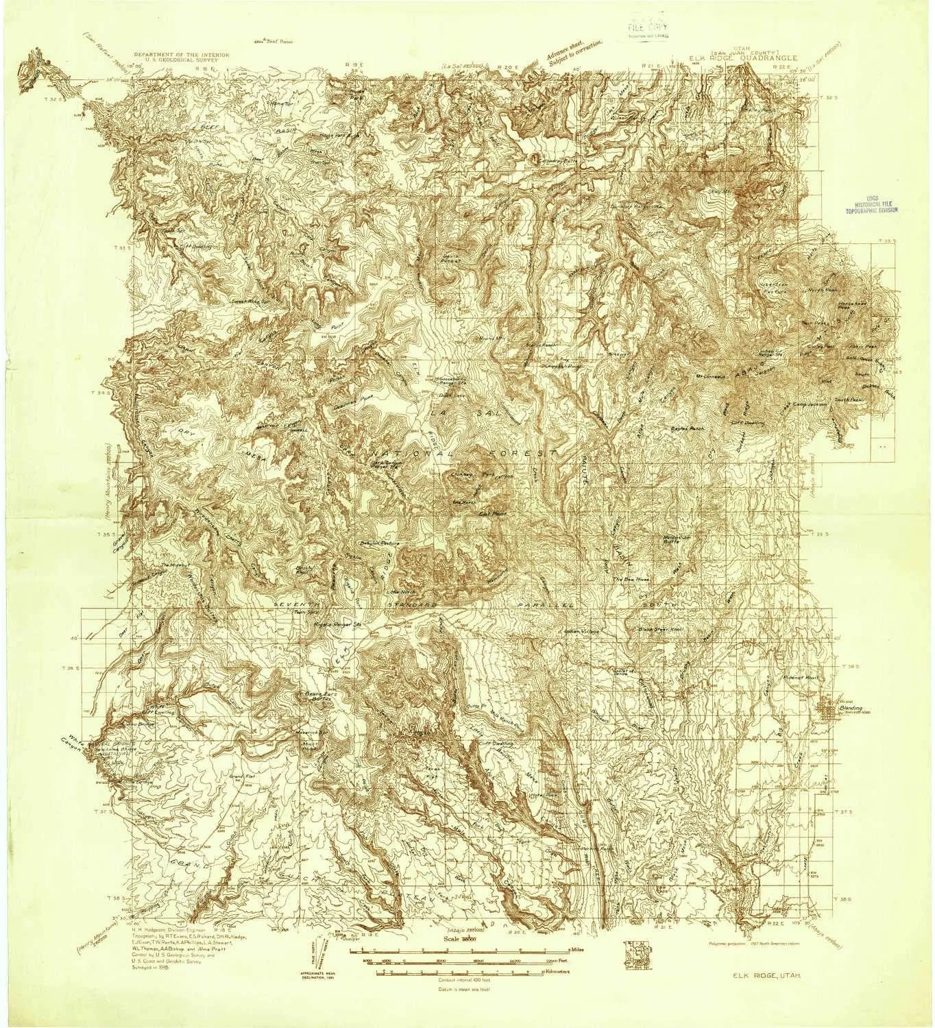
- USGS topographic map of Elk Ridge, UT, at 1:96000 scale. Heavier material. Waterproof. Tear-resistant. Foldable. Perfect for the outdoors.
- Cities, towns, villages: Indian Village
- Islands: Consult topo map preview for visible islands.
- Parks and forests: Newspaper Rock State Historical Monument,Manti-La Sal National Forest - La Sal Division
USGS topographic map of Elk Ridge, Utah, dated 1935.
Includes geographic coordinates (latitude and longitude), lines of elevation, bodies of water, roads, and more. This topo quad is suitable for recreational, outdoor uses, office applications, or wall map framing.
Printed on-demand by YellowMaps on the print material of your choice.
Shipping rolled from Minneapolis, MN, United States.
Product Number: USGS-5680249
Map Size: 27.9 inches high x 25.4 inches wide
Map Scale: 1:96000
Map Type: POD USGS Topographic Map
Map Series: HTMC
Map Version: Historical
Cell ID: 65425
Scan ID: 249134
Survey Year: 1935
Datum: NAD27
Map Projection: Polyconic
Advance: Yes
Map published by United States Geological Survey
Keywords: Overedge; Nonstandard Press Run
Map Language: English
Scanner Resolution: 600 dpi
Map Cell Name: Elk Ridge
Grid size: 30 X 30 Minute
Date on map: 1935
Geographical region: Utah, United States
Northern map edge Latitude: 38°
Southern map edge Latitude: 37.5°
Western map edge Longitude: -110°
Eastern map edge Longitude: -109.5°
Surrounding map sheets (copy & paste the Product No. in the search bar):
North: USGS-5618962,USGS-5618952,USGS-5463394,USGS-5463400,USGS-5463381
East: USGS-5462237,USGS-5462235,USGS-5455687,USGS-5461717,USGS-5462233
South: USGS-5462315,USGS-5659658,USGS-5462313,USGS-5456229,USGS-5659660
West: USGS-5462735,USGS-5462731,USGS-5461949,USGS-5459185,USGS-5462733


")

![[Upgraded] LED Headlamp Flashlight, 4 Modes Adjustable Zoomable Focusing Headlight, Ultra Bright 5 Head Light with Rechargeable Batteries, IPX-5 Waterproof for Night Camping Fishing](https://www.toolight.shop/image/upgraded-led-headlamp-flashlight-4-modes-adjustable-zoomable-focusing-headlight-ultra-bright-5-head-light-with-rechargeable-batteries-ipx-5-waterproof-for-night-camping-fishing_nX8Pia_300x.webp "[Upgraded] LED Headlamp Flashlight, 4 Modes Adjustable Zoomable Focusing Headlight, Ultra Bright 5 Head Light with Rechargeable Batteries, IPX-5 Waterproof for Night Camping Fishing")
")
