- Printed on Polypropylene (plastic)
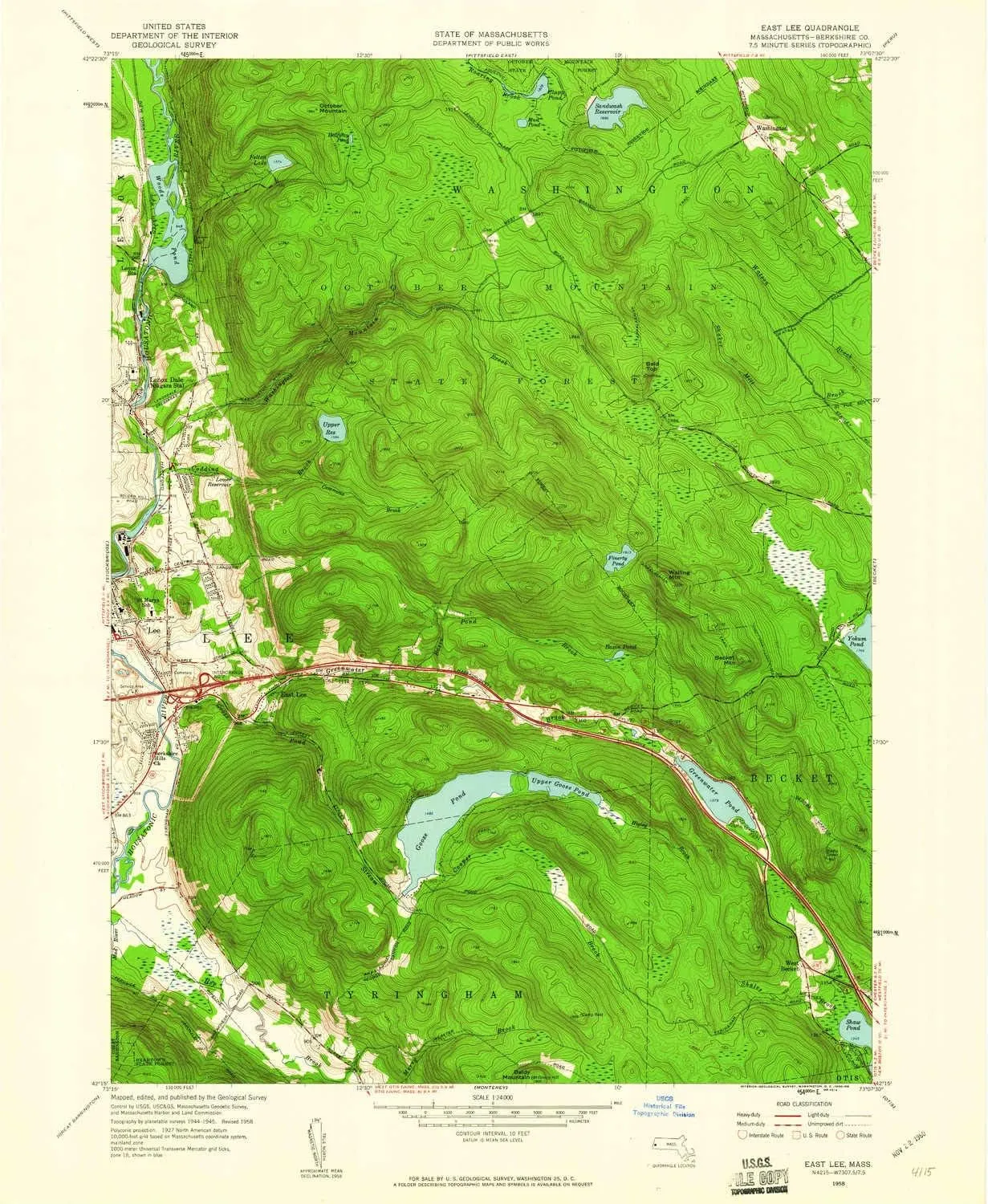
- USGS topographic map of East Lee, MA, at 1:24000 scale. Heavier material. Waterproof. Tear-resistant. Foldable. Perfect for the outdoors.
- Cities, towns, villages: East Lee,Lenox Station,Lenox Dale,Lee,Leisure Lee,West Becket
- Islands: Consult topo map preview for visible islands.
- Parks and forests: October Mountain State Forest
USGS topographic map of East Lee, Massachusetts, dated 1958, updated 1960.
Includes geographic coordinates (latitude and longitude), lines of elevation, bodies of water, roads, and more. This topo quad is suitable for recreational, outdoor uses, office applications, or wall map framing.
Printed on-demand by YellowMaps on the print material of your choice.
Shipping rolled from Minneapolis, MN, United States.
Product Number: USGS-5631635
Map Size: 26.8 inches high x 22 inches wide
Map Scale: 1:24000
Map Type: POD USGS Topographic Map
Map Series: HTMC
Map Version: Historical
Cell ID: 13392
Scan ID: 350109
Imprint Year: 1960
Woodland Tint: Yes
Survey Year: 1945
Datum: NAD27
Map Projection: Polyconic
Map published by United States Geological Survey
Map Language: English
Scanner Resolution: 600 dpi
Map Cell Name: East Lee
Grid size: 7.5 X 7.5 Minute
Date on map: 1958
Geographical region: Massachusetts, United States
Northern map edge Latitude: 42.375°
Southern map edge Latitude: 42.25°
Western map edge Longitude: -73.25°
Eastern map edge Longitude: -73.125°
Surrounding map sheets (copy & paste the Product No. in the search bar):
North: USGS-5634685,USGS-5634683,USGS-5634687,USGS-5633237,USGS-5633239
East: USGS-5631445,USGS-5634017,USGS-5631441,USGS-5631447,USGS-5632769
South: USGS-5566508,USGS-5633719,USGS-5631971,USGS-5634501,USGS-5566512
West: USGS-5634889,USGS-5635783,USGS-5633399,USGS-5633395,USGS-5634887

")


