- Printed on Polypropylene (plastic)
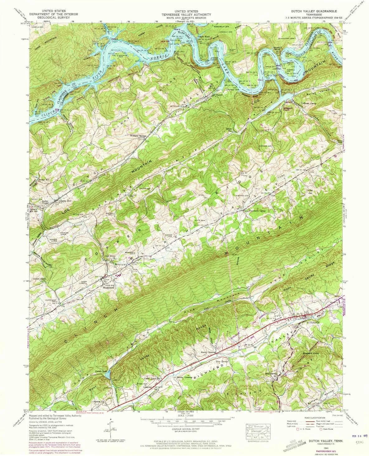
- USGS topographic map of Dutch Valley, TN, at 1:24000 scale. Heavier material. Waterproof. Tear-resistant. Foldable. Perfect for the outdoors.
- Cities, towns, villages: Rutledge,Puncheon Camp,Washburn,Clear Springs (historical),Oakman (historical),Williams Springs,Elm Springs,Lulaville,Clinch River (historical),Sunset,Liberty Hill,Beeler Mill
- Islands: Sycamore Island (historical)
- Parks and forests: Rutledge Recreational Park
USGS topographic map of Dutch Valley, Tennessee, dated 1941, updated 1973.
Includes geographic coordinates (latitude and longitude), lines of elevation, bodies of water, roads, and more. This topo quad is suitable for recreational, outdoor uses, office applications, or wall map framing.
Printed on-demand by YellowMaps on the print material of your choice.
Shipping rolled from Minneapolis, MN, United States.
Product Number: USGS-5334018
Map Size: 27.4 inches high x 22.1 inches wide
Map Scale: 1:24000
Map Type: POD USGS Topographic Map
Map Series: HTMC
Map Version: Historical
Cell ID: 13173
Scan ID: 147544
Imprint Year: 1973
Woodland Tint: Yes
Photo Revision Year: 1971
Aerial Photo Year: 1971
Datum: NAD27
Map Projection: Polyconic
Map published by Tennessee Valley Authority
Map Language: English
Scanner Resolution: 600 dpi
Map Cell Name: Dutch Valley
Grid size: 7.5 X 7.5 Minute
Date on map: 1941
Geographical region: Tennessee, United States
Northern map edge Latitude: 36.375°
Southern map edge Latitude: 36.25°
Western map edge Longitude: -83.625°
Eastern map edge Longitude: -83.5°
Surrounding map sheets (copy & paste the Product No. in the search bar):
North: USGS-5337920,USGS-5337924,USGS-5337922,USGS-5337926
East: USGS-5332428,USGS-5332424,USGS-5332432,USGS-5332422,USGS-5332430
South: USGS-5335332,USGS-5335328,USGS-5335324,USGS-5335330,USGS-5335326
West: USGS-5337018,USGS-5337020,USGS-5337026,USGS-5337022,USGS-5337024
")


