- Printed on Polypropylene (plastic)
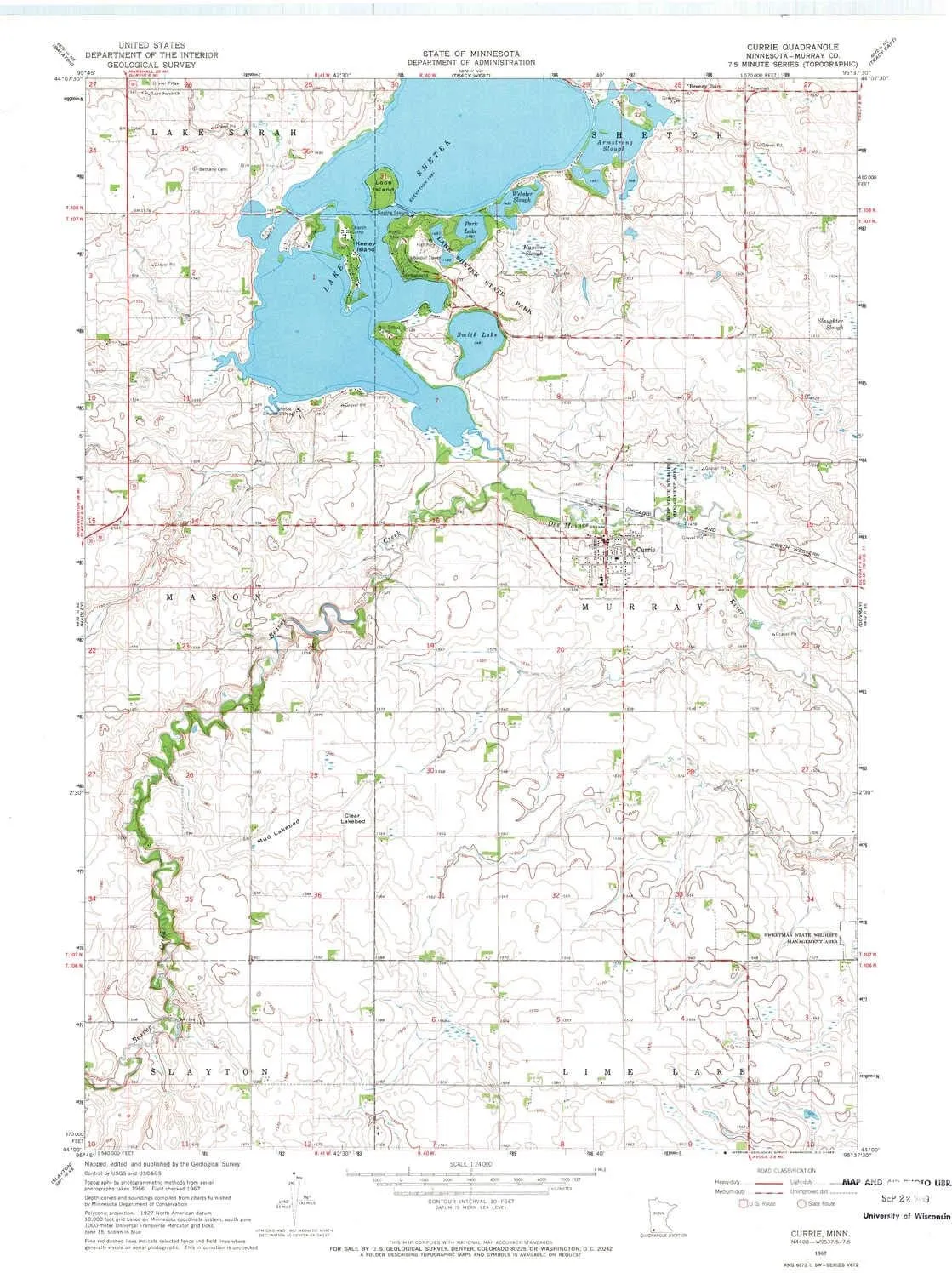
- USGS topographic map of Currie, MN, at 1:24000 scale. Heavier material. Waterproof. Tear-resistant. Foldable. Perfect for the outdoors.
- Cities, towns, villages: Currie
- Islands: Valhalla Island,Keeley Island,Loon Island
- Parks and forests: Rupp State Wildlife Management Area,Sweetman State Wildlife Management Area,Lake Shetek State Monument,End-O-Line Railroad Park,Lake Shetek State Park
USGS topographic map of Currie, Minnesota, dated 1967, updated 1969.
Includes geographic coordinates (latitude and longitude), lines of elevation, bodies of water, roads, and more. This topo quad is suitable for recreational, outdoor uses, office applications, or wall map framing.
Printed on-demand by YellowMaps on the print material of your choice.
Shipping rolled from Minneapolis, MN, United States.
Product Number: USGS-5986170
Map Size: 27.23 inches high x 21.53 inches wide
Map Scale: 1:24000
Map Type: POD USGS Topographic Map
Map Series: HTMC
Map Version: Historical
Cell ID: 11063
Scan ID: 504280
Imprint Year: 1969
Woodland Tint: Yes
Aerial Photo Year: 1966
Field Check Year: 1967
Datum: NAD27
Map Projection: Polyconic
Map published by United States Geological Survey
Map Language: English
Scanner Resolution: 508 dpi
Map Cell Name: Currie
Grid size: 7.5 X 7.5 Minute
Date on map: 1967
Geographical region: Minnesota, United States
Northern map edge Latitude: 44.125°
Southern map edge Latitude: 44°
Western map edge Longitude: -95.75°
Eastern map edge Longitude: -95.625°
Surrounding map sheets (copy & paste the Product No. in the search bar):
North: USGS-5989206,USGS-5989204
East: USGS-5986364
South: USGS-5985360
West: USGS-5996482,USGS-5987150,USGS-5987152


")

