- Printed on Polypropylene (plastic)
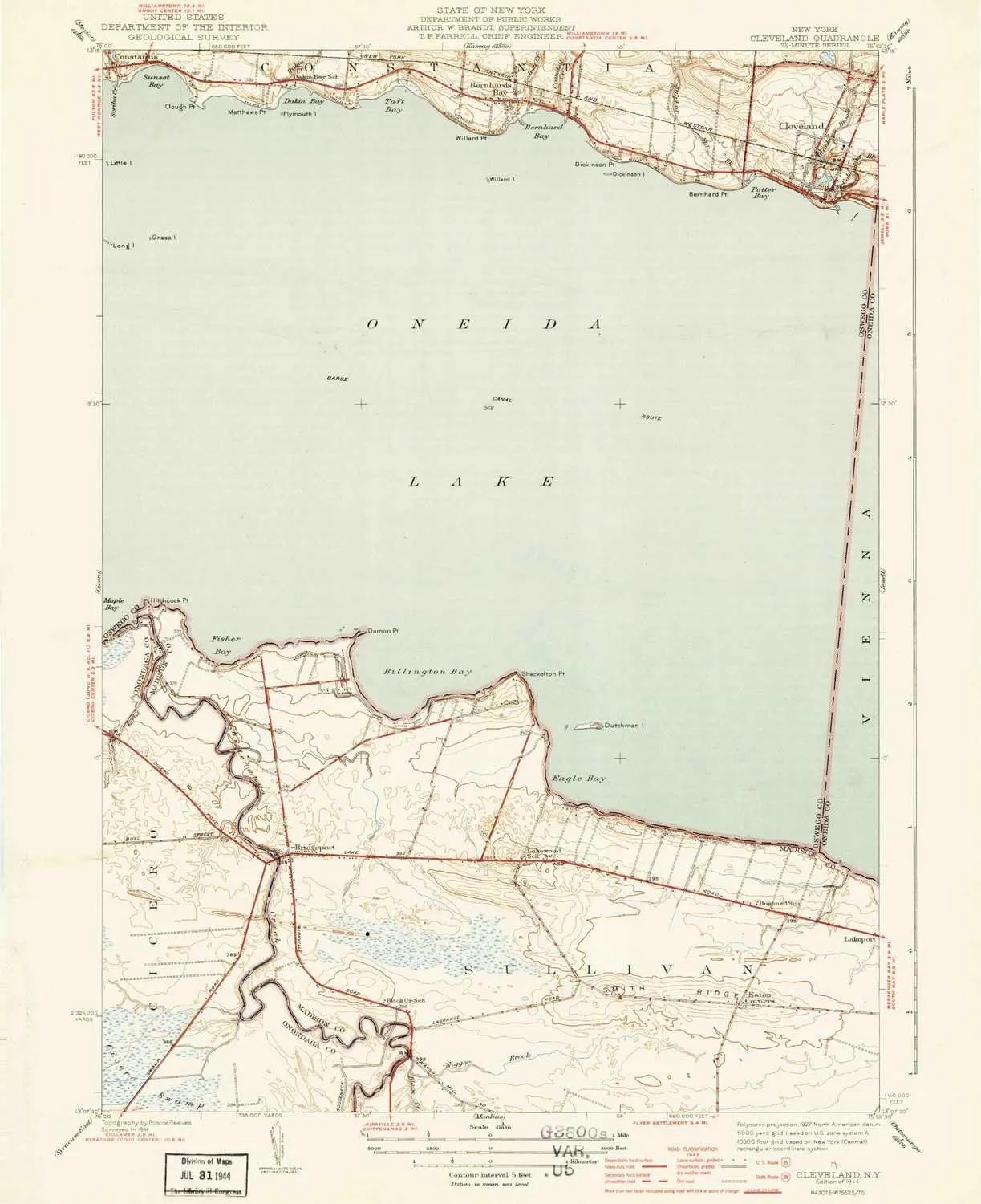
- USGS topographic map of Cleveland, NY, at 1:31680 scale. Heavier material. Waterproof. Tear-resistant. Foldable. Perfect for the outdoors.
- Cities, towns, villages: Cleveland,Eaton Corners,Bridgeport,Bernhards Bay
- Islands: Willard Island,Plymouth Island,Little Island,Dutchman Island,Dickinson Island,Grass Island
- Parks and forests: Chapman Park
USGS topographic map of Cleveland, New York, dated 1944.
Includes geographic coordinates (latitude and longitude), lines of elevation, bodies of water, roads, and more. This topo quad is suitable for recreational, outdoor uses, office applications, or wall map framing.
Printed on-demand by YellowMaps on the print material of your choice.
Shipping rolled from Minneapolis, MN, United States.
Product Number: USGS-8694466
Map Size: 19.56 inches high x 15.95 inches wide
Map Scale: 1:31680
Map Type: POD USGS Topographic Map
Map Series: HTMC
Map Version: Historical
Cell ID: 69677
Scan ID: 8034260
Survey Year: 1941
Datum: NAD27
Map Projection: Polyconic
Map published by United States Geological Survey
Map Language: English
Scanner Resolution: 600 dpi
Map Cell Name: Cleveland
Grid size: 7.5 X 7.5 Minute
Date on map: 1944
Geographical region: New York, United States
Northern map edge Latitude: 43.25°
Southern map edge Latitude: 43.125°
Western map edge Longitude: -76°
Eastern map edge Longitude: -75.875°
Surrounding map sheets (copy & paste the Product No. in the search bar):
North: USGS-5447652,USGS-5452053,USGS-5452057,USGS-5447656,USGS-5452049
East: USGS-5446432,USGS-5446426,USGS-5449893,USGS-5449895,USGS-5446430
South: USGS-5446846,USGS-5449941,USGS-5449943,USGS-5446852,USGS-5446850
West: USGS-5444960,USGS-5449711,USGS-5444968,USGS-5444966,USGS-5449713

 Stainless Steel Water Bottle")


