- Printed on Polypropylene (plastic)
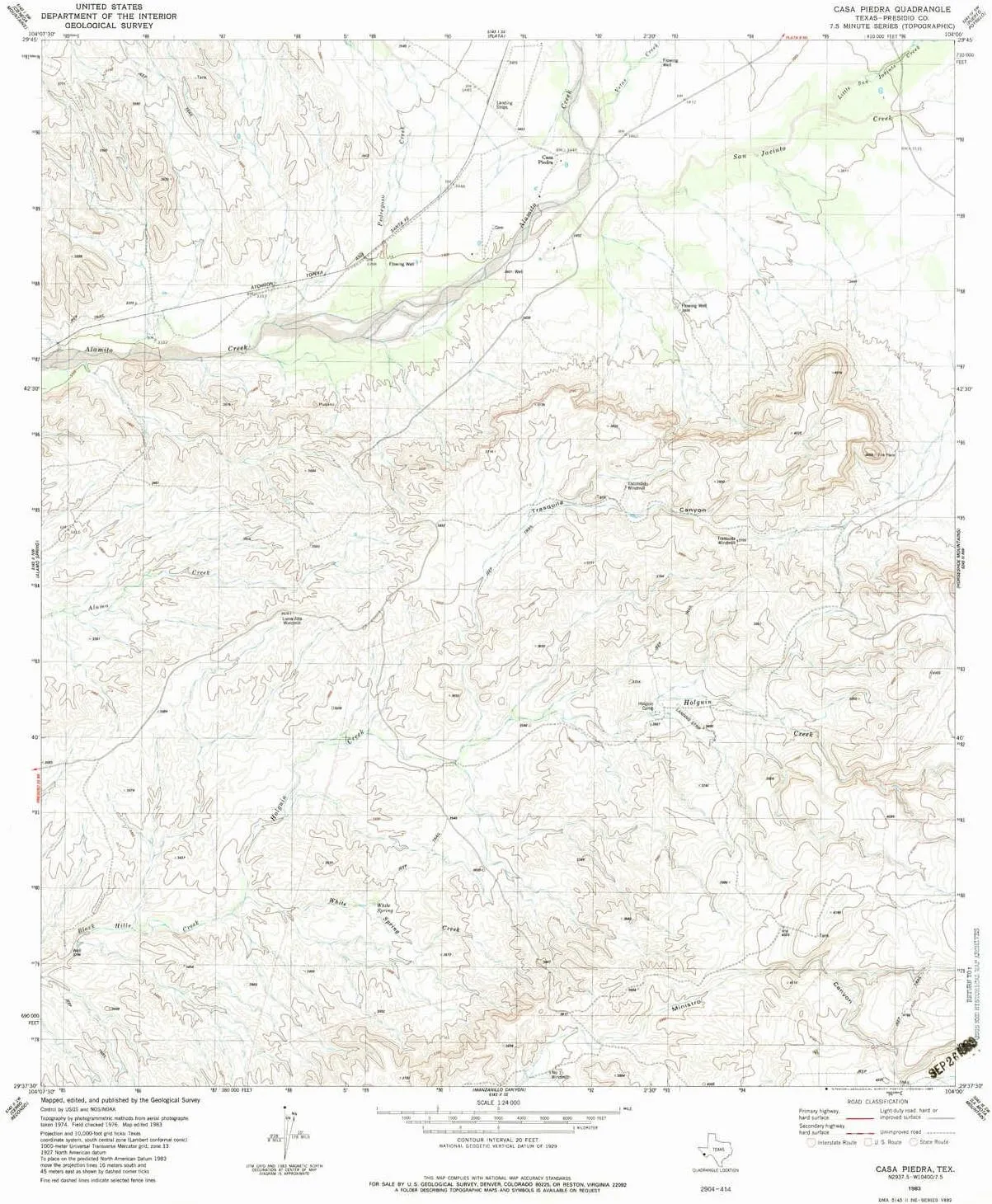
- USGS topographic map of Casa Piedra, TX, at 1:24000 scale. Heavier material. Waterproof. Tear-resistant. Foldable. Perfect for the outdoors.
- Cities, towns, villages: Casa Piedra
- Islands: Consult topo map preview for visible islands.
- Parks and forests: National Parks, National Forests, etc. Please preview map image for specifics.
USGS topographic map of Casa Piedra, Texas, dated 1983, updated 1983.
Includes geographic coordinates (latitude and longitude), lines of elevation, bodies of water, roads, and more. This topo quad is suitable for recreational, outdoor uses, office applications, or wall map framing.
Printed on-demand by YellowMaps on the print material of your choice.
Shipping rolled from Minneapolis, MN, United States.
Product Number: USGS-5483535
Map Size: 27.1 inches high x 23.2 inches wide
Map Scale: 1:24000
Map Type: POD USGS Topographic Map
Map Series: HTMC
Map Version: Historical
Cell ID: 7491
Scan ID: 105529
Imprint Year: 1983
Woodland Tint: Yes
Visual Version Number: 1
Aerial Photo Year: 1974
Edit Year: 1983
Field Check Year: 1976
Datum: NAD27
Map Projection: Lambert Conformal Conic
Map published by United States Geological Survey
Map Language: English
Scanner Resolution: 600 dpi
Map Cell Name: Casa Piedra
Grid size: 7.5 X 7.5 Minute
Date on map: 1983
Geographical region: Texas, United States
Northern map edge Latitude: 29.75°
Southern map edge Latitude: 29.625°
Western map edge Longitude: -104.125°
Eastern map edge Longitude: -104°
Surrounding map sheets (copy & paste the Product No. in the search bar):
North: USGS-5492303
East: USGS-5487657
South:
West:

 - Waterproof, Topographic, Recreation, Full Color, Smooth Finish, 1999 Paper Size")


)")


")
