- Printed on Polypropylene (plastic)
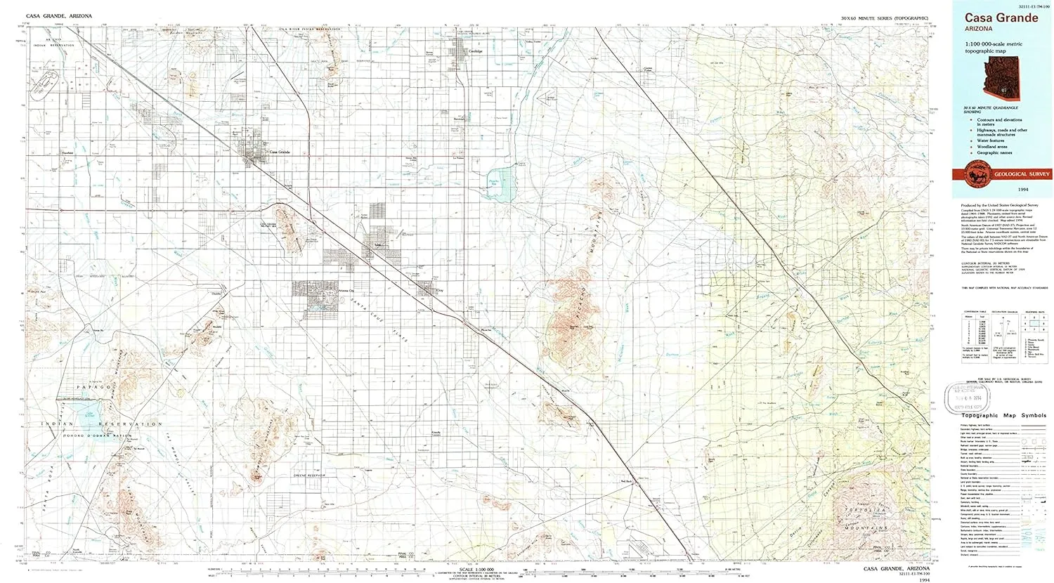
- USGS topographic map of Casa Grande, AZ, at 1:100000 scale. Heavier material. Waterproof. Tear-resistant. Foldable. Perfect for the outdoors.
- Cities, towns, villages: Bon,Red Rock,North Komelik,Friendly Corners,Avra,Shopishk,Tat Momoli,Coolidge,Eleven Mile Corner,Vaiva Vo,Stanfield,Arizola,La Palma,Jackrabbit House,Arizona City,Chuichu,Randolph,Toltec,Picacho,Cactus Forest,Borree Corner,Valley Farms,Nariska,Casa Grande,Eloy,Laguna,Wymola
- Islands: Consult topo map preview for visible islands.
- Parks and forests: Elliott Park,Roadside Park Rest Area,North Park,Toltec Mini Park,Casa Grande Ruins National Monument,Western Manor Park,City Park,Washington Mini Park Site,West Park,Tom Mix Monument,Pinal County Fairgrounds,Upeart Park,North Park,Casa Grande Mountain Park,Picaclo Peak Nature Trail,San Carlos Park,Oniel Park,Rancho Grande Park,West Side Park,Ward Park,Curiel School Mini Park Site,Trekell Park,Mosely Park,Southwest Gas Site Mini Park,East Park
USGS topographic map of Casa Grande, Arizona, dated 1994, updated 1994.
Includes geographic coordinates (latitude and longitude), lines of elevation, bodies of water, roads, and more. This topo quad is suitable for recreational, outdoor uses, office applications, or wall map framing.
Printed on-demand by YellowMaps on the print material of your choice.
Shipping rolled from Minneapolis, MN, United States.
Product Number: USGS-5549086
Map Size: 24.1 inches high x 44 inches wide
Map Scale: 1:100000
Map Type: POD USGS Topographic Map
Map Series: HTMC
Map Version: Historical
Cell ID: 67249
Scan ID: 315237
Imprint Year: 1994
Woodland Tint: Yes
Aerial Photo Year: 1992
Edit Year: 1994
Datum: NAD27
Map Projection: Universal Transverse Mercator
Map published by United States Geological Survey
Map Language: English
Scanner Resolution: 600 dpi
Map Cell Name: Casa Grande
Grid size: 30 X 60 Minute
Date on map: 1994
Geographical region: Arizona, United States
Northern map edge Latitude: 33°
Southern map edge Latitude: 32.5°
Western map edge Longitude: -112°
Eastern map edge Longitude: -111°
Surrounding map sheets (copy & paste the Product No. in the search bar):
North: USGS-5547960,USGS-5549590,USGS-5547952,USGS-5547956,USGS-5549164
East: USGS-5549470,USGS-5549468,USGS-5554594,USGS-5549474,USGS-5554598
South: USGS-5555674,USGS-5549242,USGS-5555676,USGS-5548678,USGS-5549244
West: USGS-5553248,USGS-5548946,USGS-5548944,USGS-5553246,USGS-5549128
")


")

