- Printed on Polypropylene (plastic)
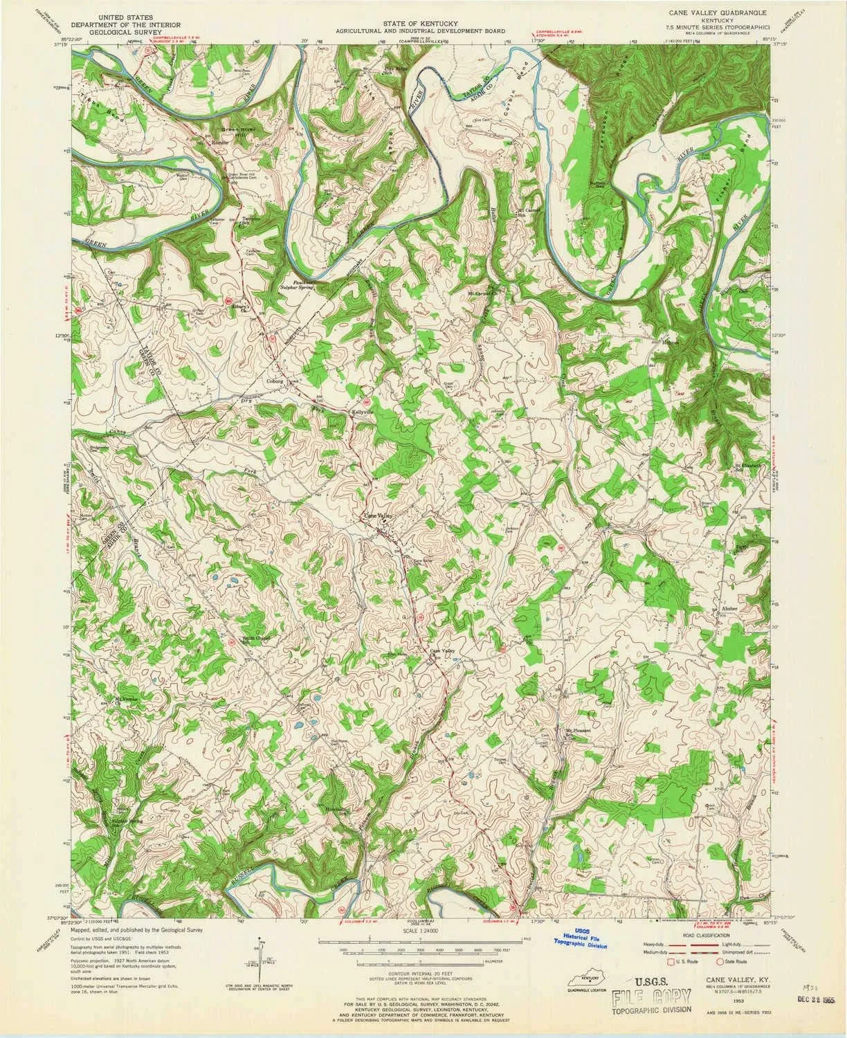
- USGS topographic map of Cane Valley, KY, at 1:24000 scale. Heavier material. Waterproof. Tear-resistant. Foldable. Perfect for the outdoors.
- Cities, towns, villages: Romine,Kellyville,Coburg,Cane Valley,Mount Pleasant (historical),Absher,Holmes,Cyclone (historical)
- Islands: Consult topo map preview for visible islands.
- Parks and forests: Green River Bridge Historical Marker,Independence Day Fight Historical Marker
USGS topographic map of Cane Valley, Kentucky, dated 1953, updated 1965.
Includes geographic coordinates (latitude and longitude), lines of elevation, bodies of water, roads, and more. This topo quad is suitable for recreational, outdoor uses, office applications, or wall map framing.
Printed on-demand by YellowMaps on the print material of your choice.
Shipping rolled from Minneapolis, MN, United States.
Product Number: USGS-5290074
Map Size: 27 inches high x 22 inches wide
Map Scale: 1:24000
Map Type: POD USGS Topographic Map
Map Series: HTMC
Map Version: Historical
Cell ID: 7044
Scan ID: 803387
Imprint Year: 1965
Woodland Tint: Yes
Aerial Photo Year: 1951
Field Check Year: 1953
Datum: NAD27
Map Projection: Polyconic
Map published by United States Geological Survey
Map Language: English
Scanner Resolution: 508 dpi
Map Cell Name: Cane Valley
Grid size: 7.5 X 7.5 Minute
Date on map: 1953
Geographical region: Kentucky, United States
Northern map edge Latitude: 37.25°
Southern map edge Latitude: 37.125°
Western map edge Longitude: -85.375°
Eastern map edge Longitude: -85.25°
Surrounding map sheets (copy & paste the Product No. in the search bar):
North: USGS-5290050,USGS-5290058,USGS-5290054,USGS-5290056,USGS-5290052
East: USGS-5291820,USGS-5291822,USGS-5291816,USGS-5291818
South: USGS-5290326,USGS-5290328,USGS-5290330
West: USGS-5291218,USGS-5291212,USGS-5291214,USGS-5291216


")
, 2.4 Inch 8Cr13MoV Steel Blade with Black Oxide Coating, Every Day Utility Knife with Carbon Strength and High Tech Function, 3.5 oz.,Gray")


