- Printed on Tyvek® (synthetic)
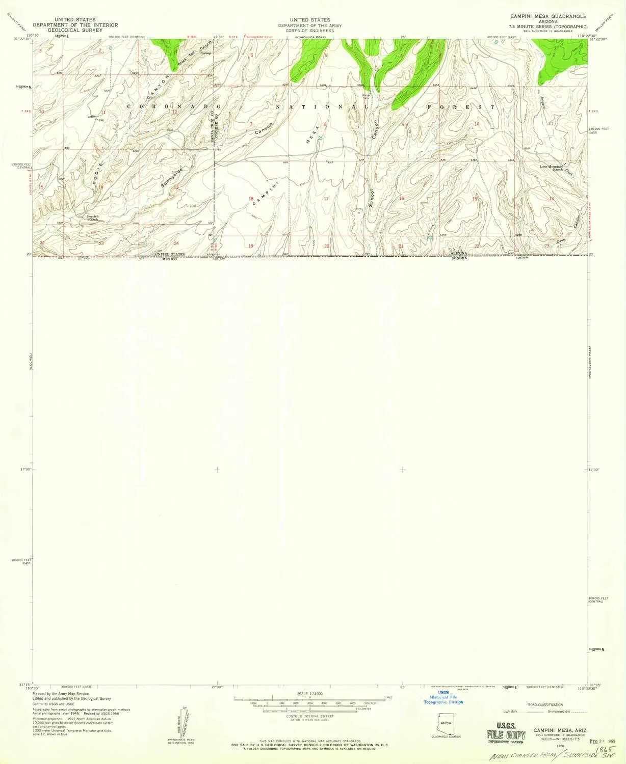
- USGS topographic map of Campini Mesa, AZ, at 1:24000 scale. Lighter material. Waterproof. Tear-resistant. Foldable. Very durable. Perfect for backpacking and the outdoors.
- Cities, towns, villages: Please see map preview to find populated places, townships, as well as roads and street names if available.
- Mountains: Campini Mesa
- Valleys: Blacktail Canyon,Cave Canyon,Sunnyside Canyon,School Canyon
USGS topographic map of Campini Mesa, Arizona, dated 1958, updated 1959.
Includes geographic coordinates (latitude and longitude), lines of elevation, bodies of water, roads, and more. This topo quad is suitable for recreational, outdoor uses, office applications, or wall map framing.
Printed on-demand by YellowMaps on the print material of your choice.
Shipping rolled from Minneapolis, MN, United States.
Product Number: USGS-5550644
Map Size: 26.9 inches high x 22 inches wide
Map Scale: 1:24000
Map Type: POD USGS Topographic Map
Map Series: HTMC
Map Version: Historical
Cell ID: 6973
Scan ID: 310704
Imprint Year: 1959
Woodland Tint: Yes
Aerial Photo Year: 1946
Field Check Year: 1958
Datum: NAD27
Map Projection: Polyconic
Map published by United States Geological Survey
Map published by United States Army Corps of Engineers
Map published by United States Army
Map Language: English
Scanner Resolution: 600 dpi
Map Cell Name: Campini Mesa
Grid size: 7.5 X 7.5 Minute
Date on map: 1958
Geographical region: Arizona, United States
Northern map edge Latitude: 31.375°
Southern map edge Latitude: 31.25°
Western map edge Longitude: -110.5°
Eastern map edge Longitude: -110.375°
Surrounding map sheets (copy & paste the Product No. in the search bar):
North: USGS-5552876,USGS-5552878,USGS-5552880,USGS-5552874,USGS-5552870
East: USGS-5556308,USGS-5554054,USGS-5554058,USGS-5554052,USGS-5554050
South:
West: USGS-5553458,USGS-5553462,USGS-5553456,USGS-5548212,USGS-5553454


, Ultimate Survival Tool, Tactical Military Spade, Compact Entrenching Tool for Camping, Off Roading, Metal Detecting, Backpacking and Emergency")


