- Printed on Polypropylene (plastic)
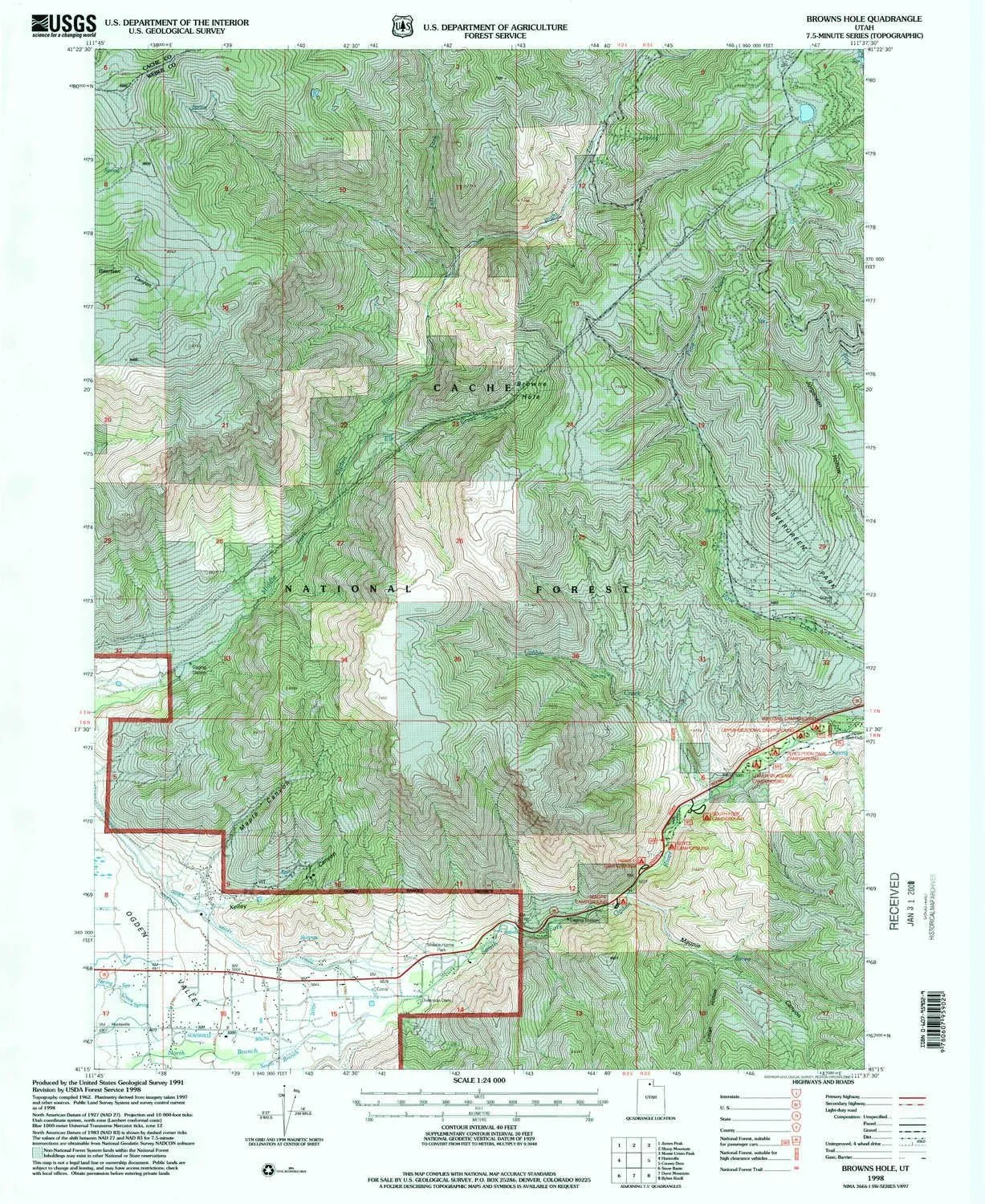
- USGS topographic map of Browns Hole, UT, at 1:24000 scale. Heavier material. Waterproof. Tear-resistant. Foldable. Perfect for the outdoors.
- Cities, towns, villages: Huntsville Hollow,Mountain Valley Meadows,Green Hill Country Estates,South Fork Ranchettes,Evergreen Park
- Islands: Consult topo map preview for visible islands.
- Parks and forests: Evergreen Park
USGS topographic map of Browns Hole, Utah, dated 1998, updated 2000.
Includes geographic coordinates (latitude and longitude), lines of elevation, bodies of water, roads, and more. This topo quad is suitable for recreational, outdoor uses, office applications, or wall map framing.
Printed on-demand by YellowMaps on the print material of your choice.
Shipping rolled from Minneapolis, MN, United States.
Product Number: USGS-5455907
Map Size: 26.8 inches high x 21.9 inches wide
Map Scale: 1:24000
Map Type: POD USGS Topographic Map
Map Series: HTMC
Map Version: Historical
Cell ID: 5725
Scan ID: 248311
Imprint Year: 2000
Woodland Tint: Yes
Aerial Photo Year: 1997
Edit Year: 1998
Datum: NAD27
Map Projection: Lambert Conformal Conic
Map published by United States Geological Survey
Map published by United States Forest Service
Map Language: English
Scanner Resolution: 600 dpi
Map Cell Name: Browns Hole
Grid size: 7.5 X 7.5 Minute
Date on map: 1998
Geographical region: Utah, United States
Northern map edge Latitude: 41.375°
Southern map edge Latitude: 41.25°
Western map edge Longitude: -111.75°
Eastern map edge Longitude: -111.625°
Surrounding map sheets (copy & paste the Product No. in the search bar):
North: USGS-5460689,USGS-5460687,USGS-5460685,USGS-5460691,USGS-5460683
East: USGS-5456185,USGS-5456177,USGS-5456179,USGS-5456183,USGS-5456181
South: USGS-5456947,USGS-5462685,USGS-5462683,USGS-5456945
West: USGS-5458079,USGS-5458087,USGS-5458081,USGS-5458083,USGS-5458077

")
")

 w/Battery and Eco Sensa USB-C Charging Cable")


