- Printed on Polypropylene (plastic)
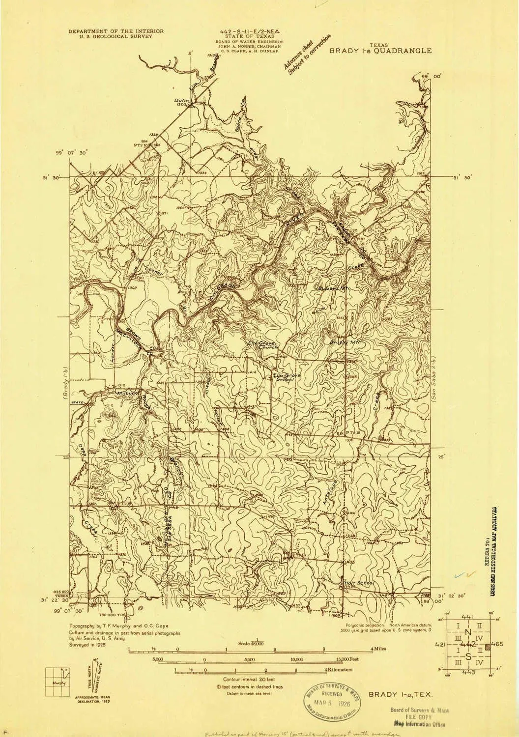
- USGS topographic map of Brady 1 a, TX, at 1:48000 scale. Heavier material. Waterproof. Tear-resistant. Foldable. Perfect for the outdoors.
- Cities, towns, villages: Keys Crossing,Beasley Crossing,Elm Grove,Milburn
- Islands: Consult topo map preview for visible islands.
- Parks and forests: National Parks, National Forests, etc. Please preview map image for specifics.
USGS topographic map of Brady 1 a, Texas, dated 1925.
Includes geographic coordinates (latitude and longitude), lines of elevation, bodies of water, roads, and more. This topo quad is suitable for recreational, outdoor uses, office applications, or wall map framing.
Printed on-demand by YellowMaps on the print material of your choice.
Shipping rolled from Minneapolis, MN, United States.
Product Number: USGS-5678790
Map Size: 19.9 inches high x 14 inches wide
Map Scale: 1:48000
Map Type: POD USGS Topographic Map
Map Series: HTMC
Map Version: Historical
Cell ID: 14168
Scan ID: 123800
Visual Version Number: 1
Survey Year: 1925
Datum: NAD
Map Projection: Polyconic
Advance: Yes
Map published by United States Geological Survey
Keywords: Nonstandard Press Run; Overedge
Map Language: English
Scanner Resolution: 600 dpi
Map Cell Name: Elm Grove
Grid size: 7.5 X 7.5 Minute
Date on map: 1925
Geographical region: Texas, United States
Northern map edge Latitude: 31.5°
Southern map edge Latitude: 31.375°
Western map edge Longitude: -99.125°
Eastern map edge Longitude: -99°
Surrounding map sheets (copy & paste the Product No. in the search bar):
North: USGS-5482953,USGS-5482955
East: USGS-5482765,USGS-5678928
South: USGS-5487077
West: USGS-5490319,USGS-5490317,USGS-5678792


